Shaggy
Member
Back at ya from Carolina BeachHappy 4th from KDHView attachment 119676
Back at ya from Carolina BeachHappy 4th from KDHView attachment 119676
Good news is that rain cell is about to move out from your way. Nothing but blue skies up here. Going be a beautiful day for the entire Carolina coast.Back at ya from Carolina Beach
I was at the beach last week. Saw more rain there than I have at home in 2 months. Big dubI'll just plan a vacation in your area. Sure to rain it's Tom Brady Sucks off then. Just had lightning strike about 300 yards away.View attachment 119675
This is the first good mean we've seen all summer. #IgotjokesNo kidding it's been brutal. Fortunately the means look amazing over the next 2 weeks with the heat ridge stuck in the west and broad troughing in the east. It'll be hard to unsee the near 4 inch mean from the 0z eps. We have a decent chance here to erase the D0 for our area and potentially the D1/2 areas as well. Given our track record since April I expect total fail
You ain't wrong though about 2 weeks ago the eps mean was around 1.3 here. Had like .7 in that time so it wasn't too far offThis is the first good mean we've seen all summer. #Igotjokes
Yeah this is the heaviest rain I've seen in a while and of course it's while I'm on vacation. Heard from weathernc that my neck of the woods back home did pretty good yesterday.I was at the beach last week. Saw more rain there than I have at home in 2 months. Big dub
You're optimistic. Get the front through Wednesday and we might be able to do 0%
 I mean it is 2 days away right. Lol
The wave train around the closed ridge just to our west is exciting but failing is easy if timing is off. Remember a few weeks ago when we thought we were going to get a massive mcs and ended up with debris clouds and subsidence.What could go wrong? ?
Toes or you are not there . NowHappy 4th from KDHView attachment 119676
WRAL is, too, after completely blowing the forecast yesterday for storms and heavy rain.No.
View attachment 119672
I see RAH is in hype mode about Wednesday I'll be sure to plan on a dry day
SPC 24 hours out has been just as bad as the models showing a big snowstorm 10 days out.What could go wrong? ?
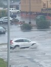
At the beach with me today. My fishing is in a rain/lightening delay. Its pretty green this half of Brunswick county, corn looks pretty good. But from western half back to house it got torched, nada.Where the storms at?
Have you ever looked at the probabilities within the convective outlooks? They typically aren't that high in this part of the country and usually boil down to low percent chances that equal less than 1 severe report per county. Media would do a big service if they started speaking in probability and not broad brushing level x with no context imoSPC 24 hours out has been just as bad as the models showing a big snowstorm 10 days out.


The spot where I have my vegetable garden in Southeastern Wake County might give your area some competition. My corn did make it up to four feet tall before tasseling. My watermelons, cantaloupes and cucumbers are toast. My squash plants and okra will be the next to go if this dry weather continues. My tomato, eggplant and pepper plants are hanging in there for now. The past few summers have been wet comparatively speaking so I guess we just forgot what a drought looks like in Central and Eastern North Carolina. I'm hoping this week will have at least a couple of days with some significant rain.Can't remember the last time we had measurable rain IMBY. Everything is dead and crunchy, grass everywhere is brown. Corn in the fields is less than 2ft tall. I think the area around my house may be one of the driest in the state currently.

Have you ever looked at the probabilities within the convective outlooks? They typically aren't that high in this part of the country and usually boil down to low percent chances that equal less than 1 severe report per county. Media would do a big service if they started speaking in probability and not broad brushing level x with no context imo
Indeed.Another reason why having 5 levels with wording that doesn't make sense does more bad than good. Four levels are enough, and actually have descriptions that don't contradict each other.


I like the 3 levels of slight, moderate, and high risk. That seemed to work pretty well for years.
I'm not trying to be contrary, but I don't really like probability forecasting all that much. But it is the trendy thing now, particularly when it comes to snow. For example, you'll be in a probability zone of 70% likelihood of >4" of snow 24 hours out and then end up with .5".
They've gotten too cute with the severe zones. A Slight Risk should raise awareness that severe is a possibility, where as a High Risk should be rare and rightly so, put people on high alert for an outbreak.
I'm not sure how you message the risk of thunderstorms/rain concurrently with the risk of any of those storms becoming severe. We have a 60% chance of storms but only a 20% probability that any of those will become severe.
In general, the public is going to be slow to really understand any particular system and the media is going to hype everything up to the Nth degree anyway.
I think that to a large extent, many in the forecasting community have become lazy, relying on the wide prevalence of modeling and infinitely instantaneous streams of data, sacrificing experience and good old fashioned elbow grease forecasting. Technology is helpful, but it doesn't replace experience, instinct, pattern recognition, and hard work. But the general public doesn't much care about any of that.


Kind of got "skipped over" here last night, as outflow died, but then triggered the nee convection over "Atlanta Core" .. but prior night got 2.48" so no complaints locallyPicked up another .84” last night. I think the drought in my local area is about toast.
2.19 in my gauge from last evening, it was very loud and intense, ATL is very soggy right now,Kind of got "skipped over" here last night, as outflow died, but then triggered the nee convection over "Atlanta Core" .. but prior night got 2.48" so no complaints locally