cd2play
Member
I stormt. Picked up almost 1" with a lightning fest thunderstorm.
It stormed *I stormt. Picked up almost 1" with a lightning fest thunderstorm.
Post in the main thread.Been raining on and off here since 6, I'm more in the stratiform rain but .2 so far. Wondering if those storms down toward Fayetteville can get up here later.
Sent from my SM-G955U using Tapatalk
Post in the main thread.
Please stop being a jabroni. For real. I like you and want you to be able to post. But it's not going to work out well with the continued nincompoopery in the non-banter threads.Post in the main thread.
Share some with me. Havent gotten any all day at my house. ?Over 6 inches for the event. We don’t need any more

Nincompoopery has commenced! I’ve only gotten 3.41 storm total! ?
Post totals in correct thread or take it to American. Thanks ?Nincompoopery has commenced! I’ve only gotten 3.41 storm total! ?
It’s great and needed, but I was hugging the CMC, like I do for cad events! ?Seems like a good total
no that won’t be necessaryI’m looking forward to highs in the 60s Wednesday, should I start a thread!?
Too bad we can’t even get dewpoints like that in the middle of winter!Dewpoints in the 40s at RDU Wednesday morning
Sent from my SM-G955U using Tapatalk

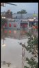
NAM is interesting for your area and all of eastern NC. Lot of rain. Not so much back this way tho.Washed out roads causing a mess around my area.
https://www.wral.com/weekend-floodwaters-collapse-us-401-causing-issues-for-wake-drivers/18442230/
More to come after all this rain and landslides. I think Ohio had some rain.4.0 earthquake hit cleveland, Ohio today.
https://www.google.com/amp/s/www.fo...quake-in-lake-erie-rattles-northeast-ohio.amp
Rain has nothing to do with earthquakes lol.More to come after all this rain and landslides. I think Ohio had some rain.
I think long dry stretches then heavy rain does influence. And same for the ground freezing and thawing. Local micro triggers.Rain has nothing to do with earthquakes lol.