I for one won't complain about a little break from the cold because of our situation with this no insulation cold ass house and propane bill. Buttttt.. I can guarantee when they start building our new house(anytime now) there will be weather to delay or cause problems. Anything and everything has caused delays and I expect no different when they actually start...
-
Hello, please take a minute to check out our awesome content, contributed by the wonderful members of our community. We hope you'll add your own thoughts and opinions by making a free account!
You are using an out of date browser. It may not display this or other websites correctly.
You should upgrade or use an alternative browser.
You should upgrade or use an alternative browser.
Pattern Jarring January
- Thread starter ForsythSnow
- Start date
gawxnative
Member
Well Wild... I m guessing you are double checking the insulation specs for the new house... coldest winter I had was the year I stayed in a 1935 built country house...BRRRRI for one won't complain about a little break from the cold because of our situation with this no insulation cold ass house and propane bill. Buttttt.. I can guarantee when they start building our new house(anytime now) there will be weather to delay or cause problems. Anything and everything has caused delays and I expect no different when they actually start...
Round Oak Weather
Member
It needs to repeat itself this yearBut you know what they say, history likes to repeat itself.
Barring any major warmth over the next 11 days RDU will finish Jan below normal making that the last 4 of last 6 below normal. All below normal Jan have been followed by a BN Feb during that period
Sent from my SM-G955U using Tapatalk
Sent from my SM-G955U using Tapatalk
I was in aiken then and got 9 inches. It was amazing. Came in during the day too. I wish.I'm hoping for a repeat of Feb. 2010 for us, that would definitely fill all of that grey in for SC at least, well actually from Dallas across the I-20 corridor.
February 2010 was awesome. Good Miller A track with no worries about temps. I had 3-4" in Cleburne county, and it broke the 8 year old curse of no snow storms over 2".
I'm ok with the January thaw, as long as Fab Feb is a Feb 1899 redux! 
Not an impossibility
Not an impossibility
pcbjr
Member
No, not an impossibility:I'm ok with the January thaw, as long as Fab Feb is a Feb 1899 redux!
Not an impossibility
Weather conditions in early February 1899 -
During the first week of February, very cold conditions gripped the western third of the United States. Temperatures fell as low as 33°F (1 °C) at Los Angeles California, 9°F ( -13°C) at Portland Oregon -9°F (-23 C) at Boise, Idaho, and 12ºF (-11ºC) at Seattle, Washington on the third and fourth. Meanwhile, much of the Middle Atlantic, South Atlantic and Gulf states were experiencing unseasonably mild conditions.Temperatures soared to 63°F (17ºC) at Richmond Virginia, and 72°F (22°C) at Raleigh, North Carolina on the fourth, and to 81°F (27°C) at Savannah, Georgia on the fifth.
But likely, Nah ...
GeorgiaGirl
Member
think we got 6 inches in that storm.... it was the first snowstorm over 3 inches here since the 90s too.. if I recall correctly.
You're thinking of a different storm in 2010 that was a little under two weeks earlier...
So much banter. Could we take the casual talk into the actual Banter thread and keep this one for discussing future weather trends for January?
ForsythSnow
Moderator
Yeah, sounds like that was a very -PNA was present at the time, and likely the flip was drastic to a +PNA. Everyone wishes for an 1899 snowstorm of course, but I'm sure the next one will be in 20 years at least. I think we can get something still, it's just we have a warm period and a pattern that favors massive cutters. Even the NE is going to warm up. Maybe we can as mentioned before get some good rain to help the drought.No, not an impossibility:
Weather conditions in early February 1899 -
During the first week of February, very cold conditions gripped the western third of the United States. Temperatures fell as low as 33°F (1 °C) at Los Angeles California, 9°F ( -13°C) at Portland Oregon -9°F (-23 C) at Boise, Idaho, and 12ºF (-11ºC) at Seattle, Washington on the third and fourth. Meanwhile, much of the Middle Atlantic, South Atlantic and Gulf states were experiencing unseasonably mild conditions.Temperatures soared to 63°F (17ºC) at Richmond Virginia, and 72°F (22°C) at Raleigh, North Carolina on the fourth, and to 81°F (27°C) at Savannah, Georgia on the fifth.
But likely, Nah ...
One of JBs latest FB posts says, when cold comes back, it'll start in the West and go East. I'm guessing like our Christmas/ New Years outbreakNo, not an impossibility:
Weather conditions in early February 1899 -
During the first week of February, very cold conditions gripped the western third of the United States. Temperatures fell as low as 33°F (1 °C) at Los Angeles California, 9°F ( -13°C) at Portland Oregon -9°F (-23 C) at Boise, Idaho, and 12ºF (-11ºC) at Seattle, Washington on the third and fourth. Meanwhile, much of the Middle Atlantic, South Atlantic and Gulf states were experiencing unseasonably mild conditions.Temperatures soared to 63°F (17ºC) at Richmond Virginia, and 72°F (22°C) at Raleigh, North Carolina on the fourth, and to 81°F (27°C) at Savannah, Georgia on the fifth.
But likely, Nah ...
accu35
Member
Im enjoining the warmth today. I love my cold and winterstorms, but the warm air feels really for now. Im enjoying getting out doing things with family and taking care of my lemon trees. Ill be ready to reload by February with cold.
pcbjr
Member
Larry,Hey, neighbor! I realize Gainesville didn't overperform vs forecasts radiationally last night like I thought it would. But looking at your DP of 16 being only 4 warmer than 24 hours ago and even after realizing the DP will rise again during evening into the 20s, could y'all overperform tonight? The current temperature is 11 warmer than 24 hours ago, but the RH is 17% vs 21% 24 hours ago and there may be as good if not even better radiational cooling conditions, if the cirrus stays away, due to the Arctic high then being even more directly overhead than this morning. (I'm watching 250 mb RHs. All levels lower than that look very dry though). The NWS is forecasting 32. I've decided to double down on last night's miss and predict 29 for tomorrow morning's low. Even if today's high reaches 63 or so, Gainesville can radiate down ~34 degrees with optimal radiation. I've seen it happen. They can radiate like nobody's business.
Looks like you/we nailed it - was 28º shortly before daybreak!
Phil
Storm5
Member
Man the ensembles sure point towards more arctic outbreaks as we get into February. Could some possibly go below normal January and February during a Nina winter???? Enjoy the brief warm-up....
Sent from my SM-J320VPP using Tapatalk
Sent from my SM-J320VPP using Tapatalk
Down to 20 last night! High of 60 today, 67 tomorrow! Still patches of snow here and there. Looks like normal to 10 above for the next 10-15 days, but I can handle that!
accu35
Member
12z gfs keeps cold shots coming.
GeorgiaGirl
Member
12z GFS says enjoy your warm up as it'll get cold again in the future. At this point for the month I think I finish at right about average, maybe slightly more at most, but even slightly more would be a far cry from last year (which was around +10).
pcbjr
Member
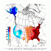
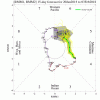
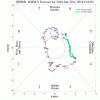
Any "cold" for the remainder of this month will be (looks to be) transient at best ...
For example ...
View attachment 3350
View attachment 3352
View attachment 3354
View attachment 3355
Remember when LR models were trying to flip the EPO for 2 months to no avail?... Pepperidge farms remembers
dsaur
Member
The firestorm upon impact will warm the ground, so any subsequent snow fall will melt at first, and cut totalsLet's get hit by this asteroid NASA says is coming Feb 3 and go into a mini ice age. Anyone on board?
dsaur
Member
Time things right and any cold will workAny "cold" for the remainder of this month will be (looks to be) transient at best ...
For example ...
View attachment 3350
View attachment 3352
View attachment 3354
View attachment 3355
pcbjr
Member
Tony,Time things right and any cold will workJust need to push some rain into that cad late week, like Goofy had a few days ago, when it was suppressed. Chances galore, but requires timing on the players entrances. At least the cad is hanging around the stage door waiting on Miss Moisture, lol.
I love cold; despise heat. Probably more than most. But, gotta call 'em as they appear.
But maybe I'm just in the brown acid recovery tent ...
And Cad does little outside of Cad areas ...
LOL
Best!
Phil
NASA says "Zero chance of impact within the next 100 years" so for now our snow totals will just have to be cut by a good ol' fashion warm noseThe firestorm upon impact will warm the ground, so any subsequent snow fall will melt at first, and cut totals
Nice rain chances over the coming 15 days. I would be happy to bring home 2-3 inches of rain during that period.
Sent from my SM-G955U using Tapatalk
Sent from my SM-G955U using Tapatalk
I guess I'm the only one who is over winter and ready for severe weather season ?
tonysc
Member
You are.I guess I'm the only one who is over winter and ready for severe weather season ?
I guess I'm the only one who is over winter and ready for severe weather season ?
I enjoy tracking severe weather, but winter threats are still more fun.
pcbjr
Member
There is a special building, far away, secure, and isolated, where entry and exit very well monitored, and the staff is very accommodating and understanding ...I guess I'm the only one who is over winter and ready for severe weather season ?
Last edited:
CentralGAColdFront
Member
I'm severely starting to become concerned that this developing drought is going to wreck havoc with temperatures over the upcoming summer. Outside of a 50 percent chance of showers Monday night, the rest of the week looks dry for me.
Round Oak Weather
Member
Dang was kinda looking forward to a mini Ice age maybe next timeNASA says "Zero chance of impact within the next 100 years" so for now our snow totals will just have to be cut by a good ol' fashion warm nose
Last edited:

12z GFS should ease your concerns. Maybe need to be more concerned about flash flooding at some point if this is even close to being correctI'm severely starting to become concerned that this developing drought is going to wreck havoc with temperatures over the upcoming summer. Outside of a 50 percent chance of showers Monday night, the rest of the week looks dry for me.
Kylo
Member
Can’t see the hemispheric pattern on the Euro EPS but has EPO diving negative into February.


whatalife
Moderator
Can’t see the hemispheric pattern on the Euro EPS but has EPO diving negative into February.


Sent from my iPhone using Tapatalk
Kylo
Member

Sent from my iPhone using Tapatalk
Wow...looks better then I thought.
whatalife
Moderator
Wow...looks better then I thought.
Yep. Sure does look good.
Sent from my iPhone using Tapatalk
Last edited:
Xtreme Weather
Member
Interesting to date departure from normal temp wise for my area ANB from BMX
[TEMPERATURE DATA]
AVERAGE MONTHLY: 35.5
DPTR FM NORMAL: -7.5
HIGHEST: 71 ON 11
LOWEST: 9 ON 17
[NO. OF DAYS WITH]
MAX 32 OR BELOW: 3
MAX 90 OR ABOVE: 0
MIN 32 OR BELOW: 14
MIN 0 OR BELOW: 0
[HDD (BASE 65) ]
TOTAL THIS MO. 522
DPTR FM NORMAL 104
TOTAL FM JUL 1 1593
DPTR FM NORMAL 73
[TEMPERATURE DATA]
AVERAGE MONTHLY: 35.5
DPTR FM NORMAL: -7.5
HIGHEST: 71 ON 11
LOWEST: 9 ON 17
[NO. OF DAYS WITH]
MAX 32 OR BELOW: 3
MAX 90 OR ABOVE: 0
MIN 32 OR BELOW: 14
MIN 0 OR BELOW: 0
[HDD (BASE 65) ]
TOTAL THIS MO. 522
DPTR FM NORMAL 104
TOTAL FM JUL 1 1593
DPTR FM NORMAL 73
Brent
Member
I guess I'm the only one who is over winter and ready for severe weather season ?
Nope still gotta get my snow lmao
Larry,
Looks like you/we nailed it - was 28º shortly before daybreak!
Phil
The "Great Radiator" rarely disappoints. So, radiation allowed a 34 F drop, which isn't unusual under these conditions. Note also that even though the DP rose to 30 last evening, the eventual low was 2 colder and the DP fell back to 26 allowing for the 28 low.
I saw that today's high was only 1 warmer than yesterday. Beautiful day there and here today. I'm sure I would have been at Memorial Park if I had been there. But I had a great walk here with this great wx.
pcbjr
Member
Ditto on all scores!The "Great Radiator" rarely disappoints. So, radiation allowed a 34 F drop, which isn't unusual under these conditions. Note also that even though the DP rose to 30 last evening, the eventual low was 2 colder and the DP fell back to 26 allowing for the 28 low.
I saw that today's high was only 1 warmer than yesterday. Beautiful day there and here today. I'm sure I would have been at Memorial Park if I had been there. But I had a great walk here with this great wx.


