looks like icon... I guess still around so that is good
-
Hello, please take a minute to check out our awesome content, contributed by the wonderful members of our community. We hope you'll add your own thoughts and opinions by making a free account!
You are using an out of date browser. It may not display this or other websites correctly.
You should upgrade or use an alternative browser.
You should upgrade or use an alternative browser.
Pattern Januworry
- Thread starter SD
- Start date
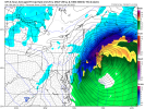
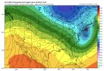
East on this run of the gfs, the 500mb look changes every run pretty drastically still. General idea is some kind of phased system is probable next weekend, but will it phase far enough west to impact us or will it phase late and crush New England
Sent from my iPhone using Tapatalk
Sent from my iPhone using Tapatalk
NCSNOW
Member
- Joined
- Dec 2, 2016
- Messages
- 9,540
- Reaction score
- 18,971
Oh yea. Perfect spot 6 days out. 991 as she blows off the coast. That was a decent shot eastern NC.looks like icon... I guess still around so that is good
Dont sleep on mid week. Close enough to keep watching. Get low out of the way in NE, just a wrinkle away
LukeBarrette
im north of 90% of people on here so yeah
Meteorology Student
Member
2024 Supporter
2017-2023 Supporter
bingcrosbyb
Member
Dang the NE gets pounded by that nor'easter in the 0z.
NorthGaWinter4
Member
It’s just not the year for north Georgia. Losing everything to the East....
This one is 7 days out at this range all long range models will have pretty big shifts one way are other just hope they all slowly starting closing in on same idea by Monday/Tuesday... or maybe don't the 12z GFS was a monsterIt’s just not the year for north Georgia. Losing everything to the East....
ForsythSnow
Moderator
Far too early to talk trends. We just have a signal, same with Tuesday. Fluctuations are too significant and Tuesday thus suite warmed a ton. Trends with recent storms have been clueless on certain elements until verification so we can still have 100s of miles of shifts within days.This one is 7 days out at this range all long range models will have pretty big shifts one way are other just hope they all slowly starting closing in on same idea by Monday/Tuesday... or maybe don't the 12z GFS was a monster
Iceagewhereartthou
Member
If next week's storm is too far east again I'm gonna cry!
dsaur
Member
Got the weak low crossing Fla. Got the 0 line close by. I agree....just want the timing. Keep getting the shots, and one might hit a good bit of the viewing area instead of being so selective.Oh yea. Perfect spot 6 days out. 991 as she blows off the coast. That was a decent shot eastern NC.
Dont sleep on mid week. Close enough to keep watching. Get low out of the way in NE, just a wrinkle away
bingcrosbyb
Member
It's way too early for that. We have time for things to happen next week and beyond. Happy for the guys back east, especially our SC neighbors. I get it though. I am ready for something to happen our way but the small event last week kind of worked out.It’s just not the year for north Georgia. Losing everything to the East....
Brent
Member
It’s just not the year for north Georgia. Losing everything to the East....
Yeah same here. We can't even get a good rain
Long range NAM is sooooo close across central AL early next week. A few degrees from 925mb to the surface….
Clem282340
Member
How is northern AL looking early next weekLong range NAM is sooooo close across central AL early next week. A few degrees from 925mb to the surface….
Looking at the changes on the Euro at 120hrs make me think the Euro is gonna be east with the big storm.
Gonna be way east.

