NWMSGuy
Member
I could see that as well. Although the below is just distant noise, this makes the second time the GFS has showed such a solution within the past week.

Yeah whether we get something or not,gonna be some fun model runs coming upMan there are some brutal cold blasts showing in the long range . Still think we have one or two more board wide threats before February 10th
Sent from my iPhone using Tapatalk
That's voodoo land; as James spann would say lol.I could see that as well. Although the below is just distant noise, this makes the second time the GFS has showed such a solution within the past week.
View attachment 109103
The 120 hour frame, is intriguing, I'd count everything to be in play with winter systems until it's almost go time lol. If the low pressure would bomb some over the gulf and time it right with cold air we would get a nice little snow. Waiting to see the 12z model suite.I still think we'll have a couple more threats to track during the coming weeks. Nothing set in stone yet as but when you have digging cold air and energy flying around to the south you have be on the lookout.
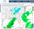
Hmm euro a bit more optimistic with colder air in assocation with this wave. Is this finally Alabamas chance for some statewide snow? (Probably not) ?.View attachment 109062
I'm watching this one for the mountains, though. Could be a nice little snowfall to chase with marginal temps so the roads are clear.The timing continues to be off for the vast majority of the SE on models as of now for that Tuesday Gulf low to give wintry precip. When the moisture arrives, it isn’t meeting up with an Arctic high to its north and also there’s no stubborn low level cold (wedge) to meet up with the moisture for the Ga/Carolina CAD areas. So, this is still looking to be a mostly no big deal for wintry for at least the bulk of the SE. Mostly looking like everyone’s favorite, a cold rain. Maybe though there would be some light stuff on the backside in those areas prone to that sort of thing. The caveat to all of this is that there’s still a small chance for things to change enough to make it more of a wintry threat only because it is still 4-4.5 days out.
Yeah 4-5 days out is a LOT for a winter setup lol. Just a thing to keep in mind that this setup may change some. And things may mesh together betterThe timing continues to be off for the vast majority of the SE on models as of now for that Tuesday Gulf low to give wintry precip. When the moisture arrives, it isn’t meeting up with an Arctic high to its north and also there’s no stubborn low level cold (wedge) to meet up with the moisture for the Ga/Carolina CAD areas. So, this is still looking to be a mostly no big deal for wintry for at least the bulk of the SE. Mostly looking like everyone’s favorite, a cold rain. Maybe though there would be some light stuff on the backside in those areas prone to that sort of thing. The caveat to all of this is that there’s still a small chance for things to change enough to make it more of a wintry threat only because it is still 4-4.5 days out.
I think the changes that would need to happen to get the cold air into the boundary layer would need to be showing up on the short range models in the 48 to 64 hour time frame. So we really only have about 2 days for it to change.Yeah 4-5 days out is a LOT for a winter setup lol. Just a thing to keep in mind that this setup may change some. And things may mesh together better
It also joined the GFS on the tuesday snow for N GA. I've been looking at this time frame but given the GFS was on an island I wasn't thinking too much of it. Now that it's closer and unchanged, I'll look to what the Euro will show.Icon has something at the end of the run. Too early to really know anything concrete, though.


I wouldn’t write Tuesday off yet at this point. Especially for northeast Georgia and surrounding areas. GFS was quite interesting. Surface temperatures gonna be very marginal but there is still time for things to trend one way or the other.View attachment 109124View attachment 109125View attachment 109126
 It's honestly mostly surface temps that are the thing that's marginal fortunately. With enough moisture and the timing being morning it can be pulled off.
It seems to be exclusively N GA on this. Alabama's soundings are very warmI'm betting this'll be another close no show for central Alabama ?. Eventually we have to catch a break lol.