BHS1975
Member
That's gotta be the strongest ever for that latitude for a non tropical system.
Sent from my iPhone using Tapatalk
That's gotta be the strongest ever for that latitude for a non tropical system.
Sent from my iPhone using Tapatalk

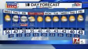
If someone told me this would be the forecast during a period of 10 days in January after we already had a winter storm .. I would laugh View attachment 108004.. this is impressive #januworryaboutnothingView attachment 108005
Say again? When did Dubuque, Iowa become a Southeastern state? ?Accu35, is that you?
If I got a third of that....How about that Canadian output earlier. rektView attachment 108051
GFS also had several storms in the pipeline with most being pretty suppressed which is right where we want them.0z euro has a major winter storm brewing at day 8. Very very cold surface temps yet again. We’re in the middle of an epic stretch of winter weather folks.
Sent from my iPhone using Tapatalk

Me too. I think we are about to switch to a trough in the west in February. I also don't see any real promising setups in the next two weeks. It's looking like we are going to leave January with a few cold rains and near average temps. That will not erase the huge warm departure's earlier this month. I can see Atlanta staying 4 to 5 degrees above average for the month, easy.I see signs of maybe a change late this month and into first few days into FEB. noticing more and more storms along the west coast as we start FEB
Me too. I think we are about to switch to a trough in the west in February. I also don't see any real promising setups in the next two weeks. It's looking like we are going to leave January with a few cold rains and near average temps. That will not erase the huge warm departure's earlier this month. I can see Atlanta staying 4 to 5 degrees above average for the month, easy.


