Snownut
Member
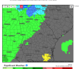
That's a long way from a TrendUm, this warmer trend ? View attachment 102420View attachment 102421
Sent from my SM-A526U using Tapatalk
That's a long way from a TrendUm, this warmer trend ? View attachment 102420View attachment 102421
So it goes into 8 and then 1? Am I reading that right?
I guess it’s better delayed then denied, that’s a great look with strong high pressure rooted from the Arctic, far out but it’s something to look at I guess, classic CP flow View attachment 102422
Not that surprising tbh pac jet extension brought the mean low center into the GOA region, temporary western ridge gets beaten down in time as energy ejects and the whole construct breaks down and releases as the pacific jet retracts and the mean low center reestablishes in the aleutians which renews western ridging and you get the current post D12 super cold. Soooo at least a short period of zonal across Noam is likely where the pv will be titled east or tugged poleward with not much connection to it. Interestingly enough the 0z eps was still building western heights at 360 hr...Um, this warmer trend ? View attachment 102420View attachment 102421
It heading into the COD would be just as good as it going into a good MJO phase.
In the COD which is equally as good for snow and cold.So it goes into 8 and then 1? Am I reading that right?
Yep, I’m literally not even trying to be a heat miser or whatever I’m getting the rep of, I’m just showing a trend I don’t like, I legitimately want it to snow so bad and it’s frustrating seeing things delay in every possible way, like this week/early next week looked so much better back then until the pacific jet went to Far East and extended to Far East which is still good for cold, but sucks for snow, and now this issue, here’s to hoping that really cold post hour 300 makes it here because that signal is extremely impressive.Not that surprising tbh pac jet extension brought the mean low center into the GOA region, temporary western ridge gets beaten down in time as energy ejects and the whole construct breaks down and releases in time as and pacific jet retracts and the mean low center reestablishes in the aleutians which renews western ridging and you get the current post D12 super cold. Soooo at least a short period of zonal across Noam is likely and the pv will be titled east with not much connection to it.
Yeah I completely understand where you are coming from. As bad as its been here in VA you guys have really gotten the shaft down there the past couple years. I would be frustrated too.Yep, I’m literally not even trying to be a heat miser or whatever I’m getting the rep of, I’m just showing a trend I don’t like, I legitimately want it to snow so bad and it’s frustrating seeing things delay in every possible way, like this week/early next week looked so much better back then until the pacific jet went to Far East and extended to Far East which is still good for cold, but sucks for snow, and now this issue, here’s to hoping that really cold post hour 300 makes it here because that signal is extremely impressive.
Remember the old saying the models rush pattern changes? It's probably some of what we are seeing here but the eps hinted at some of what we are seeing. If you go back to old runs you can see the models were too fast with the Pacific jet retraction and continue to be. As long as the retraction is still going to take place not much reason for concern. Things are delayed, sure, but let's see if they are truly deniedYep, I’m literally not even trying to be a heat miser or whatever I’m getting the rep of, I’m just showing a trend I don’t like, I legitimately want it to snow so bad and it’s frustrating seeing things delay in every possible way, like this week/early next week looked so much better back then until the pacific jet went to Far East and extended to Far East which is still good for cold, but sucks for snow, and now this issue, here’s to hoping that really cold post hour 300 makes it here because that signal is extremely impressive.
Really good for ATL. I see nothing be good signs with that pic, 8,1 or COD is great .It heading into the COD would be just as good as it going into a good MJO phase.


Hey my beach trip is over I’m ready for the cold now so it still probably won’t show up ?Man, you gotta stop hanging with Carysnow95 and poiman
Did someone say 04If you want to see similar pac evolutions look at 04 and 14
And 14Did someone say 04
It was a nino I believe so I'm not as sold on the cold Dec but the pacific is behaving similarly. I think 04 had more of a -nao tendencyDid someone say 04