-
Hello, please take a minute to check out our awesome content, contributed by the wonderful members of our community. We hope you'll add your own thoughts and opinions by making a free account!
You are using an out of date browser. It may not display this or other websites correctly.
You should upgrade or use an alternative browser.
You should upgrade or use an alternative browser.
Pattern Januworry
- Thread starter SD
- Start date
I can not remember which poster said this yesterday, but are we concerned about how our "fantasy storm" continues to be pushed later in the month? The poster had a compelling argument. I just can not find the post. We look at how well the pattern is and look for fantasy storms to back up the models? ?
Avalanche
Member
Where are you?We've added 3" in the last two hours. 15" total so far.
Stephenb888
Member
It’s definitely not a good thing to have the cold constantly forecasted another week/weeks out.I can not remember which poster said this yesterday, but are we concerned about how our "fantasy storm" continues to be pushed later in the month? The poster had a compelling argument. I just can not find the post. We look at how well the pattern is and look for fantasy storms to back up the models? ?
Nah the pattern as a whole can produce at any time for a fairly long duration so seeing storms pop up at different times just showing how conducive the pattern is at producing somethingI can not remember which poster said this yesterday, but are we concerned about how our "fantasy storm" continues to be pushed later in the month? The poster had a compelling argument. I just can not find the post. We look at how well the pattern is and look for fantasy storms to back up the models? ?
ATLwxfan
Member
I mean there hasn’t really been a fantasy storm. There have been the required players showing up repeatedly throughout the run and yes occasional runs show a hit. GFS is sniffing things out with a lot of moving parts. Then the PV has to decide how it’s going to influence.
The likelihood of us getting a board wide hit in a small window is low. However seems to be that we’ve got a fairly big window - one we haven’t seen in a long time. Sooner or later…
Sent from my iPhone using Tapatalk
The likelihood of us getting a board wide hit in a small window is low. However seems to be that we’ve got a fairly big window - one we haven’t seen in a long time. Sooner or later…

Sent from my iPhone using Tapatalk
D
Deleted member 1449
Guest
Where are you?
Holland, Michigan, and about 200 yards from the shore of Lake Michigan.
SnowNiner
Member
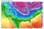
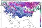
I don't know. The good thing last night/this morning on GEFS looks like the pacific jet stays moderately extended to Hawaii to keep the ridge from retrograding too far west all the way to the end of the run. That's great. But for some reason it seems to me the cold is taking longer and longer to get into the SE, like the ridge axis is just a bit too far west, cold is again stuck out in the west/central US. I would think based on the overall H5, the ridges and conus trough that we'd be in a good spot for cold to spill east, but the GEFS isn't showing it unload. It's holding it back.  ?
?


Did the Jan 2-4 winter storm show up 7-10 days out? Seems to me it did not and the pattern wasn't as conducive then. If the pattern is better, which it is, and that pattern holds, which it appears it will, then give it time, something will show up. It's not like it's common to track 10 day winter storms, there not like TCs. Lol
NoSnowATL
Member
I think it started popping up around day 4-5Did the Jan 2-4 winter storm show up 7-10 days out? Seems to me it did not and the pattern wasn't as conducive then. If the pattern is better, which it is, and that pattern holds, which it appears it will, then give it time, something will show up. It's not like it's common to track 10 day winter storms, there not like TCs. Lol
NoSnowATL
Member
3 days out actually.I think it started popping up around day 4-5
ATLwxfan
Member
I don't know. The good thing last night/this morning on GEFS looks like the pacific jet stays moderately extended to Hawaii to keep the ridge from retrograding too far west all the way to the end of the run. That's great. But for some reason it seems to me the cold is taking longer and longer to get into the SE, like the ridge axis is just a bit too far west, cold is again stuck out in the west/central US. I would think based on the overall H5, the ridges and conus trough that we'd be in a good spot for cold to spill east, but the GEFS isn't showing it unload. It's holding it back.

This is true but we don’t want a huge cold Press either. It’s a delicate balance. I’d personally rather see us flirting with cold than see the hammer.
Sent from my iPhone using Tapatalk
Cary_Snow95
Member
Down to 34 this morning. Not bad considering it was 50 at 11pm
Yeah, the cold has been holding back all winter. The continent is flooded with pacific air, and no one S of Chicago has seen snow??I don't know. The good thing last night/this morning on GEFS looks like the pacific jet stays moderately extended to Hawaii to keep the ridge from retrograding too far west all the way to the end of the run. That's great. But for some reason it seems to me the cold is taking longer and longer to get into the SE, like the ridge axis is just a bit too far west, cold is again stuck out in the west/central US. I would think based on the overall H5, the ridges and conus trough that we'd be in a good spot for cold to spill east, but the GEFS isn't showing it unload. It's holding it back.?

NCSNOW
Member
- Joined
- Dec 2, 2016
- Messages
- 9,579
- Reaction score
- 19,089
Be interesting if those single digit temps being advertised, verify in the day 10-15 range. Not sure when the last time Greensboro made a run at 0, got in the low single digits. Dont remember if we did past year or 2If the GFS and its ensembles are close to being correct in recent runs, the January 20th-25th looks to be the greatest opportunity for the entire SE to score, event the Deep South. That’s way out there, but should provide us with lots of fun ( and aggravation) tracking over the next couple of weeks. Good luck, and enjoy the ride!
Does anyone have an EPS report? Does it look as favorable as the GEFS?
blueheronNC
Member
This is true but we don’t want a huge cold Press either. It’s a delicate balance. I’d personally rather see us flirting with cold than see the hammer.
Sent from my iPhone using Tapatalk
Since I moved back here in 2018, every snow event has been above freezing. 34-36F and snow. About time we got one of those 24F snows.
You rarely see a 300+ hour Winter storm consistently work it's way into the medium range then into short range & ultimately verify, especially for the Southeast. In favorable patterns, these things are going to pop up in the medium range then we work forward with that. Something is brewing the 3rd or 4th week of the month, just a hunch. I'll eat the crow if it doesn't.
packfan98
Moderator
It's been a while. Chances are those super cold model runs won't verify. However, it could very well put our area in the sweet spot for a storm when it modifies. This time of the year is when we can score like the mid-atlantic regions do often does when they "steal" our storm. Fun times at the very least.Be interesting if those single digit temps being advertised, verify in the day 10-15 range. Not sure when the last time Greensboro made a run at 0, got in the low single digits. Dont remember if we did past year or 2
Last edited:


