Z
-
Hello, please take a minute to check out our awesome content, contributed by the wonderful members of our community. We hope you'll add your own thoughts and opinions by making a free account!
You are using an out of date browser. It may not display this or other websites correctly.
You should upgrade or use an alternative browser.
You should upgrade or use an alternative browser.
Pattern Januworry
- Thread starter SD
- Start date
Storm5
Member
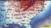
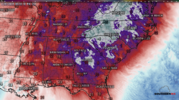
All eyes on next weekend . Front comes through hanging an arctic front with a possible system . Giddy up
Sent from my iPhone using Tapatalk
Sent from my iPhone using Tapatalk
We aint hitting no 44 today. Sitting at 37 looking at 2 week old sleet piles in the parking lot that refuse to melt.
- Joined
- Jan 23, 2021
- Messages
- 4,603
- Reaction score
- 15,199
- Location
- Lebanon Township, Durham County NC
The sleet piles will never die. I still see them here as well.We aint hitting no 44 today. Sitting at 37 looking at 2 week old sleet piles in the parking lot that refuse to melt.
Z
Zander98al
Guest
I haven’t made any specific predictions for February yet but instead am only saying I don’t see any sign of a drastic change to mild domination in the SE and have plenty of hope it averages BN in the first half of February based on models, analogs (like 1985, 1972, 1934, 1899, and 1895), and the MJO.
Ok, what the heck. I’m predicting that ATL and RDU will both be at least 3 BN 2/1-14. I’m not predicting wintry precip as that’s a crapshoot, but being BN helps more than hurts the chances.
Bumping this post of mine from January 17th during a period when the general discussion was centering on a potential overall pattern change to mild in early February as models were hinting at a warmup near February 1st as the PNA was then predicted to fall late this month. I was doubting that change to a mild pattern citing ENSO analogs (1985, 1972, 1934, 1899, and 1895) the MJO, and extended models (Euro weeklies/CFS) and was asked for a prediction:
“I’m predicting that ATL and RDU will both be at least 3 BN 2/1-14.”
Looking at today’s models, I feel pretty good about this despite an expected mild February 1-3. Let’s see what happens.
I’ll also copy this into the February thread.
Christian T Murray
Member
HurricaneSolomon
Member
- Joined
- Dec 6, 2021
- Messages
- 154
- Reaction score
- 276
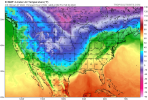
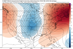
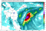
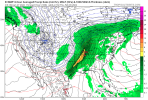
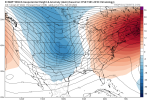
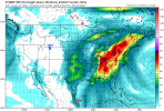
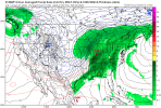
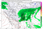
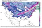
all eyes back in fantasy land!View attachment 111194
This type of signal has actually been pretty consistent the last two or three days.
Sent from my iPad using Tapatalk
It'll trend Northeast as we draw nearer. They never trend NW anymore.
32 degrees. Stiff wind. Almost 2 pm. Full sunshine. Arctic air.
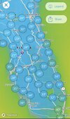
1. Miami and Ft. Myers with forecasts of 38/32 tonight would have their coldest since January of 2010!
2. SAV and Gainseville, FL, with fcasts of low 20s would have their coldest since Jan of 2018. @pcbjr
3. Middle 40s with a nice wind here now. Similar at Hogtown. Going to try to go walking in this shortly. Tonight will actually be a bit nippy for even me. So, I'll try to get it it in before dark if I can.
4. Going to water the Sego Palms for extra protection but they should be ok regardless from what I've read. They have moss around them. By the way, I just read that they're not really palms.
Will drip my outside faucets.
Last edited:
pcbjr
Member
Larry,1. Miami and Ft. Myers with forecasts of 38/32 tonight would have their coldest since January of 2010!
2. SAV and Gainseville, FL, with fcasts of low 20s would have their coldest since Jan of 2018. @pcbjr
3. Middle 40s with a nice wind here now. Similar at Hogtown. Going to try to go walking in this shortly. Tonight will actually be a bit nippy for even me. So, I'll try to get it it in before dark if I can.
4. Going to water the Sego Palms for extra protection but they should be ok regardless from what I've read. They have moss around them. By the way, I just read that they're not really palms.
Will drip my outside faucets.
The wind is dying it seems, the RH has dropped considerably, never cracked 40º until late AM ... my weather guess is that the radiator goes bonkers tonight ... could go lower than the "official" call of 23º ...
Phil
Edit:
From local NWS:
Tonight will be downright COLD and widespread lows in the low 20s,
with localized readings into the upper teens, is expected tonight.
With the 10-12 hours of subfreezing temperatures
tonight, this arctic cold outbreak will undoubtedly result in
impacts; folks please protect your outdoor animals, sensitive
plants, ensure exposed pipes are properly insulated and check on
others that may not have sufficient shelter.
Last edited:
CAE has had 2 wintry events within a weeks time also unusualKATL: this month is 1st with 4 different T+ SN/IP events since 1/2014
KCHS: this month is 1st with 2 different T+ SN/IP events since 12/2010.
Great stats as always. I'm a little surprised our forecast lows aren't lower considering the near 0 dewpoints and dying winds. It looks like our winds quickly shift from the southwest after midnight, maybe that is the culprit.1. Miami and Ft. Myers with forecasts of 38/32 tonight would have their coldest since January of 2010!
2. SAV and Gainseville, FL, with fcasts of low 20s would have their coldest since Jan of 2018. @pcbjr
3. Middle 40s with a nice wind here now. Similar at Hogtown. Going to try to go walking in this shortly. Tonight will actually be a bit nippy for even me. So, I'll try to get it it in before dark if I can.
4. Going to water the Sego Palms for extra protection but they should be ok regardless from what I've read. They have moss around them. By the way, I just read that they're not really palms.
Will drip my outside faucets.
Currently 32/7 looks like another 10-15 tonight
I’m 32/13 with calm winds now. NWS says 21 but I don’t see how we aren’t we’ll into the teens.
- Joined
- Jan 23, 2021
- Messages
- 4,603
- Reaction score
- 15,199
- Location
- Lebanon Township, Durham County NC
I’m thinking single digits for people like @NCSNOW who got more snowCurrently 32/7 looks like another 10-15 tonight
GeorgiaGirl
Member
High 41
Pretty brutal outside with the wind. The daily walk for exercise wasn't fun.
Will be interesting to see how low it can get.
Pretty brutal outside with the wind. The daily walk for exercise wasn't fun.
Will be interesting to see how low it can get.
Agreed. If anyone is able to fully decouple early with or without snow cover 7, 8, 9 seems realistically doable with dews generally -5-0.I’m thinking single digits for people like @NCSNOW who got more snow
This is probably the most impressive arctic air we have had in place since 2018. It would have been interesting to see what we could have done with a deeper snow pack or having the winds down now instead of near or after midnight. Have to think widespread single digits to low negative single digits
most recent RDU ob was 30/-1 with wind chill 22
Currently 32/7 looks like another 10-15 tonight
27/ -3 WC 18
RAH calling for 15.
10-15 seems reasonable.?...
LickWx
Member
Winds should keep up tonight which would limit things . Still I’d say coldest night of year for many.
- Joined
- Jan 5, 2017
- Messages
- 3,779
- Reaction score
- 5,990
Dropping like a rock. Down to 31 already!
Breezey still. Kido said it was 11 up in Boone on truck thermometer. Could see mtn area hitting -0 if wind will die offI’m thinking single digits for people like @NCSNOW who got more snow
28/-2
ForsythSnow
Moderator
Dropping like a rock here, 1 degree of per 15 mins. 25.2/5.9
26.8F 10.0
25.9/8.9, we were warmer than I thought last night by a couple of degrees, bottomed out at 21, so interested to see where we head tonight.
23.7 temp
5.2 dew point
Forecasted low was 24 ?
5.2 dew point
Forecasted low was 24 ?
Down to 21.7. I’m going to guess 17 here.23.7 temp
5.2 dew point
Forecasted low was 24 ?
26.4/7, temp has come up 2° and dp has dropped 5°. Still some wind which is why not bottoming out yet
21/12
Brent
Member
Weather Underground has 37 and WeatherBug has 48 ?
Just went under 20! Curious to see what we bottom out at.
I bottomed at 17. Careful or we may trigger Stormlover.Just went under 20! Curious to see what we bottom out at.
12° this morning holy smokes and my waters frozen ughh
Fountainguy97
Member
13.6 this morning, not gonna lie hoping it's the last teens but have my doubts
Last edited:

