The system we are going to be dealing with for the next 24-36 hours is just the appetizer before the main course comes in next weekend! I know my chances of winning the Mega Millions are better than seeing something like this but I like what I'm seeing for next Friday and Saturday.Bombs away, 30+" in RDU too


-
Hello, please take a minute to check out our awesome content, contributed by the wonderful members of our community. We hope you'll add your own thoughts and opinions by making a free account!
You are using an out of date browser. It may not display this or other websites correctly.
You should upgrade or use an alternative browser.
You should upgrade or use an alternative browser.
Pattern Januworry
- Thread starter SD
- Start date
Loganville Winter
Member
It would be interesting to know how many times that has even been modeled before. Much less actually come to fruition. Amazing!The system we are going to be dealing with for the next 24-36 hours is just the appetizer before the main course comes in next weekend! I know my chances of winning the Mega Millions are better than seeing something like this but I like what I'm seeing for next Friday and Saturday.
Darklordsuperstorm
Member
If we can get that look on the Florida coast mid Feb I'll be a happy personNot to mention the heat dome that builds in. Luckily it's in fantasy land so it won't verify.
Here is a loop of all Euro Weekly runs since mid-Dec for the period of Jan 23-30

Here is a loop of all Euro Weekly runs since mid-Dec for the period of Jan 23-30
The CFS caught onto the cold late January much earlier than the Euro weeklies did.
Last edited:
- Joined
- Jan 2, 2017
- Messages
- 1,568
- Reaction score
- 4,283
La Ninas getting better and El Ninos getting worse??
Kind of seems that way, though I would still like to rock and roll with Mod or Strong Nino (just not the super strong Ninos like 15-16). Lot of the weak El Ninos post 1980 have been poor winters
Note the trend of AAM increasing during La Ninas.....and that Dec 2021 was highest AAM during a La Nina since Dec 1995 (Winter of 95-96) which was a 'wintry winter'. Dec 2021 AAM spike and MJO movement likely contributing factors to our more wintry pattern in Jan.
I've heard it all now!
18z GFS looks much different with the energy. Still need it to consolidate a few hundred miles west.

Come to Jimmy 

^ Yeah the GFS was close to a bomb there.....same with the new CMC
Here was the CMC during the period of interest late next week.....can we make it 3 weeks in a row with a winter storm chance?

GFS, CMC, and Euro all very close tonight with deep diving bomb into the SE late next week.....one to watch

Downeastnc
Member
GFS, CMC, and Euro all very close tonight with deep diving bomb into the SE late next week.....one to watch
Would be awesome to pull it off, snow three weeks in a row with a chance for a couple of nearly statewides, would be Mar 1960 all over again.
Two dusting a would make a half an inch right? 
Wow really coming down … this is going to be one great event that I think will overpreform it’s just accumulating so quickly and we’re going to be colder tomorrow. Probably will end up with a half an inch if I’m lucky
truly a table setter
truly a table setter
Z
Zander98al
Guest
Hmm euro a bit more optimistic with colder air in assocation with this wave. Is this finally Alabamas chance for some statewide snow? (Probably not) ?.
BHS1975
Member
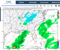
Hmm euro a bit more optimistic with colder air in assocation with this wave. Is this finally Alabamas chance for some statewide snow? (Probably not).View attachment 109062
 .
.Got a lot of work to do still on the temps even here. The weekend bomb is the one to watch.
Sent from my iPhone using Tapatalk
the boundary layer is gonna be tough to overcome for the Tuesday system outside of the higher elevations.
probably some onset sleet though for many. otherwise, meh.
probably some onset sleet though for many. otherwise, meh.
I still think we'll have a couple more threats to track during the coming weeks. Nothing set in stone yet as but when you have digging cold air and energy flying around to the south you have be on the lookout.
Storm5
Member
Man there are some brutal cold blasts showing in the long range . Still think we have one or two more board wide threats before February 10th
Sent from my iPhone using Tapatalk
Sent from my iPhone using Tapatalk
NWMSGuy
Member
I could see that as well. Although the below is just distant noise, this makes the second time the GFS has showed such a solution within the past week.

Flotown
Member
Yeah whether we get something or not,gonna be some fun model runs coming upMan there are some brutal cold blasts showing in the long range . Still think we have one or two more board wide threats before February 10th
Sent from my iPhone using Tapatalk
Z
Zander98al
Guest
That's voodoo land; as James spann would say lol.I could see that as well. Although the below is just distant noise, this makes the second time the GFS has showed such a solution within the past week.
View attachment 109103
Z
Zander98al
Guest
The 120 hour frame, is intriguing, I'd count everything to be in play with winter systems until it's almost go time lol. If the low pressure would bomb some over the gulf and time it right with cold air we would get a nice little snow. Waiting to see the 12z model suite.I still think we'll have a couple more threats to track during the coming weeks. Nothing set in stone yet as but when you have digging cold air and energy flying around to the south you have be on the lookout.
Hmm euro a bit more optimistic with colder air in assocation with this wave. Is this finally Alabamas chance for some statewide snow? (Probably not) ?.View attachment 109062
The timing continues to be off for the vast majority of the SE on models as of now for that Tuesday Gulf low to give wintry precip. When the moisture arrives, it isn’t meeting up with an Arctic high to its north and also there’s no stubborn low level cold (wedge) to meet up with the moisture for the Ga/Carolina CAD areas. So, this is still looking to be a mostly no big deal for wintry for at least the bulk of the SE. Mostly looking like everyone’s favorite, a cold rain. Maybe though there would be some light stuff on the backside in those areas prone to that sort of thing. The caveat to all of this is that there’s still a small chance for things to change enough to make it more of a wintry threat only because it is still 4-4.5 days out.
- Joined
- Jan 5, 2017
- Messages
- 3,806
- Reaction score
- 6,060
- Joined
- Jan 5, 2017
- Messages
- 3,806
- Reaction score
- 6,060
I'm watching this one for the mountains, though. Could be a nice little snowfall to chase with marginal temps so the roads are clear.The timing continues to be off for the vast majority of the SE on models as of now for that Tuesday Gulf low to give wintry precip. When the moisture arrives, it isn’t meeting up with an Arctic high to its north and also there’s no stubborn low level cold (wedge) to meet up with the moisture for the Ga/Carolina CAD areas. So, this is still looking to be a mostly no big deal for wintry for at least the bulk of the SE. Mostly looking like everyone’s favorite, a cold rain. Maybe though there would be some light stuff on the backside in those areas prone to that sort of thing. The caveat to all of this is that there’s still a small chance for things to change enough to make it more of a wintry threat only because it is still 4-4.5 days out.
Z
Zander98al
Guest
Yeah 4-5 days out is a LOT for a winter setup lol. Just a thing to keep in mind that this setup may change some. And things may mesh together betterThe timing continues to be off for the vast majority of the SE on models as of now for that Tuesday Gulf low to give wintry precip. When the moisture arrives, it isn’t meeting up with an Arctic high to its north and also there’s no stubborn low level cold (wedge) to meet up with the moisture for the Ga/Carolina CAD areas. So, this is still looking to be a mostly no big deal for wintry for at least the bulk of the SE. Mostly looking like everyone’s favorite, a cold rain. Maybe though there would be some light stuff on the backside in those areas prone to that sort of thing. The caveat to all of this is that there’s still a small chance for things to change enough to make it more of a wintry threat only because it is still 4-4.5 days out.
- Joined
- Jan 5, 2017
- Messages
- 3,806
- Reaction score
- 6,060
I think the changes that would need to happen to get the cold air into the boundary layer would need to be showing up on the short range models in the 48 to 64 hour time frame. So we really only have about 2 days for it to change.Yeah 4-5 days out is a LOT for a winter setup lol. Just a thing to keep in mind that this setup may change some. And things may mesh together better
ForsythSnow
Moderator
It also joined the GFS on the tuesday snow for N GA. I've been looking at this time frame but given the GFS was on an island I wasn't thinking too much of it. Now that it's closer and unchanged, I'll look to what the Euro will show.Icon has something at the end of the run. Too early to really know anything concrete, though.

BufordWX
Member
I wouldn’t write Tuesday off yet at this point. Especially for northeast Georgia and surrounding areas. GFS was quite interesting. Surface temperatures gonna be very marginal but there is still time for things to trend one way or the other.


Z
Zander98al
Guest
I'm betting this'll be another close no show for central Alabama ?. Eventually we have to catch a break lol.
ForsythSnow
Moderator
I wouldn’t write Tuesday off yet at this point. Especially for northeast Georgia and surrounding areas. GFS was quite interesting. Surface temperatures gonna be very marginal but there is still time for things to trend one way or the other.View attachment 109124View attachment 109125View attachment 109126
 It's honestly mostly surface temps that are the thing that's marginal fortunately. With enough moisture and the timing being morning it can be pulled off.
ForsythSnow
Moderator
It seems to be exclusively N GA on this. Alabama's soundings are very warmI'm betting this'll be another close no show for central Alabama ?. Eventually we have to catch a break lol.


D
Deleted member 609
Guest
Boom?

BufordWX
Member
It’s the pattern that keeps giving.
D
Deleted member 609
Guest
Holy ---- balls
