• Hello, please take a minute to check out our awesome content, contributed by the wonderful members of our community. We hope you'll add your own thoughts and opinions by making a free account!

Pattern Januworry

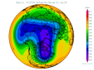
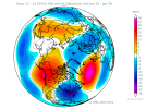
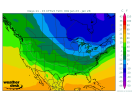
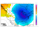
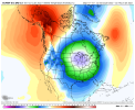
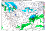
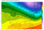
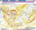
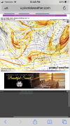
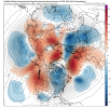
In combo with the rising PNA, it is hard as a cold lover to not like these:

View attachment 100771View attachment 100772
Noticing a few members now want to take it through low amp phase 1 and 2. The good thing I see is that it’s staying on the left side which is obviously what we want. I know a lot of people were playing down the importance of the MJO last week with how bleak the models were looking and there are certainly other pieces of the puzzle, but I’m a firm believer now that it’s the single most important index in a LaNina… what happened with the pattern last February made be a believer of that. Obviously the models are seeing us going into phase 8 and are responding to more troughs in the east
 
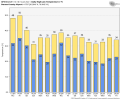
What’s your reasoning on that? I’m not saying that those highs will definitely verify, but there’s certainly a lot of ensemble support right now that well below average high temperatures is in the cards for that week.
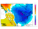
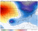
1046 sitting over the central US at d10 on the euro with below 0 dews on the doorstep of the region. We get the pattern the gfs/euro are advertising we are going to see the coldest temps in years (since 2018) for NC/SC/GA
 
1046 sitting over the central US at d10 on the euro with below 0 dews on the doorstep of the region. We get the pattern the gfs/euro are advertising we are going to see the coldest temps in years (since 2018) for NC/SC/GA
Lol then there’s this at hour 150, high around/below freezing 821F34A2-4654-4282-B311-FEED1D3E54C1.png
 
1046 sitting over the central US at d10 on the euro with below 0 dews on the doorstep of the region. We get the pattern the gfs/euro are advertising we are going to see the coldest temps in years (since 2018) for NC/SC/GA
I agree completely, and as I said it’s not just operationals doing goofy things, as there is lot of support in the ensembles for it. One thing I would watch for that time is something trying to develop along the front if it stalls near the Gulf Coast… perhaps a weak wave, but with that type of airmass in place you can see nice widespread 2-4 inch type event
 
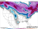
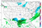
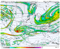
I didn’t realize the gefs was this good for this system, if the euro could hop on to the cho cho weenie train, then this might need a thread in a day or 2, another interesting look for the same areas we’re watching with Monday mornings system A171E738-9FAF-439A-919A-0D77272BFFF5.png090DB746-5009-4CC2-8F39-67B317953871.png
 
1046 sitting over the central US at d10 on the euro with below 0 dews on the doorstep of the region. We get the pattern the gfs/euro are advertising we are going to see the coldest temps in years (since 2018) for NC/SC/GA
AFD this afternoon said the next cold shot here mid/late week, will be colder than the next day or two here. We touch 30 on Tuesday and then go basically 20 highs and -5 to 10 lows for the next 10-15 days! That can only benefit y’all down the line!
 
I agree completely, and as I said it’s not just operationals doing goofy things, as there is lot of support in the ensembles for it. One thing I would watch for that time is something trying to develop along the front if it stalls near the Gulf Coast… perhaps a weak wave, but with that type of airmass in place you can see nice widespread 2-4 inch type event

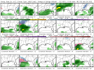
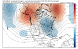
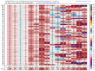
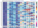
Indeed, look at all of the members with 1045+ mb highs in red: this is believable based on the MJO forecast:

341B568F-3C06-4CD5-B153-EAE415EAA791.png
 
That 18z gfs run was probably the most exciting but infuriating thing I've seen. Great hemispheric pattern right through 384 but warms up to rain with almost every system.

I haven't looked yet. Let me guess, no -NAO and an annoying WAR? :)
 
  • Like
Reactions: SD
I didn’t realize the gefs was this good for this system, if the euro could hop on to the cho cho weenie train, then this might need a thread in a day or 2, another interesting look for the same areas we’re watching with Monday mornings system View attachment 100818View attachment 100819
Although this is a bit different evolution than our current one I do worry about more amplification and such going NW with this system if we’re starting here .. but we will see how far that cold air initially can push through I think the more it can push through the further south the snow could end up
 
AFD this afternoon said the next cold shot here mid/late week, will be colder than the next day or two here. We touch 30 on Tuesday and then go basically 20 highs and -5 to 10 lows for the next 10-15 days! That can only benefit y’all down the line!
217F24E9-B71C-4338-ABDF-868832FEB9B7.png99DE89D1-4650-4326-A725-7B25100D34D6.png
 
Back
Top