Mahomeless
Member
- Joined
- Oct 17, 2023
- Messages
- 900
- Reaction score
- 2,158
Congrats Chicago!...This is how it starts for them...ripper inside 180. Don’t let Met start thread
View attachment 187155
Congrats Chicago!...This is how it starts for them...ripper inside 180. Don’t let Met start thread
View attachment 187155
MarchWhen do we torch? Ready for distant gobbles on a hillside!

This one is ours. Reel it in!View attachment 187340
View attachment 187342
View attachment 187343
We are back to being in this tread.
Next up is this system. By the time it tends north it will be perfect for the ones who missed out of this weekend system.

And it will 1000% happen, crazy how it’s so easy for them to get pure snow and we have such a problem here with warm air, every time.Canadian showing it as well.View attachment 187345
If at first you don't succeed, try, try again!
View attachment 187344
Canadian showing it as well.View attachment 187345
")


Nah; it will either be a coastal and nail the same cities last year or be another cutter and nail the same cities this week. We couldn't get snow here if you moved us to the south pole.View attachment 187340
View attachment 187342
View attachment 187343
We are back to being in this tread.
Next up is this system. By the time it tends north it will be perfect for the ones who missed out of this weekend system.
Tracking a D6 threat with already an inch of ice on my trees is going to take a toll on me, Grit^ The whole period between Feb 7 and Feb 21 on the Weeklies looks like your images there Jimbo!
But will you and I have power to track it?dream season in play View attachment 187350
And there’s support. I’ll never sleep again View attachment 187351View attachment 187352


Ice up big boy, you got this!Tracking a D6 threat with already an inch of ice on my trees is going to take a toll on me, Grit

 make it stop


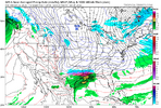
Anyone have the Kuchera map for this?
It's fairly similar, it just is longer duration than 24 hours for the region and I didn't want to do the total snow since that would be infected by this weekend's system. Kuchera snow for RDU is 17-18".Anyone have the Kuchera map for this?


It’s true…didn't we just watch all the models do the same thing only to fail even in the shorter range for snow, i do not trust them 10 days out at all. if the ukmet doesn't have it, i'm out
I agree with you.didn't we just watch all the models do the same thing only to fail even in the shorter range for snow, i do not trust them 10 days out at all. if the ukmet doesn't have it, i'm out


But can it miss to our south? Sigh. We can’t winNo way anything misses us to our NW in this pattern…no chance….i triple dog dare it too
View attachment 187407
I won’t be able to handle another Florida snow….But can it miss to our south? Sigh. We can’t win

Better than a mid-Atlantic northeastern snow.I won’t be able to handle another Florida snow….