-
Hello, please take a minute to check out our awesome content, contributed by the wonderful members of our community. We hope you'll add your own thoughts and opinions by making a free account!
You are using an out of date browser. It may not display this or other websites correctly.
You should upgrade or use an alternative browser.
You should upgrade or use an alternative browser.
Pattern January Joke
- Thread starter SD
- Start date
A timing thingIf blocking isn't strong enough or doesn't hang around, well, we know the drill.
broken025
Member
How do we stop this from going north for the next 219 hours?
Mahomeless
Member
So who is making the storm threat thread? I vote we do it early to change the mojo.
LukeBarrette
im north of 90% of people on here so yeah
Meteorology Student
Member
2024 Supporter
2017-2023 Supporter
td tide
Member
South Central Alabama left out as usual I would say pretty good chance this verifies
Don't sweat it, the entire southeast will be left out of it in 7 days.South Central Alabama left out as usual I would say pretty good chance this verifies
Love the positivityDon't sweat it, the entire southeast will be left out of it in 7 days.
ColdCoreLow
Member
Don't worry, it will be in Chicago by Monday and Pensacola by next ThursdaySouth Central Alabama left out as usual I would say pretty good chance this verifies
SnowNiner
Member
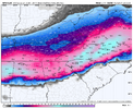
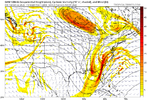
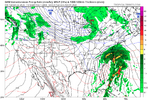
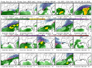
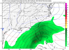
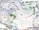
AI’s have something in the vicinity View attachment 187357View attachment 187356
I’m afraid we’re just getting started
That's about right where we want it at this lead time. I'm literally driving to VA beach to go on a cruise Feb 1. Guaranteed I get snowed in CLT.
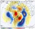
That’s split flow heaven along the west coast with cold TPV pressing down. Leave the southern wave alone and let it cook. It’s the “good” El Niño pattern
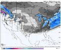
View attachment 187581
Agreed! For the love of all that is holy, NO BAJA LOWS or phasing!!!
It's the gfs though. I'm listening to the euro and even then it will rad. correct about mid-week. Who knows, maybe it corrects towards us favorably mid week.
PvilleWeather
Member
I absolutely LOVE where we sit with this one here in South Central Alabama! Can’t ask for a much better look at this range. Plus, with the snow/ice pack up north combined with a continued supply of Arctic air….Yum!!!!South Central Alabama left out as usual I would say pretty good chance this verifies
BKWRN29
Member
I hope next weekends system is a north to south board crusher so we can all get our fill!  the fact the consistency is already there, I think this will be a big storm. The question is for who, atp.
Positivity doesn't make it snow. But I'm just playing around, sorta kinda.South Central Alabama left out as usual I would say pretty good chance this verifies
Scooter
Member
We need to keep the other thread going as long as possible so this one stays quiet! We will have snowpack to our North, isn't that helpful to keep temps in check? Tracking these systems is what's so fun anyways.
ajr
Member
Already trending north...
Evidently lol. If that were the case, these nothing-burgers would make a lot more sense.Positivity doesn't make it snow. But I'm just playing around, sorta kinda.
broken025
Member
billyweather
Member
Showmeyourtds
Member
At this point, I'm not even going to give it any credence at all. Too many damaged hopes from what was supposed to be 48 hours out. It sucks to suckBam gonna be fighting for this one too. There appears to be a storm
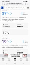
View attachment 187572
GiantBear
Member
I try to think the same thing, but by being here, we are giving it some credence. One thing stands out to me for the end of the month; it will likely be very cold for much of our region.At this point, I'm not even going to give it any credence at all. Too many damaged hopes from what was supposed to be 48 hours out. It sucks to suck
Speaking of timing. You have a good memory /fascination with winter wx over the years. I've experienced this a few times throughout the years, where we get into patterns and they get a rhythm giving us winter wx on the same day of the week or weekend , for consecutive weeks in a row. Last one I remember was Jan 2022 I believe. We kept getting small 1-2 inch events for like 3 straight weekends. Had it happen twice back in the 80's, late Feb/March of 2013.A timing thing
Could we be getting into one now perhaps? No way to tell until you look in the rear view mirror. But when I see what's happening on the LR outlook for Feb and this next weekend threat. Makes you start to wonder.
By middle of next week:
I will have seen it snowflake/ no ice 4 separate times allready
Been through a major winter/Ice storm
Possibly record a 0/sub zero low for the 1st time in forever.
Only thing missing will be a true Blue all snow / miller A winter storm. eclipsing annual snow accum for the 1st time in I don't know when, several years.
Good Times
SegTindo
Member
Tbh it’s been pretty consistent so far but we should get pass this first winter storm then see what happens
Sent from my iPhone using Tapatalk
It'll be in Michigan and Pennsylvania in the next few runsAlready trending north...
broken025
Member
wow
Member
Looks like ice.
WEATHERBOYROY
Member
You may be right, but according to the Model, the 925 and 850 are below freezing for 18 hrs of precip from bham to just north of Atl?Looks like ice.
Cbmatt2408
Member
At this point I'm not going to get excited even if it is actively snowing outside. I still will think its just going to go north.
LittleMountain
Member
Where’s the EURO play by play for next week? 
Right now the Euro snows on the gulf coast.Where’s the EURO play by play for next week?
Two things, huge potential and it moves like a snail.
lexxnchloe
Member
BKWRN29
Member
This storm set up would be different, no? I know the CAD always messes us up in south central Alabama so if this is more of a gulf low/ artic air situation then i feel more confident we can actually score.At this point, I'm not even going to give it any credence at all. Too many damaged hopes from what was supposed to be 48 hours out. It sucks to suck
lexxnchloe
Member
This wont be like this storm. A compact low which should draw in cold air.This storm set up would be different, no? I know the CAD always messes us up in south central Alabama so if this is more of a gulf low/ artic air situation then i feel more confident we can actually score.
This storm wasn’t supposed to be like this storm 7 days ago.This wont be like this storm. A compact low which should draw in cold air.
lexxnchloe
Member
But it was always going to be a strung out mess with overrunning. If the 2nd storm happens it will be a classic gulf to off Hatteras stormThis storm wasn’t supposed to be like this storm 7 days ago.

