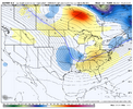
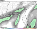
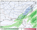
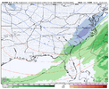
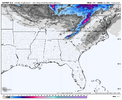
Updated Guidance from NWS GSP
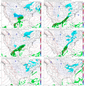
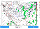
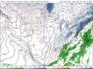
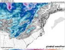
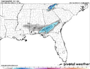
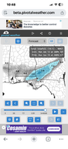
KEY MESSAGE 2: ACCUMULATING SNOWFALL IS EXPECTED WEDNESDAY
NIGHT THROUGH LATE MORNING THURSDAY OVER THE MOUNTAINS OF NC,
MAINLY ALONG THE TN BORDER AND AT ELEVATIONS ABOVE 3500 FT, WHICH
MAY RESULT IN SOME TRAVEL IMPACTS. HOWEVER, THE EXPECTED AMOUNTS
CONTINUE TO TREND DOWNWARD.
THESE WINTERTIME SITUATIONS WHEN YOU HAVE TO RELY ON THE PHASING
OF NRN AND SRN STREAM SHORT WAVES TO GET THE BIG SNOW ARE ALWAYS
TRICKY AND FICKLE, AND THIS ONE LOOKS NO DIFFERENT, AS THE LATEST
MODEL RUNS CONTINUE THE TREND AWAY FROM ANYTHING SIGNIFICANT
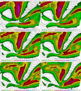
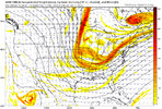
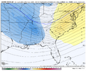
WEDNESDAY INTO THURSDAY. THE PROBLEM APPEARS TO BE THE LEAD SRN
STREAM SHORT WAVE MOVING ACROSS THE GULF COAST ON WEDNESDAY. THIS
FEATURE DOESN'T ALLOW MUCH IN THE WAY OF MOISTURE RETURN AHEAD
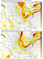
OF THE MAIN DEEP MID/UPPER TROF DIGGING DOWN OVER THE GREAT
LAKES/MIDWEST/MS VALLEY REGIONS ON WEDNESDAY. THE BEST FORCING
WITH THIS INITIAL WAVE NOW LOOKS AS IF IT WILL SKIRT PAST THE
FCST AREA TO THE SOUTH AND EAST EARLY IN THE DAY ON WEDNESDAY
BEFORE THE BETTER MOISTURE CAN MOVE UP FROM THE SOUTHWEST. THIS
IS ACADEMIC ANYWAY, BECAUSE THE COLD AIR WILL STILL BE ON THE
WEST SIDE OF THE MTNS DURING THIS TIME. THE FORCING ASSOCIATED
WITH THE DIGGING UPPER TROF AXIS SHOULD STILL REACH THE MTNS IN
THE AFTERNOON ON WEDNESDAY AND THEN MOVE ACROSS THE FCST AREA
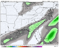
WEDNESDAY NIGHT AND EARLY THURSDAY, BUT THE FORCING LOOKS TO BE
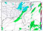
WEAKER THAN PREVIOUS RUNS AND MAINLY FRONTOGENETIC. PRECIP SHOULD
MOVE IN FROM THE WEST IN THE AFTERNOON AS AN ELEVATION-DEPENDENT
RAIN-TO-SNOW. CONFIDENCE IS STILL RELATIVELY GOOD THAT THE COLD AIR
WILL ARRIVE BY WEDNESDAY EVENING TO CHANGE OVER THE PRECIP TO SNOW
DOWN TO THE VALLEYS. THERE'S STILL ENOUGH GOING FOR IT TO EXPECT A
DUSTING TO A HALF INCH OF SNOW OVER MANY OF THE MTN VALLEYS MAINLY
WEDNESDAY EVENING. HOWEVER, THIS CONTINUES TO LOOK LIKE A MORE
AND MORE MINOR EVENT AS THE FORCING LOOKS WEAKER AND SHORT-LIVED
WITH THE TROF AXIS MOVING THROUGH QUICKLY, AND WITH THE DEEPER
MOISTURE MOVING EAST OF THE MTNS BY 06Z THURSDAY. ALTHOUGH THE
REMAINING MOISTURE WILL BE SHALLOW, THE TOP OF THE MOIST LAYER
WILL REMAIN IN THE DENDRITIC SNOW GROWTH ZONE (BELOW -12 C).
EXPECT A QUICK TRANSITION TO NW FLOW SNOW PRODUCTION BY MIDNIGHT,
THEN CONTINUING THROUGH DAYBREAK ALONG THE TN BORDER, AND TAPERING
OFF TO FLURRIES BY MIDDAY. NOTE THAT THE MODEL BLEND DOESN'T
HANDLE NW FLOW SNOW SITUATIONS VERY WELL WITH A BIAS TOWARD ENDING
TOO EARLY, SO PRECIP CHANCES WERE EXTENDED INTO THURSDAY MORNING
WHICH RAISES THE QPF A BIT. EVEN WITH TAKING THAT INTO ACCOUNT,
THE FCST AMOUNTS LOOK UNIMPRESSIVE, WITH MAYBE SOME HIGH ELEVATION
POINTS NEAR THE TN BORDER REACHING ADVISORY CRITERIA. OF NOTE,
HOWEVER, WILL BE THE PLUMMETING TEMPERATURES OVERNIGHT, WELL DOWN
INTO THE TEENS AND 20S, WHICH COULD RESULT IN SOME TRAVEL ISSUES
ON SLIPPERY ROADS. BOTTOM LINE IS THAT A WATCH IS NOT NECESSARY,
BUT WE WILL MONITOR FOR A POSSIBLE ADVISORY IN SOME LOCATIONS.
KEY MESSAGE 3: SIGNIFICANTLY COLDER TEMPERATURES WILL PERSIST FROM
THURSDAY THROUGH THE WEEKEND. DANGEROUSLY COLD WIND CHILLS WILL
BE POSSIBLE ABOVE 3500 FT THURSDAY NIGHT THROUGH FRIDAY MORNING
AND AGAIN SUNDAY NIGHT AND MONDAY MORNING.
WHAT SHOULD EFFECTIVELY BE AN ARCTIC FRONT SHOULD BE EAST OF THE
FCST AREA BY DAYBREAK THURSDAY WITH STRONG COLD ADVECTION ACROSS
THE REGION. TEMPS WILL BE HELD DOWN 10-15 DEGREES BELOW NORMAL
THURSDAY AND THURSDAY NIGHT, MEANING TEMPS WILL NOT GET OUT OF THE
TEENS AND 20S ACROSS THE MOUNTAINS FOR HIGHS THURSDAY, AND WILL
BOTTOM OUT IN THE SINGLE DIGITS TO LOWER TEENS OVER THE MTNS AND
TEENS EAST OF THE MTNS EARLY FRIDAY MORNING. ALTHO THE TREND ON
THE WIND CHILL IS UP SLIGHTLY BECAUSE OF LESS WIND, IT WOULDN'T
TAKE MUCH OF A FCST ERROR IN WIND SPEED TO PUSH SOME OF THE HIGH
ELEVATIONS DOWN INTO THE REALM OF THE COLD WEATHER ADVISORY.
SOME MODERATION IS LIKELY FRIDAY AND SATURDAY AS THE UPPER TROF
MOVES AWAY AND A PROGRESSIVE RIDGE MOVES THROUGH, BUT TEMPS STILL
STAY DOWN 5-10 DEGREES UNDER AVERAGE. THERE COULD BE ANOTHER BRIEF
SHOT OF NW FLOW SNOW SHOWER ACTIVITY FRIDAY NIGHT AND SATURDAY
WITH NO SIGNIFICANT ACCUM INDICATED.
THE GUIDANCE DIGS ANOTHER UPPER TROF DOWN FROM THE NRN PLAINS
SATURDAY INTO SUNDAY WHICH WOULD DRIVE A REINFORCING COLD FRONT
ACROSS THE REGION AT SOME POINT, DIPPING THE TEMPS BACK DOWN TO
WELL BELOW NORMAL. ANOTHER POSSIBLE DANGEROUS WIND CHILL SITUATION
COULD DEVELOP OVER THE HIGH ELEVATIONS SUNDAY NIGHT AND MONDAY
MORNING AS A RESULT.

