wow
Member
The precip should explode there with that upper level output
I already hate AI because the vort maps lack depth. They look like water color paintingsSo we have AI vs non-AI
Looks like Ga. snow comes with the cold core ULL. Big winners and losers with those that wouldn't be determined until go-time.


West of the apps could get onset ice La/MS/ALFeel it in my bones. Round 2 gonna be a big mountain snow. Gonna be real hard for them to miss here
Out of curiosity does anyone have any idea how well the ai models handle evaporational and dynamical cooling?Dr. No's cousin is a dud for all outside of the mountain upslope folks out to ten days.
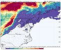
View attachment 182018
It would be nice if we had an idea. I would think you would still get a better idea from the SR Mesoscale models closer to a potential event.Out of curiosity does anyone have any idea how well the ai models handle evaporational and dynamical cooling?


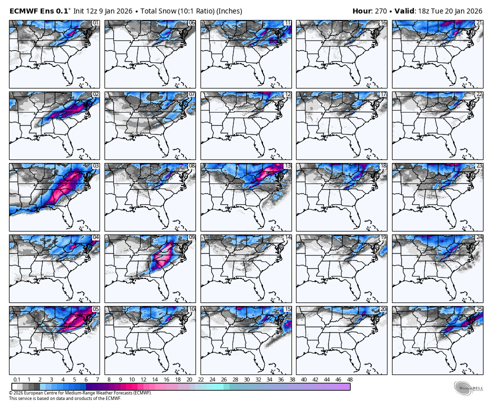

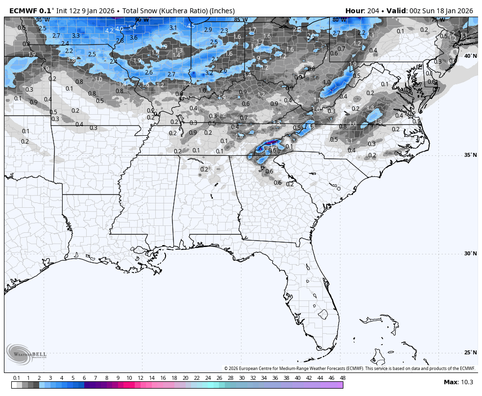
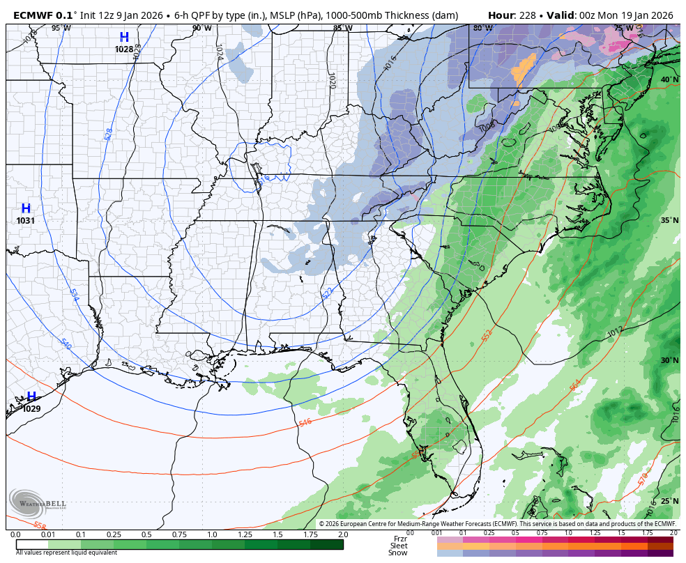
 Looking through the panels the EURO is honking the horn a lot more on storm threat 2. Barely any hits for storm 1
40 kinda reminds me of that control run last night
3, 9, 40 really throwing off that mean there lolMight as well share these...
What's a crusherWow there is a very similar "crusher" path in some of those members..
Paste jobWhat's a crusher

I try and stay out of the fray when the model runs are coming in and let the PBP guys do work. I'm happy that we are seeing proof of life with the pattern over the next 10 days. As @Ross said, it's a sticky wicket. It can work, but it might be hard. The best thing (and this IS a good thing) is that we are solidly in the game, and there are paths to victory. The ONLY thing we can do is wait. But at least it is finally good to have something to track besides a D10+ day pattern. The time for sleep is over.Might as well share these...
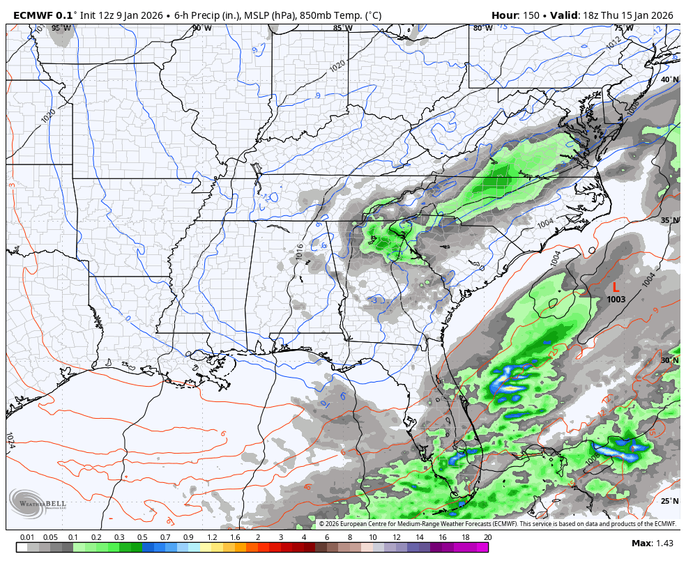
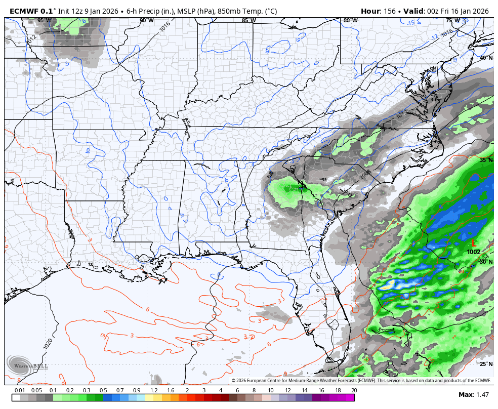
I really hope you are right. 99% of the time, us Central and Eastern NC folks are sweating the warm nose from an amped up Miller A.It’s a lot easier to pull lows closer to the coast inside day 5, much more difficult to push them to the coast or offshore once inland tracks are shown. Day 7 is a solid look for central and eastern NC.
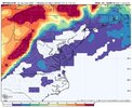
I agree. That EURO run for storm 1 also had dewpoints in the single digits with temps near freezing as it arrives. That should have been showing snow on the surface chartsyall gotta stop worrying about clown maps and qpf charts when something like this shows up:
View attachment 182045
In all honesty, Historical footprint would say 2,5 are most realistic should a big dog play out jmoI try and stay out of the fray when the model runs are coming in and let the PBP guys do work. I'm happy that we are seeing proof of life with the pattern over the next 10 days. As @Ross said, it's a sticky wicket. It can work, but it might be hard. The best thing (and this IS a good thing) is that we are solidly in the game, and there are paths to victory. The ONLY thing we can do is wait. But at least it is finally good to have something to track besides a D10+ day pattern. The time for sleep is over.


.png")