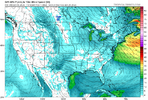
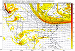
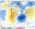
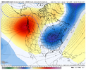
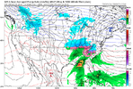
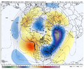
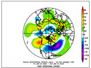
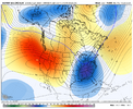
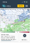
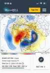
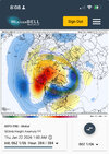
When’s the last time an event started as rain and ended as a decent snow here? Wait I’ll tell you: Christmas 2010Damn!!! 300hohrs out and you can still see the Lee side warm bubble in the upstate!
-
Hello, please take a minute to check out our awesome content, contributed by the wonderful members of our community. We hope you'll add your own thoughts and opinions by making a free account!
You are using an out of date browser. It may not display this or other websites correctly.
You should upgrade or use an alternative browser.
You should upgrade or use an alternative browser.
Pattern January Joke
- Thread starter SD
- Start date
trackersacker
Member
HailCore
Member
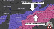
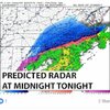
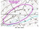
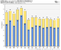
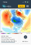
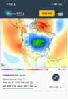
And it was one of those classic overnight snowfalls for many. There is just something about heavy snow at night that is just magical. Nothing like waking up to a blanket of white on the ground, especially if it was bare when you went to bed. Haven’t seen an overnight snow like that in my area since Jan 2018, almost all of the major notable events have been in the day over the past few years.View attachment 181342View attachment 181343View attachment 181344Who remembers January 6th, 2017?
That was a good one
NBAcentel
Member
trackersacker
Member
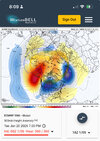
Feels like models are starting to look like January of last year again with looks like thisAIGFS ens looks amazing tonight View attachment 181349View attachment 181350
NBAcentel
Member
I was gonna go March 1, 2009When’s the last time an event started as rain and ended as a decent snow here? Wait I’ll tell you: Christmas 2010

It raine almost all night before and the day of, until about 3pm and we still picked up 6-8” at about 35 degrees! Those rates tho
trackersacker
Member
accu35
Member
As in cold or stormy?View attachment 181355Euro ensemble certainly a lot more bullish middle of next week than it’s operational run
trackersacker
Member
Deeper trough in the mean so possiblyAs in cold or stormy?
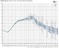
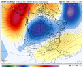
0Z GEFS pretty much retained the stronger/longer midmonth +PNA of the 18Z.
But the 0Z EPS didn’t budge on its now earlier than GEFS end of its midmonth +PNA and to a strong -PNA that actually made it warmer in the SE than its prior two runs 1/19-20 with NN instead of a bit BN. I continue to have supported hope that this will change like the GEFS has been doing. We’ll see.
The warmer 1/19-20 EPS runs counter to its much less credible op that brings Barney into the SE at the same time.
0Z EPS 360: strong -PNA


Last edited:
Just monitoring the CFS daily for trends. It's really flipped and turns on the cold as we head toward last 10 days of January. Matches what we are seeing on all other guidance days 7-15. Kind of step down back to normal wx/ temps for this time of year next week, and another step down/ allowing the barney Cold to visit in and out deeper south last 10 days of the month. Had some sub freezing days here and saw a couple single digit low temps.
rburrel2
Member
rburrel2
Member
Even if we drop a trough in the southwest in the long range and get some slight ridging over the south east… I think that probably leads to some type of CAD/ice storm around January 21st. Source region is going to be extremely cold at that time and if we get the slight ridging it should promote wedging. That time period definitely has the widest goal posts so far this year for a winter storm, imo.
Yeah, pursuing the overnight ensembles is sobering. Both the EPS and GEFS essentially keep the SE above normal for the entirety of the runs. If the pattern depicted at the end of all of the big three verifies, we lose January.0Z GEFS pretty much retained the stronger/longer midmonth +PNA of the 18Z.
But the 0Z EPS didn’t budge on its now earlier than GEFS end of its midmonth +PNA and to a strong -PNA that actually made it warmer in the SE than its prior two runs 1/19-20 with NN instead of a bit BN. I continue to have supported hope that this will change like the GEFS has been doing. We’ll see.
The warmer 1/19-20 EPS runs counter to its much less credible op that brings Barney into the SE at the same time.
0Z EPS 360: strong -PNA
View attachment 181357
View attachment 181356
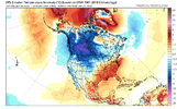
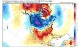
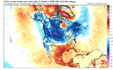
Yeh I mean besides the crazy 00z GFS run, nothing exciting overnight with guidance.Yeah, pursuing the overnight ensembles is sobering. Both the EPS and GEFS essentially keep the SE above normal for the entirety of the runs. If the pattern depicted at the end of all of the big three verifies, we lose January.
View attachment 181361
View attachment 181362
View attachment 181363
How did I get to this after reading all the good stuff overnight lol I literally was getting pumped all the way until this post.Yeah, pursuing the overnight ensembles is sobering. Both the EPS and GEFS essentially keep the SE above normal for the entirety of the runs. If the pattern depicted at the end of all of the big three verifies, we lose January.
View attachment 181361
View attachment 181362
View attachment 181363
rburrel2
Member
Um, no.Yeah, pursuing the overnight ensembles is sobering. Both the EPS and GEFS essentially keep the SE above normal for the entirety of the runs. If the pattern depicted at the end of all of the big three verifies, we lose January.
View attachment 181361
View attachment 181362
View attachment 181363
rburrel2
Member
If you've been living at hour 384 this year, you've had a rough winter.
I'll pick you back up. It gets Bueno on cfs past 1/22, right where ensembles stop. The webber 2014 , Fab Feb/March redux might materialize. Just don't hold your breathe on any Fab Feb news from models, until you actually witness it.How did I get to this after reading all the good stuff overnight lol I literally was getting pumped all the way until this post.
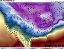
rburrel2
Member
People can feel how they wanna feel, but I’m personally super encouraged about winter weather prospects. The best I’ve felt all season actually. We have a legit window coming up in the heart of climo. Let’s reel it in.
It's the only weather we got.If you've been living at hour 384 this year, you've had a rough winter.
CNCsnwfan1210
Member
The models have been on auto correct in the medium range wanting to put a trough out west only to replace it with a ridge. It’s a +TNH winter pattern. Even if a trough does try to build in the PNW/W coast it doesn’t last long. I personally wouldn’t put much stock in those long range “ghost” troughs out west.
Sent from my iPhone using Tapatalk
Sent from my iPhone using Tapatalk
rburrel2
Member
NCWeatherNow
Member
It looks like everything downtrended significantly last night, as usual. 
NCWeatherNow
Member
We cant even reel in rain anymore, it kinda sucks in the SE latelyIf you've been living at hour 384 this year, you've had a rough winter.
I wouldn't say that. The worrisome ensemble means are unchanged. The operational runs are always going to swing wildly in these crazy day +10 runs we're playing around with, and are a reminder that, within the means, there are members that show how we can still score.It looks like everything downtrended significantly last night, as usual.
Everything definitely didn't downtrend significantly... Not sure how you came to that.It looks like everything downtrended significantly last night, as usual.
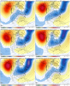
But i will say, nothing improved. We climaxed at the 00z GFS op run, after that nothing really changed since yesterday afternoon. We didn't have much movement one way or the other just past Day 10 with the massive bowl trough setting up. Next weeks storm risk is there, but currently it looks mainly like a NW flow snow event. (What's new..)
Are we kicking the can to the second half of January? I think so. That's only a bad thing if we don't get anything out of it. We have what looks to be a dome of very cold air setting up for the back half of January, where that sets up.. wiggles around & where moisture overrides (overrunning) is all stuff we have to figure out in time.
What we need to do is trend away from the -PNA showing up in the long range & we need to suppress the boundary South. That's currently my main focus. We need to kick the can with the broad Southern ridge showing up.
Last edited:
CNCsnwfan1210
Member

Disappearing act with the west coast trough to a building PNA at day 10.
Sent from my iPhone using Tapatalk
Webberweather53
Meteorologist
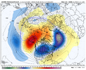
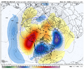
These mid-late winter -EPO/+TNH patterns are usually big roller coaster rides in the SE US.
We usually flip-flop between a torch and extreme cold, with very little room for anything in between.
A subtle shift here or there to minute details in the pattern is often the difference between those 2 extreme outcomes. The lack of long range threats (day 7+) honestly doesn’t mean in this pattern because of how razor thin the margins are between being bitterly cold or blowtorch warm.
You’re very rarely going to sniff out overrunning type winter storm threats (which are the hallmark of this pattern) outside the medium range, because the background flow is fast and your waves are usually getting shredded to bits as they encounter the Hudson Bay Vortex.
Everyone just needs to take a deep breath and relax
We usually flip-flop between a torch and extreme cold, with very little room for anything in between.
A subtle shift here or there to minute details in the pattern is often the difference between those 2 extreme outcomes. The lack of long range threats (day 7+) honestly doesn’t mean
You’re very rarely going to sniff out overrunning type winter storm threats (which are the hallmark of this pattern) outside the medium range, because the background flow is fast and your waves are usually getting shredded to bits as they encounter the Hudson Bay Vortex.
Everyone just needs to take a deep breath and relax


For sure man! Tons of cold air up top.These mid-late winter -EPO/+TNH patterns are usually big roller coaster rides in the SE US.
We usually flip-flop between a torch and extreme cold, with very little room for anything in between.
A subtle shift here or there to minute details in the pattern is often the difference between those 2 extreme outcomes. The lack of long range threats (day 7+) honestly doesn’t meanin this pattern because of how razor thin the margins are between being bitterly cold or blowtorch warm.
You’re very rarely going to sniff out overrunning type winter storm threats (which are the hallmark of this pattern) outside the medium range, because the background flow is fast and your waves are usually getting shredded to bits as they encounter the Hudson Bay Vortex.
Everyone just needs to take a deep breath and relax
View attachment 181371
View attachment 181372
CNCsnwfan1210
Member
Everything definitely didn't downtrend significantly... Not sure how you came to that.
But i will say, nothing improved. We climaxed at the 00z GFS op run, after that nothing really changed since yesterday afternoon. We didn't have much movement one way or the other just past Day 10 with the massive bowl trough setting up. Next weeks storm risk is there, but currently it looks mainly like a NW flow snow event. (What's new..)
Are we kicking the can to the second half of January? I think so. That's only a bad thing if we don't get anything out of it. We have what looks to be a dome of very cold air setting up for the back half of January, where that sets up.. wiggles around & where moisture overrides (overrunning) is all stuff we have to figure out in time.
What we need to do is trend away from the -PNA showing up in the long range & we need to suppress the boundary South. That's currently my main focus. We need to kick the can with the broad Southern ridge showing up. View attachment 181373
Basically the same story here, ridge axis already off the west coast but it’s shifting east and trying to get rid of the trough heading toward medium range.
Sent from my iPhone using Tapatalk
WolfpackHomer91
Member
Even in an "Average" or "Good not great" I feel like most climo favored areas could score a
3-6" Overrunning event at some point, Would just need to time it up overnight ect. Obviously wouldn't work for everyone, but NE GA - Raleigh (I-85 N/NW). Id say a "Great" pattern is only needed for a big dog but idk
3-6" Overrunning event at some point, Would just need to time it up overnight ect. Obviously wouldn't work for everyone, but NE GA - Raleigh (I-85 N/NW). Id say a "Great" pattern is only needed for a big dog but idk
Webberweather53
Meteorologist
For sure man! Tons of cold air up top.
We will probably see us get a good cold push initially as this EPO block sets up, then the SE ridge flexes late month as everything retrogrades.
My hunch is we will load up yet again early to mid February as the MJO orbits into the Western Hemisphere and is convectively coupled to the developing El Niño event in the Pacific.
If I'm going to take a swing at something epic (multiple inch snow followed by extended cold) I'm taking my shot with a big NW Canada/AK ridge over any other option.These mid-late winter -EPO/+TNH patterns are usually big roller coaster rides in the SE US.
We usually flip-flop between a torch and extreme cold, with very little room for anything in between.
A subtle shift here or there to minute details in the pattern is often the difference between those 2 extreme outcomes. The lack of long range threats (day 7+) honestly doesn’t meanin this pattern because of how razor thin the margins are between being bitterly cold or blowtorch warm.
You’re very rarely going to sniff out overrunning type winter storm threats (which are the hallmark of this pattern) outside the medium range, because the background flow is fast and your waves are usually getting shredded to bits as they encounter the Hudson Bay Vortex.
Everyone just needs to take a deep breath and relax
View attachment 181371
View attachment 181372
No need for anyone to @ me about the NAO

