• Hello, please take a minute to check out our awesome content, contributed by the wonderful members of our community. We hope you'll add your own thoughts and opinions by making a free account!

Pattern January Joke

Thank you. That's along the lines of what I assumed. There's been a big move to probability forecasting, using all of these various ensemble suites and their products. I think there is some value in this over short time frames and even value in longer time frames when it comes to larger scale variables.

But a 2 week snowfall probability map seems pointless to me, if you're making an actual forecast.

The industry as a whole has become very model-reliant, and leaning too heavily on probability forecasting isn't a lot better IMO, even though it might "sound" better.

Anyway, thank you.
Funny enough WRAL/Fish were trailblazers in showing probability and "showing the science". They did a lot of creative stuff with the graphics software they had at the time.

I hear you with the model reliance. I think a few things explain it:

1. TV mets are just totally overwhelmed via attrition of forecasting time. A typical TV met shift means radio hits, promos, podcasts, station ambassador, social media (which has expanded past quick tweets and could mean making a tik tok). Oh... and don't forget to slap a forecast together, produce a show and get out there on live TV. It's more efficient to have a lot of premade model graphics to fill space, especially when the forecast is relatively benign. The sum of these parts means that mets don't have the bandwidth to hand draw a "could it snow" map. If they do, it will be boring if it's realistic and won't gain much traction.

That is the noble explanation. The sleazeball explanation is what I would do during my cup of coffee in the industry, which is watch a stream of NFL Redzone from a clandestine source for a while before realizing ahh I go on air in an hour I should probably throw something together (I did not have the above responsibilities during the weekend). If you have the graphics pre-made you just plug in the latest model run.

2. The public wants this. It's not 2010 anymore... the public knows what the GFS and the Euro are. And they want to know what they say. And if AMS Certified John G Met won't show their data, Peter J Public would be happy to oblige instead, with a clown map of course. I think most TV mets would rather not speculate about long term patterns and teleconnections. Unless you are reading journals for breakfast like Webb and some other folks here, it's just not their wheelhouse. But they have to get ahead of the curve.

I know this is totally off topic from watching the -NAO pissing its pants I forgot I typed this all out earlier.
Lol

This is really good, and I think accurately reflects the modern era. Personally, I don't think it is for the better. But then again, I don't think a lot of what is going on in our culture is for the better, when I comes to things like attention span, drama, social media, getting clicks, etc. One day, the pendulum will swing back and people will crave the best (of whatever) again...not the most dramatic or best looking.

I interned with Fishel in the 90s. The team at RAL was amazing. It wasn't about probabilities back then, as a lot of that data wasnt as widely available. He and the team put a lot of effort into (they would spend hours) the forecast and analyze it to death when they got it wrong.

But as you said, the world is a lot different now.
 
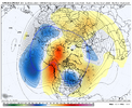
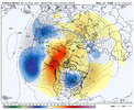
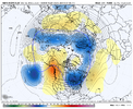
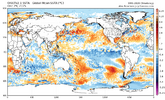
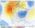
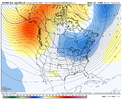
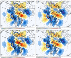
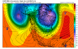
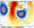
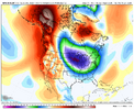
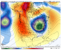
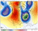
Looks like a quicker progression to a western ridge is also occuring on the EPS View attachment 180569
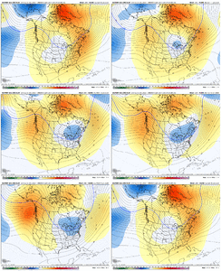
Cold drop. GEFS & GEPS unloads. Just gotta work the cold East. Mentioned a couple times my concerns with unloading cold to far West.. plenty time to tweek that though. Regardless, end of ensemble data showing that idea of a lot of cold dropping mid month onward.
 
Let’s see where we are at the middle of the January.
View attachment 180572View attachment 180573View attachment 180571

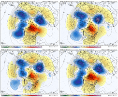
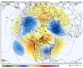
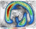
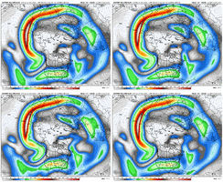
AI GEFS is farthest east with the Pac Jet extension. I don't think we have fear here with overextending the exit region of the jet and things going zonal. I would have more concern with too little extension and the ridge/trough being too far west as Mitch has mentioned (or quickly retrograding west). Again, the advantage of January is the longer wavelengths and wider ridge/trough patterns, so you don't have to be as perfect with placement to move some cold air in.

But it's anyone's guess on how much the jet extends and holds the extension. Asia looks better than it did in December for sure as it's not loaded with low pressure, and there is a bit more momentum being pumped into the jet. There are various solutions on the tropical forcing, but it seems to want to work thru the Maritime Continent and into the W Pac. If it hangs too far west there, that would favor a bit more west ridge/trough placement.

Dec 30 AIGEFS.png
 
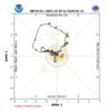
Looking ahead MJOwise, I hope today’s GEFS forecast doesn’t verify as it has it going into a strengthening 6 as we approach mid Jan:
IMG_6632.png

Phase 6 in Jan is one of the warm E US phases on average along with 4-5. Say it ain’t so, GEFS! Of course, even if it verifies, the warmth is just based on the average and it can of course still end up cold.

IMG_5609.png


The EPS is definitely better though not great as it heads into a weak 7, which is pretty neutral on avg:
IMG_6633.png

I’d prefer to see weak to moderate 8-1-2 for the best shot at a cold E US pattern in Jan.
 
AI GEFS is farthest east with the Pac Jet extension. I don't think we have fear here with overextending the exit region of the jet and things going zonal. I would have more concern with too little extension and the ridge/trough being too far west as Mitch has mentioned (or quickly retrograding west). Again, the advantage of January is the longer wavelengths and wider ridge/trough patterns, so you don't have to be as perfect with placement to move some cold air in.

But it's anyone's guess on how much the jet extends and holds the extension. Asia looks better than it did in December for sure as it's not loaded with low pressure, and there is a bit more momentum being pumped into the jet. There are various solutions on the tropical forcing, but it seems to want to work thru the Maritime Continent and into the W Pac. If it hangs too far west there, that would favor a bit more west ridge/trough placement.

View attachment 180578
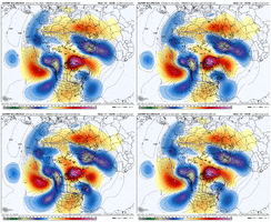
Looks like the biggest forcing mech heading forward is gonna be that Rossby wave that backs up around 150E into mid Jan, you can see it getting going towards the end of the EPS. favors a equatorward shift of the pac jet but not exactly telling on how far it extends per say, it’s still kinda hard to see a coherent MJO signal on modeling/ens other then convection wisely distributed here and there. For next week it seems like what killed our look is actually to much pacific jet And poleward shifted at that from the +EAMT event. Not shocking honestly, a lot of the times after a +EAMT event you start out with a extension and poleward shifted jet before it shifts equatorward IMG_1527.gifIMG_1528.gifIMG_1529.gif
 
Last edited:
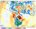
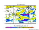
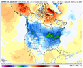
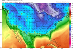
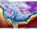
I’m asking this because I’m genuinely curious so don’t take offense to this, but isn’t this what the weekly map looks like every January? I feel like I see this same map every winter in January and it never verifies.

Absolutely not.

Edit: However, I need to warn you that WxBell 2m Euro Weeklies are too cold as they’re colder than ECMWF’s in-house output. There’s something off with the WxBell algos. That’s one of the reasons I prefer to post the in-house maps.

@Stevo24 and @Mitch West for the edit about WxBell being too cold
 
Last edited:
I’m asking this because I’m genuinely curious so don’t take offense to this, but isn’t this what the weekly map looks like every January? I feel like I see this same map every winter in January and it never verifies.
Nah man. This is a pretty strong signal.. especially at this range. As mentioned, the cold is coming.. where it drops, bleeds, how far South & if it makes the connection to give us a Southeast Winter storm is the question.
 
Looking ahead MJOwise, I hope today’s GEFS forecast doesn’t verify as it has it going into a strengthening 6 as we approach mid Jan:
View attachment 180580

Phase 6 in Jan is one of the warm E US phases on average along with 4-5. Say it ain’t so, GEFS! Of course, even if it verifies, the warmth is just based on the average and it can of course still end up cold.

View attachment 180581


The EPS is definitely better though not great as it heads into a weak 7, which is pretty neutral on avg:
View attachment 180584

I’d prefer to see weak to moderate 8-1-2 for the best shot at a cold E US pattern in Jan.
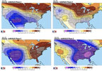
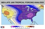
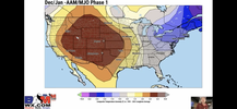
6DDA895A-BC4A-4C2F-BB89-9595085A11F9.jpegA7C178DA-3B48-48B5-AE3D-35472CBA5CDE.jpeg77C6F4C7-D599-430B-82B9-848D668C34E3.pngSomething that *might* have some merit is what Bam has been talking about with the -AAM/MJO correlation and in the traditional sense phase 6 is warm, but they’re argument is in January the -AAM/MJO combo feeds the cold pattern because it enhances the EPO. Hoping that’s the outcome here.

Additionally, they were talking about the brief warmup ahead of the main cold pattern given Indian Ocean convection. They’ve done pretty well lately.
 
View attachment 180592View attachment 180593View attachment 180594Something that *might* have some merit is what Bam has been talking about with the -AAM/MJO correlation and in the traditional sense phase 6 is warm, but they’re argument is in January the -AAM/MJO combo feeds the cold pattern because it enhances the EPO. Hoping that’s the outcome here.

Additionally, they were talking about the brief warmup ahead of the main cold pattern given Indian Ocean convection. They’ve done pretty well lately.

Thanks for posting this. I’m going to need to research this myself to feel comfy with BAMwx’s idea of the highly counterintuitive idea of a very cold E US on average during La Niña (-AAM) Jan phase 6 periods. I can do it but it will take time. Actually anyone can do it!

In the meantime, I’ll continue to root for weak to moderate 8-1-2 over 6 or even 7.

I’m also going to ask others elsewhere about this.
 
Nah man. This is a pretty strong signal.. especially at this range. As mentioned, the cold is coming.. where it drops, bleeds, how far South & if it makes the connection to give us a Southeast Winter storm is the question.
All depends on the strength of the se ridge which models r starting show long range
 
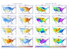
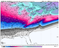
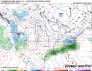
Every single time there is a beautiful snowstorm map for the Southeast, it is the CFS. I don't even have to look at the model type on the image. I just know it's the CFS.
And it always looks the same. A warm nose in South Carolina. Lmao
 
Back
Top