• Hello, please take a minute to check out our awesome content, contributed by the wonderful members of our community. We hope you'll add your own thoughts and opinions by making a free account!

Pattern January Joke

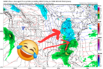
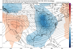
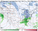
You disappointed me again this morning with my forecast you sent out... Flipping rain chance Friday night :confused: lol
Temp has been rising overnight, 43 when I went to bed. Currently 49, but the front is knocking on our door. Looks like we may play who can kick the can the furthest in January... #wintersuxanymore
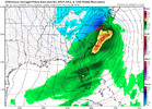
Ha, well if it makes you feel any better, still some wiggle room to dry up Fri night if you’d rather that.

IMG_5970.png

But if it’s snow you want, i’ll have to politely ask you to join the queue 😞

I’d be surprised if you didn’t even get a light wintry chance in January, just based off climo+pattern as it stands
 
Ha, well if it makes you feel any better, still some wiggle room to dry up Fri night if you’d rather that.

View attachment 180316

But if it’s snow you want, i’ll have to politely ask you to join the queue 😞

I’d be surprised if you didn’t even get a light wintry chance in January, just based off climo+pattern as it stands
Yeah I was messing with ya. ;) I agree; I will be very disappointed if I don't at least get a mixed bag of something in January. But we're fighting two battles, so far moisture and now it seems temps may not work out either? It's really unbelievable how hard it is to get winter precip anymore... It used to be no problem to get an Ice storm around here, but I haven't had a good Ice storm in a long time. It's just all screwed up anymore. I'm beginning to think we have a climate of Georgia here now.
 
Once the nao block retrogrades into the Davis strait region or even a little west that will probably be our best shot in this part of the pattern evolution. Before that the look is doable but it's threading the needle with a stroke of luck and that's hard to get fully behind
 
As long as models continue to show that -NAO no need to be concerned yet. If we get that stout of blocking surface features will catch up and winter will arrive. Patience
I agree 100% but I would think that at some point soon, fantasy storms should start showing up often, and under D10. No?
My thinking is it's a dang bad pattern when you can't even get fantasy storms to show up on any of the 50 models we have now . lol
 
  • Snowman
Reactions: IWC
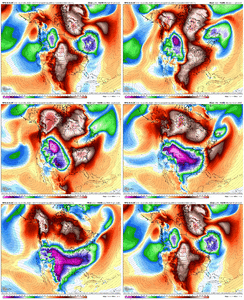
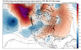
Alaska bakes and somehow so do we. Just ridiculous
dc746f5d9941cbe7010377773b5170eb.jpg

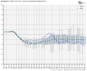
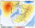
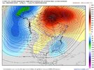
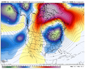
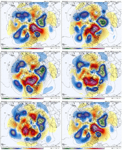
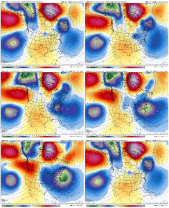
6Z GEFS 360: another -PNA

IMG_6593.png

IMG_6595.png

IMG_6596.png

IMG_6597.png

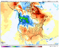
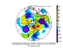
But hope is there from both the 0Z EPS’ +PNA that was posted last night as well as this, which shows that 90 day -PNA bias and E US bias map of GEFS:
IMG_6432.png
 
I agree 100% but I would think that at some point soon, fantasy storms should start showing up often, and under D10. No?
My thinking is it's a dang bad pattern when you can't even get fantasy storms to show up on any of the 50 models we have now . lol
Yeah I'd like to see some fantasy storms pop as well but I personally think we're still a couple days away from that. We're still a ways from locking in a west based -NAO, and in our neck of the woods, a west based -NAO can get it done. If NYD rolls up and nothing close showing LR, maybe time to worry but even then, it ain't over
 
6f108772a2f92dd72f05f06a120f2352.jpg

Not a bad look around 1/9, more of a west based -NAO with a slight +PNA and trough axis over the SE/mid Atlantic. Roughly 24% of members showing measurable snow around 1/9-1/10. We have a starting point, love to see a slow steady increase in members in the coming days.


Sent from my iPhone using Tapatalk
 
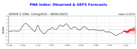
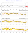
More on the 0Z GEFS. The CPC GEFS PNA confirms what WxBell has that I posted: a -PNA trend in week 2. If this were to verify it would be opposite of what we’d want in the SE, but fortunately it has had a -PNA bias and has been verifying poorly.

Yesterday’s GEFS PNA: was going in +PNA direction late in week 2
IMG_6573.png

Today’s said “never mind”, I’ll stay -PNA through the end:
IMG_6601.png
 
I agree 100% but I would think that at some point soon, fantasy storms should start showing up often, and under D10. No?
My thinking is it's a dang bad pattern when you can't even get fantasy storms to show up on any of the 50 models we have now . lol
in my experience if you get robust blocking it takes a few cycles for the medium range to catch up. getting the blocking is like establishing the run

that being said if this is going to be a productive pattern then i would like to begin to see more long range fever dreams pop up. i need to see proof of concept!
 
That’s not the look we want. We ain’t trying to do Feb 2021. Haha but the cold air signal mid to late month is very impressive

I assume you know that BAMwx is in the Midwest (Indiana) (they have lots of clients there as a result) and thus has a somewhat different perspective about the SE US vs the Midwest.

Today’s 12Z ensemble week two means will be extra interesting for me due to the major disagreement.
 
More on the 0Z GEFS. The CPC GEFS PNA confirms what WxBell has that I posted: a -PNA trend in week 2. If this were to verify it would be opposite of what we’d want in the SE, but fortunately it has had a -PNA bias and has been verifying poorly.

Yesterday’s GEFS PNA: was going in +PNA direction late in week 2
View attachment 180323

Today’s said “never mind”, I’ll stay -PNA through the end:
View attachment 180324
I've got a strong bias towards the PNA as the most important pattern for the SE winter. I know the NAO can work wonders but from what I've seen that works much better for the NE folks. Of course, a +PNA and a -NAO would be great; but if I had to pick only one it would be the +PNA. So that's what I'm looking for going forwards. With hopes of -NAO magic.
 
Back
Top