broken025
Member
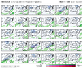
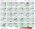
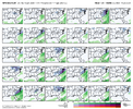
GaWX, can you do Atlanta's? thank youThe 12Z EPS for SAV has gotten my attention for the small chance of Sun AM light snow/flurries, which in this area would be a big deal due to the relative rarity being that most winters get nothing. My expectations are low due to climo, it being pretty dry overall with member qpf progs being light, and marginal temps.
So, fwiw, here are some 12Z EPS images: ~25% of members have snow, which is notably high:
View attachment 183020
Mean: 0.2”, notable for here:
View attachment 183021
Just came back from there today. Had a dusting in the groundThink I may need to make a trip to Pittsburgh
View attachment 183041
Trending better. 18Z clips the NC coast. We have 4-5 days to trend better. We absolutely can not afford a reversal of the good trends over the 24 hours.
Coming back to this from Friday, the favorable tropical forcing / MJO appear to be driving the improving model trends for the last week of January. Euro suite in particular is keeping the Pac Jet nice and extended out at the end of their runs. Let's see if the trends can continue and if we can marry cold with storm.Hey man - yeah EPS & Eur Wk look pretty poor after next week. GFS & CMC Suites not as bad with some cold to our north. MJO / Trop forcing look good, not a red flag. Biggest concern I see is what looks to be a decent -EAMT event in about a week which would want to retract the jet in the following week, and a lot of times the models don’t catch on with that until we get closer in…but that would lower our chances at seeing the western ridging we need for cold. Ever evolving, we’ll see how it goes
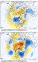
4 more weeks...Coming back to this from Friday, the favorable tropical forcing / MJO appear to be driving the improving model trends for the last week of January. Euro suite in particular is keeping the Pac Jet nice and extended out at the end of their runs. Let's see if the trends can continue and if we can marry cold with storm.
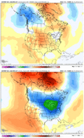
Here is Euro Weekly run from today vs 4 days ago for Jan 29
View attachment 183051
View attachment 183052
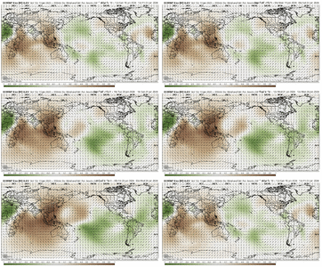
-VP uplift working west even here at the Dateline in the tropical Pacific (El Nino like look here)
View attachment 183054
View attachment 183055
To add to this I could be easily talked into cold lasting longer but as some point the mjo has to get back into the MC... right?4 more weeks...
4 more weeks...
Seriously though phases 2 and 3 aren't bad in Feb. I have a total dumpster fire pattern after roughly valentines day but its off to the races until then
I have about 9/25 hits of various amounts on that set of panels.
You and me bothThink I may need to make a trip to Pittsburgh
View attachment 183041
Yea completed doubted its outputs earlier, didn’t even bat an eye to them tbh lol. LR hrrr is pretty badHRRR drying up the precipitation. To no one's surprise.View attachment 183075
Yeah that is pretty legit. If we could just activate the STJ at all. But that ridge axis out west is not bad. Just need a little less chaotic flow.That’s a monster -AO…. It’s gonna get really really cold if this looks stays. View attachment 183077View attachment 183076
That’s a monster -AO…. It’s gonna get really really cold if this looks stays. View attachment 183077View attachment 183076

Might be a higher chance of getting single digits/negatives in the SE then snow with this look… the analogs popping up for the -AO are all truly cold centric, some snowed, even good ones, but the focus was the extreme cold. This look is infamous for putting a cold lobe of mid-low level cold air into NA and separating it from the ArcticYeah that is pretty legit. If we could just activate the STJ at all. But that ridge axis out west is not bad. Just need a little less chaotic flow.
If we don't snow with this pattern we may never see snow againThat’s a monster -AO…. It’s gonna get really really cold if this looks stays. View attachment 183077View attachment 183076
My biggest concern about this pattern has been it getting too overbearing to snow more than many other potential failsThat’s a monster -AO…. It’s gonna get really really cold if this looks stays. View attachment 183077View attachment 183076
Might be a higher chance of getting single digits/negatives in the SE then snow with this look… the analogs popping up for the -AO are all truly cold centric, some snowed, even good ones, but the focus was the extreme cold. This look is infamous for putting a cold lobe of mid-low level cold air into NA and separating it from the Arctic
25,14,85,77 were someWhat are the analogs? I figure Jan 85 would be one of them
Sent from my iPhone using Tapatalk
Its got a little snow on the front end of the cold flavor to it with the trough axis coming back east before bottoming outMight be a higher chance of getting single digits/negatives in the SE then snow with this look… the analogs popping up for the -AO are all truly cold centric, some snowed, even good ones, but the focus was the extreme cold. This look is infamous for putting a cold lobe of mid-low level cold air into NA and separating it from the Arctic
Yeah the GFS AI shows that wellMight be a higher chance of getting single digits/negatives in the SE then snow with this look… the analogs popping up for the -AO are all truly cold centric, some snowed, even good ones, but the focus was the extreme cold. This look is infamous for putting a cold lobe of mid-low level cold air into NA and separating it from the Arctic
NAM is the king of tilt
