Forevertothee
Member
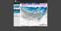
The SW trend is definitely there.Still though. Man View attachment 182959
The SW trend is definitely there.Still though. Man View attachment 182959
All of the means have snow noise at the end of their runs now.
EPS, GEFS, cmce, AIFS means all showing activity.
And they all look excellent in terms of the 5h field.
Several coastal plain hits on the EPS. one skewing it a bit, but looks like an overall increase vs 6z for the eastern folks
How about UK Mogreps?
Sent from my iPhone using Tapatalk


plenty of time for this to reasonably evolve into a real thingStill though. Man View attachment 182959
The models have been taking baby steps forward today. Lets see if these baby steps continue until some of us will be dancing a victory dance.All of the means have snow noise at the end of their runs now.
EPS, GEFS, cmce, AIFS means all showing activity.
And they all look excellent in terms of the 5h field.
Ice sort of sucks on its own unless it’s the mid/lower 20’s kind. Light prolonged drizzle with no runoff and everything freezes up nicely. Yeah with that comes problems but there are also big problems with heavy wet snow and we all love that. I’ll take a sleet storm at this point as long as nobody within 500 miles of me sees snow while I’m getting sleeted onWe've seen times before where we keep getting better looks for part of our setup, but nothing panned out in the end. We weren't necessarily grasping at straws, but the negatives outweighed the positives in the end. I'm not sure how much better we can trend at this point??? However, if anyone in the SE outside of the upslope areas sees some accumulating snow, that's not all bad. I do hope that the bigger threat down the road can pan out (no ice storm though).

this cant be realCJ back on board lolView attachment 182971

I’m aggravatedthis cant be real
Would definitely be real for CAE lolthis cant be real


I know that ain’t for my neck of the woods cause I can’t even get a raindrop anymore.CJ back on board lolView attachment 182971

Thanks for keeping us AL folks in the loop. I appreciate it!View attachment 182976
View attachment 182977View attachment 182978
Seeing an area like Dothan, Alabama with a mean like this just tells me that the gulf is being tapped on 20% of the members. Most will laugh this off but the look is still there. Until we lose this completely then you won’t lose me on this threat at all. It was a very slight improvement from 00z
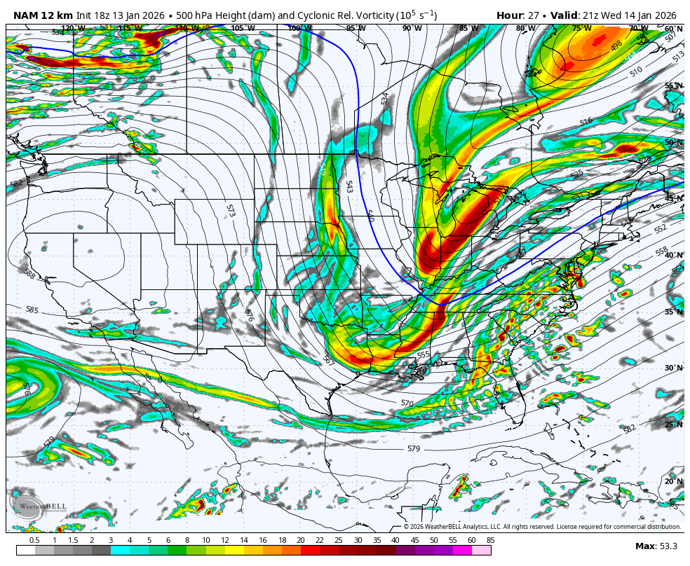
For what it's worth, the nam looks a little more juiced up for Thursday. Extra little kink in the vort map makes it look interesting anyway.
Agreed esp parts of Alabama and west georgia look juiced up for some backend flakes to me.For what it's worth, the nam looks a little more juiced up for Thursday. Extra little kink in the vort map makes it look interesting anyway.

Just wait to hear him when that NW trend kicks inCJ back on board lolView attachment 182971
Yep, time to give it our best shot for glory thus far this winter / or go down swinging. Euro weeklies here for Jan 26 to Feb 2. We should have a better shot at some periods of high pressure to our north over the Lakes in this patternAll of the means have snow noise at the end of their runs now.
EPS, GEFS, cmce, AIFS means all showing activity.
And they all look excellent in terms of the 5h field.


I told ya that would be the period if it can’t happen in that look I give upYep, time to give it our best shot for glory thus far this winter / or go down swinging. Euro weeklies here for Jan 26 to Feb 2. We should have a better shot at some periods of high pressure to our north over the Lakes in this pattern
View attachment 182984
View attachment 182985
View attachment 182986
View attachment 182987
View attachment 182988


This looks like the way things went around here in Feb 1989.