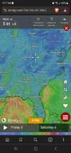
If only our low pressure system wasn’t cutting into Lewisburg West VirginiaDPS running upper teens VA border counties to low-mid 20s SC border counties [Ricmond, Anson]
-
Hello, please take a minute to check out our awesome content, contributed by the wonderful members of our community. We hope you'll add your own thoughts and opinions by making a free account!
You are using an out of date browser. It may not display this or other websites correctly.
You should upgrade or use an alternative browser.
You should upgrade or use an alternative browser.
January 6th-7th Potential Storm
- Thread starter SimeonNC
- Start date
33.1/25 - WB 29.5 Looking for a tree topper icing!
Sent from my iPhone using Tapatalk
Sent from my iPhone using Tapatalk
Interesting numbers so far ahead of this system. Here is someone's station in northern Cherokee County, SC.
36/27

__________________________________________
Burnt and Oglethorpe Mountains are where CAD is stopped in Georgia, due north of Atlanta. Stations on the top are reporting 32.7/24.6, in which Pickens County is not included in FFC's advisory.

36/27
__________________________________________
Burnt and Oglethorpe Mountains are where CAD is stopped in Georgia, due north of Atlanta. Stations on the top are reporting 32.7/24.6, in which Pickens County is not included in FFC's advisory.
Drscottsmith
Member
41.5/21 in Duncan, SC 2 mi south of I 85
Lee county airport sanford is 29/24
SimeonNC
Member
35.9/24.3
39/32; no hope in dope but like, it is colder than thought
iGRXY
Member
36/22 here. NAM running high on the dews and are closer to the RGEM
severestorm
Member
Current temps and DP's


NBAcentel
Member
Worth noting, as soon as cloud cover shows up and insentropic upglide begins, temps/and dews will go up even before precipitation starts
NBAcentel
Member
This is just awful 

NBAcentel
Member
tazaroo
Member
31/23 in Asheboro. Trying to real in a glaze. ?
J1C1111
Member
I swear, these 33-35 degree rainstorms are about to make me ? and its onlythe first week of January. Almost prime time around here and this crap over and over again. Ive seen this play from start to finish and no how it starts and will end in these parts unfortunately.
Windergawx
Member
Station running! My wind is ranging 3mph to 6 just don't see a good wedge 43f
my cameras in buford are showing something flying around ATM..for joke sake let's call it a flurry
my cameras in buford are showing something flying around ATM..for joke sake let's call it a flurry
Windergawx
Member

Bannerdude
Member
Already sitting at 28/23 in Durham. If only this wasn't in-situ CAD.....
iGRXY
Member
Temp up to 38. Still sitting at 21 but the 2 degree increase means coffin here. Onto the next one
3K NAM
View attachment 010524.mp4
View attachment 010524.mp4
Temps
Dews

Dews
Windergawx
Member
severestorm
Member
Nice flow snowfall behind!

BHS1975
Member
Can't even get a tree topper out of this. Used to get those as early as November.
Sent from my iPhone using Tapatalk
Sent from my iPhone using Tapatalk
30.7/25- WB 28.2
Sent from my iPhone using Tapatalk
Sent from my iPhone using Tapatalk
I’ve been living in Jasper now for about 4 years. Prior to that lived in Carrollton. Good point on CAD here in Pickens. Mt. Oglethorpe is to the NE of Jasper in NE Pickens Co. Mt. Oglethorpe is nearly 3,300 ft. I am about 1,400 ft in Jasper. Many setups like this will leave Pickens out of advisory but will have neighboring Dawson Co. in.Interesting numbers so far ahead of this system. Here is someone's station in northern Cherokee County, SC.
36/27
View attachment 140123
__________________________________________
Burnt and Oglethorpe Mountains are where CAD is stopped in Georgia, due north of Atlanta. Stations on the top are reporting 32.7/24.6, in which Pickens County is not included in FFC's advisory.
View attachment 140124
In very strong CADs, even places like Carrollton into Eastern AL can get involved, but has been a while since we have had that type of event to stretch that far SW.
I may drive up the mtn tomorrow… likely will have ice up there. But safe bet nothing to the SW and W as the cold air will be blocked.
Currently, some very lt sprinkles here. DP 26 Temp 42 at Jasper Airport. Rain showing on radar but dry air doing its thing.
34/28 now having warmed up from 32/26 an hour ago west of Winston. We're not going to see any zr at this rate.
That won't disappoint me. It's been a couple of years since the last serious ice storm. There are a lot more vulnerable trees and I hate listening to them crash to the ground out back with the tap, tap, tap of a freezing drizzle.
That won't disappoint me. It's been a couple of years since the last serious ice storm. There are a lot more vulnerable trees and I hate listening to them crash to the ground out back with the tap, tap, tap of a freezing drizzle.
34/31 with a steady cold rain falling west of Winston. No zr on the horizon.
There goes nothing.
There goes nothing.
My gutters are telling me this was a waisted opportunity. Pouring rain outside. So hard it woke me up out of a snow dream 
Man that could’ve been fun 
No snow for you. Go back to bed.
My gutters are telling me this was a waisted opportunity. Pouring rain outside. So hard it woke me up out of a snow dream
The coldest rain at 34.3 with a WB of 33.2.
iGRXY
Member
I bottomed out at 32.8/32. That is painful as you can get
junbb1
Member
Same here, currently 32.5 with avg wind of 12 mph nne. BrutalI bottomed out at 32.8/32. That is painful as you can get
Cad Wedge NC
Member
Just a good old 33-degree rain here ... after being in the upper teens just 24 hours ago.
LukeBarrette
im north of 90% of people on here so yeah
Meteorology Student
Member
2024 Supporter
2017-2023 Supporter
Pretty sure it’s above 32 here, can’t even do ice right
Nomanslandva
Member
Slight glaze here, no pingers at all. I doubt temps reached the upper 20s as forecast and are pretty uniform in the area at 31-32 so don't figure this lasts much longer as heavier rain moves in. NAM was the first model to show all ZR-rain. It flirted colder on some runs but was pretty consistent with the warmer looks up here. ?
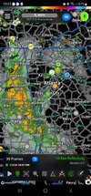
Is this from RadarScope or if different, what app?Man that could’ve been fun View attachment 140164
Nomanslandva
Member
I am sure UHI in not helping.Pretty sure it’s above 32 here, can’t even do ice right
LukeBarrette
im north of 90% of people on here so yeah
Meteorology Student
Member
2024 Supporter
2017-2023 Supporter
Always sucks, ready to be in Blacksburg for a snowstorm that’s forsure.I am sure UHI in not helping.
W
WSW
Guest
It's raining all the way up to Frederick County. Even Garrett County MD is not snow right now. Amazing how easily we fail.Always sucks, ready to be in Blacksburg for a snowstorm that’s forsure.