iGRXY
Member

CMC expanding the footprint more this run down in the upstate.

I don't recall any 5,000 ft peaks in upstate South Carolina.The real question is…. will the 5000 foot peaks in upstate sc combined with the ICON running too warm combined with the dew points verifying lower and the NAM eroding CAD too fast lead to an epic ice storm that the NWS and models just aren’t grasping?
You can always count on him coming onto a weather thread to make corny posts that a 12 year old could come up with and not actually discuss the weather on a … wait for it … weather forum. Very on par and typical for him.I don't recall any 5,000 ft peaks in upstate South Carolina.


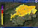
A lot of us definitely appreciate them. I often use the maps on your website as a point of reference for discussions on here.Looks like I’ll have to put out a snow/ice map for this event.


Phew. Looks like I’m gonna miss out on the Ice.
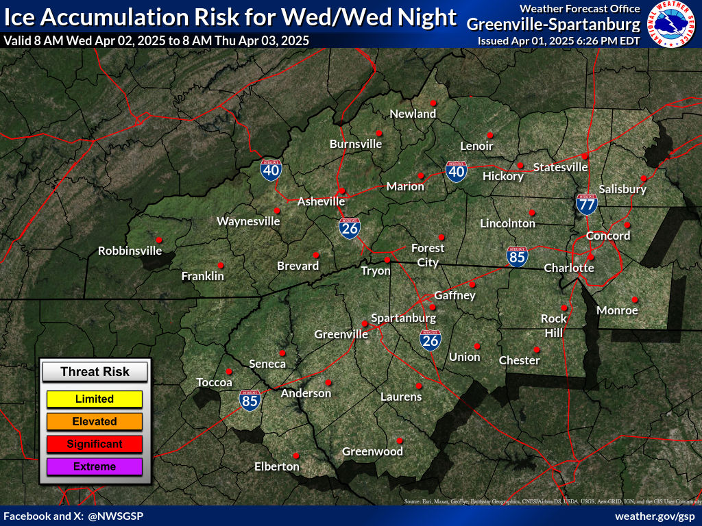
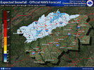
GSP appears to be using the CMC, RGEM, and CAM models for footprint and general amounts. FYI the newest RGEM is upping FRAM amounts.
Sounds about right those are prime upslope areas that will receive the most qpf before warming above freezing. Brevard to Tryon right along the escarpment.GSP is upping the totals for western areas.
Saluda is notorious for getting big totals, even in this kind of eventSounds about right those are prime upslope areas that will receive the most qpf before warming above freezing. Brevard to Tryon right along the escarpment.
Wouldn't be surprised to see storm reports of around a half inch in those neck of the woods. And possibly around mine the South Mountains in Burke County.Saluda is notorious for getting big totals, even in this kind of event
There leaning towards the insitu Cad hanging on longer than modeled especially the typical areas 1-40N to right along the escarpment.Rather shocked how bullish GSP is the areas outside the foothills, into the Piedmont, considering model guidance
I trust them tbhRather shocked how bullish GSP is the areas outside the foothills, into the Piedmont, considering model guidance
I've learned more times than not to trust GSP honestly one of the hardest to forecast in the entire country imo.I trust them tbh
Yeah I've noticed that the models are really quick to erode the CAD, even the RGEM.There leaning towards the insitu Cad hanging on longer than modeled especially the typical areas 1-40N to right along the escarpment.
Never fails.


.png")

