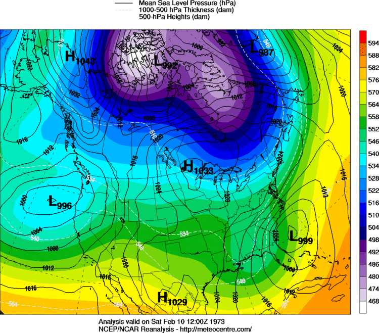
For sure Shawn! I'm curious though, what was the setup for the Feb. 73' storm? Trying to see how similar or different the setup was.You want these circled in blue to verify if you're looking for a substantial snow in the Carolinas:
Them members you got circle on the map would that bring more precipitation forward towards the upstateYou want these circled in blue to verify if you're looking for a substantial snow in the Carolinas:
Great point if that wave catches it and pulls it back is super game on, if not it might be super swing and missThe trend has definitely not been favorable for folks west of GA. As Shawn mentioned, I think this favors eastern GA/SC/NC where this could turn in to a very big deal. The other thing to remember is the Euro is still trending faster with that wave that phases with what we have been calling wave 3. That trend continued today and is what prevented this run from being a whiff. If that trend continues, it should end up digging the base of the trough further southwest. But again, would probably be too late for those in western GA and AL on west.
It’s kinda like threading the needle kind of situation here with this.Great point if that wave catches it and pulls it back is super game on, if not it might be super swing and miss
As of now this is a Carolinas setup only and tbh with recent trends and not having UKMET on board the southeast may end of being 0-3. Very frustrating.
UKMET has been better than the GFS for the last two threats up there with the euro. I don’t know what you are looking at lolThe ukmet has been like the gfs this season . It flips from run to run I wouldn’t worry about having the ukmet 6 days out
Sent from my iPhone using Tapatalk
The latest GFS update is trending even drier for our area.
Therefore, pops were reduced just slightly, mainly in the
overnight Sunday into Monday time frame to reflect the drying
trend. With the ECMWF retaining some moisture in the area, if any
preicpitation could be squeezed out of this system, it could still
be in the form of wintry precip. Further adjustments will
continue as we near the weekend.
No changes were made to our next period of interest, mid week next
week, as the system elements are still coming together. The GFS
keeps deeper moisture to our south, while the ECMWF is still
agressive with precip in our area. With cold temperatures already
in place, we will continue to monitor the potential for wintry
precipitation as the system evolves.
First, your last sentence literally says nothing lol. Second, for the pattern we are end the UKMET has been near the top with suppression with the euro. They performed the best and were the quickest to latch onto suppression with this last two threats and that’s the truth dude... edit: damn my grammar has been bad today lolWhere have you been this season ?? I’m not talking about the last two threats not sure where that came from. And being better than the gfs isn’t saying much at all
All of those members show snow either in the SE or just off the SE/MA coast. So it doesn't look bad to me.
Holy crap. If the timing of the waves are just right....
View attachment 2382