• Hello, please take a minute to check out our awesome content, contributed by the wonderful members of our community. We hope you'll add your own thoughts and opinions by making a free account!

Wintry January 23rd-27th 2026

Would support the idea of the initial surface low not going nearly as far north before it transfers
I do wonder if the few reports we have heard of an underperforming storm to the far north could suggest moisture transport is overall further south which might be connected to a further south low track? Probably too early to tell though.
 
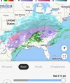
HRRR has been right in terms of the front end thump for VA folks. NAM too warm and did not have much snow up to this point for us. Got about a half inch with 5-6 more hours of snow to come. Just wish it was heavier, our flakes are tinyyyyy
Rates pretty sad so far. Models trended down from 6" on the thump to now, maybe 2-3"? NWS also backed off on totals. Still concerned about ice. NAM has little but HRRR looks worse. Not sure what to make of it all. In the back of my mind, I have "warm nose always over performs so...
 
You still have a shot at breaking records?

I dunno about that because the first round was so underwhelming but I can see some places getting 10

Well see how good it is around midnight haha. The only reason I'm a tad skeptical is last night but the models have always looked better tonight here from the beginning
 
Rates pretty sad so far. Models trended down from 6" on the thump to now, maybe 2-3"? NWS also backed off on totals. Still concerned about ice. NAM has little but HRRR looks worse. Not sure what to make of it all. In the back of my mind, I have "warm nose always over performs so...
I think the 925 mb temps will over perform. Bring me all the sleet please
 
Follow 77 and watch the temps change
View attachment 188713
The CAD is definitely doing its thing -- just wondering if it's doing TOO good of a job -- seems like precip is going to have a hard time saturating the column -- HRRR just trending to such anemic QPF around CLT, at least through daybreak.
 
NAM was matching up much better with current radar trends as of 7 pm than the RGEM. I don't know if that 100% guarantees anything later on as far as precip amounts go, but I sure hope the NAM ends up being closer to to reality than the RGEM, even if it means we have to say Kylo was right. Always be humble.
 
NAM was matching up much better with current radar trends as of 7 pm than the RGEM. I don't know if that 100% guarantees anything later on as far as precip amounts go, but I sure hope the NAM ends up being closer to to reality than the RGEM, even if it means we have to say Kylo was right. Always be humble.

Man I’ll pull for Sean Payton to win the Super Bowl if it means we avoid disaster.
 
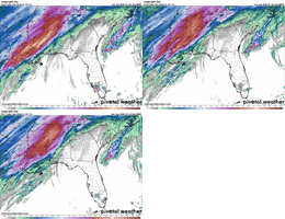
0z HRR continues trend of really cutting back on QPF from Atlanta up to Charlotte. This has been ongoing for multiple runs. The CAD is strong.View attachment 188717
This is another example of the short term models not showing the precip. This is why people keep downplaying the storm.
 
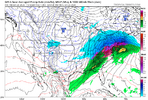
I still don’t see how this low is possibly going to ride the apps and transfer from Roanoke to the Jersey Shore (as the NAM shows). That wedge is stout!

Also, perhaps a dumb question but is there any chance those bands in the Atlantic off N FL/S GA pop a secondary low and merge with our main storm?

Well, there’s this low SSE of Wilmington.


183f594b75d31b49b59e5ac413a45e2d.jpg
 
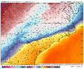
I know this doesn't really have anything to do with the winter storm, but the amount of WAA we will have here at the coast is wild. It's currently 31F in Beaufort, NC. According to the NAM, by 10am the same spot will be in the mid 60s, while Goldsboro, about 100 miles away, is still at or below freezing.
 
I know this doesn't really have anything to do with the winter storm, but the amount of WAA we will have here at the coast is wild. It's currently 31F in Beaufort, NC. According to the NAM, by 10am the same spot will be in the mid 60s, while Goldsboro, about 100 miles away, is still at or below freezing.

I’m north of the Albemarle Sound and we’re at 25°.
 
Back
Top