- Joined
- Jan 2, 2017
- Messages
- 1,566
- Reaction score
- 4,279
3k nam would be awesome imby for mostly sleet about 3 inches then a dry slot to zr Sunday night...Best case scenario!
I need to see what things look like in the morning after the 0z, 6z, and 12z runs come in before I tweak my forecast call map.
The models are not handling this arctic air mass well at all over the Southern Plains
View attachment 188293
Kinda figured this would happen
What does this cause?This high pressure has activated both cold air damming wedge regions simultaneously. Not sure i can remember this happening before
Been driving from Orlando to the snow capital of the world, Moyock, all day long. Power truck after power truck heading north. Mostly Pike and Duke. Like droves of trucks together. They're coming for ya boys and girls.
Burying NE GA and Carolina in sleetfest
Uh oh....how likely is this? This has me getting smacked with 1.16.
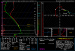
dude... that is one of the most insane soundings I've ever seen.Lol you could legit get elevated supercells in these soundings from Raleigh during the latter part of this storm.
You could totally have a storm producing hail, graupel, sleet, and/or freezing rain
View attachment 188303
What, you've never been struck by lightning with frostbite?dude...
destroying Chattanooga lol
That’s actually what I’m trying to figure out and why I’m holding off on updates for now. Could mean a more amped storm on the east coast depending on how it co varies to the wave pattern or keep the south shift going.
I presume the "dry slot" is sleet.
That “dry slot” would be putting down very efficient ZR3k nam would be awesome imby for mostly sleet about 3 inches then a dry slot to zr Sunday night...Best case scenario!
I’ve seen thunder snow.. legit! Most astounding thing I’ve seen in nature! @wow !! That’s a hoot !!!What, you've never been struck by lightning with frostbite?
What GOD is blessing us? Makes a differenceWell fellas, I know it's been said but we gotta hope and pray for as much sleet as possible and hunker down. The upstate and WNC don't need this so close after Helene but it's what we got. Everybody please stay safe and God bless you and your families!
I would not be one but surprised if that's how it plays out around here3k nam would be awesome imby for mostly sleet about 3 inches then a dry slot to zr Sunday night...Best case scenario!
How reliable is this model? This outcome would catch a ton of people off guard.End of the HRW-NSSL run. The fact that this is even a possible scenario is a bit alarming.
View attachment 188307
Do you think this would be regular rain in the upstate?This is so dumb
There are literally embedded elevated supercells in the freezing rain squall on the front
View attachment 188309
View attachment 188310
I am reading that correctly that Charlotte would be rain then? Would that help with some ice?This is so dumb
There are literally embedded elevated supercells in the freezing rain squall on the front
View attachment 188309
View attachment 188310
This is so dumb
There are literally embedded elevated supercells in the freezing rain squall on the front
View attachment 188309
View attachment 188310
I’d say “post less” but it’d be hardWhat GOD is blessing us? Makes a difference
This is so dumb
There are literally embedded elevated supercells in the freezing rain squall on the front
View attachment 188309
View attachment 188310
 Those happy about the 3K being primarily sleet. This is a sounding from only a couple hours into the storm. It’s showing as sleet but that is quite clearly a freezing rain sounding. That’s a massive deep warm nose. The other issue is the cold layer is quite cold around 2500 ft to the ground but that’s just simply not enough time to cool this back into sleet. If anything it’s hurting us because it’s giving you a super chilled rain drop with way less latent heat release. Needless to say, the 3K NAM is probably all ZR as well
why?I’d say “post less” but it’d be hard
I can totally see this happening!
What do you think the implications could be here in the Carolinas???
