-
Hello, please take a minute to check out our awesome content, contributed by the wonderful members of our community. We hope you'll add your own thoughts and opinions by making a free account!
You are using an out of date browser. It may not display this or other websites correctly.
You should upgrade or use an alternative browser.
You should upgrade or use an alternative browser.
Wintry January 23rd-27th 2026
- Thread starter SD
- Start date
Tsappfrog20
Member
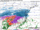
I know it’s the hrrr but it does keep the Raleigh area under freezing the entire time and has very minimal if any dry slot
Sent from my iPhone using Tapatalk
Sent from my iPhone using Tapatalk
iGRXY
Member
The HRRR is absolutely terrifying. It has absolutely perfect accrual rates and drops over an inch of liquid with probably another quarter of an inch to go at the end of the run. Starts and ends as ZR. Temps along 85 don’t get above 28 degrees and the wedge holds nearly down to I20 and well into NE Georgia for the entirety of the run. The worst part is the 1 hr rates only range from 0.04-0.08 per hour in low 20 degree temps. Even the big band drops about 0.15 per hour for a couple of hours before the back edge gets back down to that 0.08 per hour rate. Absolutely perfect accrual rates. There’s even a couple hour drag in precip but we know it’ll be freezing drizzle or light showers
Tsappfrog20
Member
Just said the same thing
Sent from my iPhone using Tapatalk
There no way..we’ve got to flip when that convection rolls through. It’s not up for debate. We have to. Need it like fresh air man
TigerSnow
Member
Probably plenty of damage done before it comes so yes, we need to flip badly.There no way..we’ve got to flip when that convection rolls through. It’s not up for debate. We have to. Need it like fresh air man
The HRRR is just mind boggling, even through squall we just stay ice… I feel like this region is still underprepared. Like people are buying stuff but if this HRRR happens it’s just….the impact still has not resonated I don’t think.
rburrel2
Member
A convective line roled through like that with the 2015 ice/sleet storm. I hit 31 degrees as it departed. Literally every model had me getting above freezing when it hit, and some of them shot me up to like 48-50 when it hit.There no way..we’ve got to flip when that convection rolls through. It’s not up for debate. We have to. Need it like fresh air man
Last edited:
The wedge is taking such a beating by then even I, a massive wedge truther, find it hard to believe it would hold that wellThere no way..we’ve got to flip when that convection rolls through. It’s not up for debate. We have to. Need it like fresh air man
HRRR at H48 is off it's rocker, not gonna happen and not even up for debate... that is all
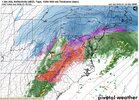
Even though it’s the long range HRRR, I actually wonder if that might be legit possibility. Most of the modeling agrees on some kind of convective line coming through overnight on Sunday. I remember that happened towards the end of the February 1996 Ice Storm in the NC Piedmont. A line of convection came through switching everything over to extremely heavy sleet with thunder and lightningHRRR has a convective line over the CAD switching precip to sleet
View attachment 188286
TigerSnow
Member
What does the precip total look like before that line? I am thinking we are mostly zr before that or hopefully some of us are sleet.The wedge is taking such a beating by then even I, a massive wedge truther, find it hard to believe it would hold that well
rburrel2
Member
I think there’s going to be more sleet in the upstate than what people expect, after going back and looking at data from that 2015 event.
Sleet wasn’t even on a consideration or possibility the day before that event, and somehow I wound up with 90% sleet and just glaze of freezing rain at the end.
-8 to -10 925s will get the job done.
Sleet wasn’t even on a consideration or possibility the day before that event, and somehow I wound up with 90% sleet and just glaze of freezing rain at the end.
-8 to -10 925s will get the job done.
iGRXY
Member
The HRRR shows you just how legit that low level cold air is and just how bad the operational are at picking it up. The areas that flip to rain on the euro and gfs as the convective band rolls through? Don’t count on it
Does it still have the low primary low tracking northeastern?The HRRR shows you just how legit that low level cold air is and just how bad the operational are at picking it up. The areas that flip to rain on the euro and gfs as the convective band rolls through? Don’t count on it
Not sure if it has any bearing on what will happen, probably not, but any of y'all noticing temps are already colder in places by several degrees a few hours earlier than almost all CAMs showed. I know imby it's 32.5 and almost all still have me in upper 30s to low 40s at this time. Just an observation
Does it still have the low primary low tracking northeastward?
If that line of convection comes through as ZR there may not be a power pole left standing within 20 miles of I-85..esp given the wind associated. And honestly, it may not matter at that point anyway
beanskip
Member
Interesting to see the 0z NAM colder in the western areas of the storm, but a little slower to bring the CAD cold into play. Thought it might be moisture/wet bulb driven, but the precip shield looks in roughly the same place. Probably just model noise, I guess.
iGRXY
Member

This is where we are at with another 3-6 hours to go in the upstate
if you remember, we actually saw a small mesohigh develop in southwest VA with that storm and it help to filter in deeper cold air driving the 925s much lower than what had been modeled. Now I’ve not seen any sign of mesohigh forming, we wouldn’t until within a few hours, but this CAD is obviously much stronger with stronger high pressure anchoring it and stronger blocking up top than that storm had.I think there’s going to be more sleet in the upstate than what people expect, after going back and looking at data from that 2015 event.
Sleet wasn’t even on a consideration or possibility the day before that event, and somehow I wound up with 90% sleet and just glaze of freezing rain at the end.
-8 to -10 925s will get the job done.
packfan98
Moderator
Godspeed to you and everyone in that regionThe HRRR is absolutely terrifying. It has absolutely perfect accrual rates and drops over an inch of liquid with probably another quarter of an inch to go at the end of the run. Starts and ends as ZR. Temps along 85 don’t get above 28 degrees and the wedge holds nearly down to I20 and well into NE Georgia for the entirety of the run. The worst part is the 1 hr rates only range from 0.04-0.08 per hour in low 20 degree temps. Even the big band drops about 0.15 per hour for a couple of hours before the back edge gets back down to that 0.08 per hour rate. Absolutely perfect accrual rates. There’s even a couple hour drag in precip but we know it’ll be freezing drizzle or light showers
Gonna be rough
rburrel2
Member
And that’s why you should never trust the long range nam. A tale as old as time
I don't trust the HRRR and never have, it tends to swing wildly but if it is even remotely close the upstate of SC and western NC is in deep, deep trouble.
If anyone in a ZR zone wants something to track up until go time, precip rates. That research I posted earlier showed you can plausibly get 1:1 ice to liquid ratios at lower hourly rates.The HRRR is absolutely terrifying. It has absolutely perfect accrual rates and drops over an inch of liquid with probably another quarter of an inch to go at the end of the run. Starts and ends as ZR. Temps along 85 don’t get above 28 degrees and the wedge holds nearly down to I20 and well into NE Georgia for the entirety of the run. The worst part is the 1 hr rates only range from 0.04-0.08 per hour in low 20 degree temps. Even the big band drops about 0.15 per hour for a couple of hours before the back edge gets back down to that 0.08 per hour rate. Absolutely perfect accrual rates. There’s even a couple hour drag in precip but we know it’ll be freezing drizzle or light showers
TigerSnow
Member
Is this a good or bad change? Looks lighter on the precip so I am hoping so.
SuperNET
Member
This event would be the first time in my life (having been born and raised in Buffalo, NY for 26 years) to maybe see a line of storms comprising of sleet and ice pellets coming at me around 6:30PM Sunday.
- Joined
- Jan 23, 2021
- Messages
- 4,602
- Reaction score
- 15,197
- Location
- Lebanon Township, Durham County NC
We had thunder ZR in 2002.
Looks more south. No sign of lack of moistureIs this a good or bad change? Looks lighter on the precip so I am hoping so.
Flatter I guess?
Isn't its wheelhouse more like 18hrs and under?HRRR at H48 is off it's rocker, not gonna happen and not even up for debate... that is all
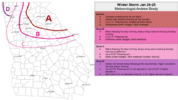
Not to far away from zone C...
mydoortotheworld
Member
I'm in the middle of the city so therefore B. We'll see what happens. My first winter storm here in midtown, I like to think that we're mostly safe from power outages but who knows.
Precip very slow getting into central NC on the NAM, 4 am Sunday just getting started good
ChattaVOL
Member
You expecting the CAD to shoot up the valley into Chattanooga?

