• Hello, please take a minute to check out our awesome content, contributed by the wonderful members of our community. We hope you'll add your own thoughts and opinions by making a free account!

Wintry January 23rd-27th 2026

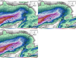
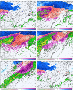
The NAM and HRRR are in totally different worlds for the RDU area and surrounding areas. The HRRR would be the worst case scenario and the NAM would save those who live here a lot of grief. The truth probably lies somewhere in the middle,
 
The NAM and HRRR are in totally different worlds for the RDU area and surrounding areas. The HRRR would be the worst case scenario and the NAM would save those who live here a lot of grief. The truth probably lies somewhere in the middle,
Isn't the NAM very accurate inside of 48 hours? I am not sure how it does with precip totals but I think that's what most say.
 
I need to see what things look like in the morning after the 0z, 6z, and 12z runs come in before I tweak my forecast call map.

The models are not handling this arctic air mass well at all over the Southern Plains

View attachment 188293


Kinda figured this would happen


In 72 hours during our retrospective, this will be the key post
 
I think there’s going to be more sleet in the upstate than what people expect, after going back and looking at data from that 2015 event.

Sleet wasn’t even on a consideration or possibility the day before that event, and somehow I wound up with 90% sleet and just glaze of freezing rain at the end.

-8 to -10 925s will get the job done.
Yea i remember that and mentioned it the other day. If we can get that level real cold we may stay sleet alot longer which im personally praying for.
 
The HRRR shows you just how legit that low level cold air is and just how bad the operational are at picking it up. The areas that flip to rain on the euro and gfs as the convective band rolls through? Don’t count on it
Just wait until it starts being fed observations within the wedge as it develops later tonight and tomorrow. It's going to go crazy cold. JMHO
 
I need to see what things look like in the morning after the 0z, 6z, and 12z runs come in before I tweak my forecast call map.

The models are not handling this arctic air mass well at all over the Southern Plains

View attachment 188293


Kinda figured this would happen


Yeah the air is very dry here
 
CAMs are liking the idea of thundersnow in the DC/Balt area. Up to 3 inches of snow per hour before our flip to sleet! I haven’t seen that since ironically, 10 years ago today. Should at least get 6 inches before the flip and could easily push a foot if we can hang on a little longer. Surface temps look to be in the 12-15 degree range

Also, I do not buy the piedmont of NC flipping to rain honestly. I’m curious as to why RAH lowered ice accums today a little despite not upping their sleet/snow totals much. I don’t see much under an inch of QPF for RDU
 
I need to see what things look like in the morning after the 0z, 6z, and 12z runs come in before I tweak my forecast call map.

The models are not handling this arctic air mass well at all over the Southern Plains

View attachment 188293


Kinda figured this would happen


What do you think the implications could be here in the Carolinas???
 
Alright north Alabama folks every time a new model runs this thing tries to bring us back in. Any thoughts?
Northwest and Northeast AL are in danger of the models under estimating the southward of extent of the arctic air with setups like this. North central AL seems to be doomed by the warm tongue.
 
I HAVE A SNEAKY FEELING THAT @Webberweather53 MIGHT BE ON TO SOMETHING AND US IN CENTRAL BAMA AROUND BMX MIGHT BE IN FOR A SHOCK IN THE NEXT FEW RUNS. THIS MIGHT PUSH FURTHER SOUTH AND KEEP THAT WARM NOSE FROM CREEPING UP LIKE IS FORECAST. IT COULD NOT EVEN COME CLOSE BUT WE WILL HAVE TO WAIT AND SEE WHEN IT GETS HERE
 
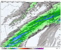
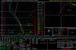
3km - impressive sleet to start and then freezing rain to end as heavy cold rain Sunday night across central NC

IMG_5456.gif


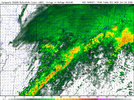
Quite the heavy rain band at the end…

IMG_5457.png
 
I'm in the middle of the city so therefore B. We'll see what happens. My first winter storm here in midtown, I like to think that we're mostly safe from power outages but who knows.
I’ve lived in midtown. And west midtown. They happen, but usually came back on quickly enough where you aren’t prolly looking at days in end without power. However. It depends on where in town. Infrastructure is prioritized and the size of outage. Interesting to go read up on what happens during such events.

But if it’s a local cut of power to say only one house/building, then you might be days on end without power.
 
Well fellas, I know it's been said but we gotta hope and pray for as much sleet as possible and hunker down. The upstate and WNC don't need this so close after Helene but it's what we got. Everybody please stay safe and God bless you and your families!
At least you finally have an answer for the question in your user ID
 
I need to see what things look like in the morning after the 0z, 6z, and 12z runs come in before I tweak my forecast call map.

The models are not handling this arctic air mass well at all over the Southern Plains

View attachment 188293


Kinda figured this would happen


That 1045 high is much further south than I expected it to be there in southern Iowa.
 
I HAVE A SNEAKY FEELING THAT @Webberweather53 MIGHT BE ON TO SOMETHING AND US IN CENTRAL BAMA AROUND BMX MIGHT BE IN FOR A SHOCK IN THE NEXT FEW RUNS. THIS MIGHT PUSH FURTHER SOUTH AND KEEP THAT WARM NOSE FROM CREEPING UP LIKE IS FORECAST. IT COULD NOT EVEN COME CLOSE BUT WE WILL HAVE TO WAIT AND SEE WHEN IT GETS HERE
Notice the axis shift of the main precip band on the short range models…it’s a lot flatter and all are coming in south. However at initialization on a lot of these models, they are still off. So it’s like they are playing catch up at the surface.

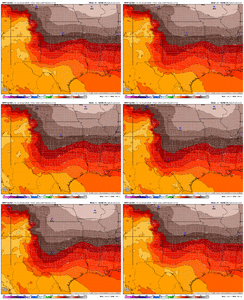
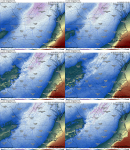
With that said, none of the models, even CAMS, are picking up the cold at the surface, 925mb, or 850mb. They are all off, some as much as 10 degrees at initialization when compared to current obs.

Will any of these errors translate downstream, that is yet to be determined, but as I have been saying all day, it would not surprise me at all to see the SLP hug the Gulf Coast all the way to the AL/GA line. Remember “path of least resistance”…..and this airmass is already proving that it will dominate.
 
What do you think the implications could be here in the Carolinas???

That’s actually what I’m trying to figure out and why I’m holding off on updates for now. Could mean a more amped storm on the east coast depending on how it co varies to the wave pattern or keep the south shift going.
 
Back
Top