• Hello, please take a minute to check out our awesome content, contributed by the wonderful members of our community. We hope you'll add your own thoughts and opinions by making a free account!

Wintry January 23rd-27th 2026

I am reading that correctly that Charlotte would be rain then? Would that help with some ice?

Potentially. The convective downdrafts from your elevated supercells would bring the warm nose to the surface as well as stronger wind gusts. Could be truly disastrous if we get any legit gust of wind with leftover ice on trees
 
View attachment 188306

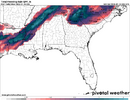
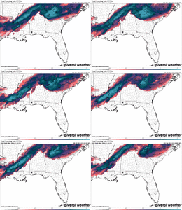
Here's the latest ice accrual map from the NWS Blend of Models hot off the press. KRDU has mentioned this model in a couple of past weather discussions this week and if this map is even close to what we might see, a lot of us would breathe a sigh of relief.
.21? Now we're talking. Tolerable
 
Potentially. The convective downdrafts from your elevated supercells would bring the warm nose to the surface as well as stronger wind gusts. Could be truly disastrous if we get any legit gust of wind with leftover ice on trees
Thanks for that follow up, I am guessing that the warm nose would cause our actual temperature to rise above freezing then as well, otherwise it would still be freezing rain?
 
Potentially. The convective downdrafts from your elevated supercells would bring the warm nose to the surface as well as stronger wind gusts. Could be truly disastrous if we get any legit gust of wind with leftover ice on trees
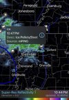
In my opinion, that line is just the NAM doing its usual outlandish antics in pretty much any scenario outside of 24 hours. It’s the same reason why is m will give you a 1060 HP during Arctic outbreaks and a routinely give us sub 900 mb hurricanes too. That line will definitely have some stout rain in it but I highly doubt we will come close to embedded cells
 
Potentially. The convective downdrafts from your elevated supercells would bring the warm nose to the surface as well as stronger wind gusts. Could be truly disastrous if we get any legit gust of wind with leftover ice on trees

I can give an example of an event where a wedge was established down here. Was 42 degrees, NNE wind. Convective line came thru, shifted the winds west, with 30 to 40mph gusts. Temps rose to 48 with very heavy rain. Squall lasted about 20 minutes. West winds continued for about another 10 minutes after that. NnE winds resumed after and the temp fell back to 40.
 
In my opinion, that line is just the NAM doing its usual outlandish antics in pretty much any scenario outside of 24 hours. It’s the same reason why is m will give you a 1060 HP during Arctic outbreaks and a routinely give us sub 900 mb hurricanes too. That line will definitely have some stout rain in it but I highly doubt we will come close to embedded cells

It’s not just the NAM showing this btw

image0.jpeg

image0.jpeg

image2.jpeg
 
View attachment 188311Those happy about the 3K being primarily sleet. This is a sounding from only a couple hours into the storm. It’s showing as sleet but that is quite clearly a freezing rain sounding. That’s a massive deep warm nose. The other issue is the cold layer is quite cold around 2500 ft to the ground but that’s just simply not enough time to cool this back into sleet. If anything it’s hurting us because it’s giving you a super chilled rain drop with way less latent heat release. Needless to say, the 3K NAM is probably all ZR as well
Got to strongly disagree. We have already discussed this earlier. That -10C layer is all that is needed to turn that to sleet. You have subfreezing air from the 850mb level all the way to the ground. That will be sleet 100% of the time .... doesn't matter how deep the melting layer is above it. Also, you have a secondary dendric growth layer that will introduce needles, columns, and sectored plates into the falling precip. This is going to be a wild time.
 
I can give an example of an event where a wedge was established down here. Was 42 degrees, NNE wind. Convective line came thru, shifted the winds west, with 30 to 40mph gusts. Temps rose to 48 with very heavy rain. Squall lasted about 20 minutes. West winds continued for about another 10 minutes after that. NnE winds resumed after and the temp fell back to 40.

30-40 mph wind gusts with 0.25” of ice on trees and power lines, we are totally cooked if that happens.
 
Yes! I got it in March '09. Lightning in snow.. It was a sight to behold.
I saw it in March of 1993. It was literally how I saw that it was snowing outside. I heard thunder and was bummed that “it was still raining”. Looked outside anyway. Immediately another flash. Nope! Snowing hard! Already accumulating.

First time ever saw it. Don’t think can top that. But seen a couple times since.

Still need to tick off thundersleet though. (And ZR, but not this time)
 
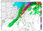
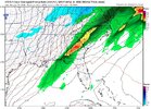
NaM with 600 MUcape and freezing rain with the thunderstorms. this is legit cool stuff View attachment 188300View attachment 188301

Potentially. The convective downdrafts from your elevated supercells would bring the warm nose to the surface as well as stronger wind gusts. Could be truly disastrous if we get any legit gust of wind with leftover ice on trees

To me it’s just a strong commahead low pressure system way north, and the tail of the comma is coming through us. Usually for winter storms the tail is in southern Georgia and Florida, lol
 
North of I20 in AL needs to really start paying attention. I had a feeling we would get to this point where we end up being that “surprise” in every event. This HP is over performing and doing it earlier….once established, it’s not going anywhere.
What makes you think that?? What modeling??
 
North of I20 in AL needs to really start paying attention. I had a feeling we would get to this point where we end up being that “surprise” in every event. This HP is over performing and doing it earlier….once established, it’s not going anywhere.
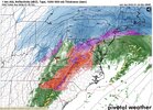
CAD will most likely eventually erode up there because of a very strong 850mb warm nose, eventually overriding the surface there. Low pressure wants to try to track right through there before eventually trying to bounce around the CAD. You should transition to rain, but areas east of you aren't so lucky.
 
Got to strongly disagree. We have already discussed this earlier. That -10C layer is all that is needed to turn that to sleet. You have subfreezing air from the 850mb level all the way to the ground. That will be sleet 100% of the time .... doesn't matter how deep the melting layer is above it. Also, you have a secondary dendric growth layer that will introduce needles, columns, and sectored plates into the falling precip. This is going to be a wild time.
The secondary dendric growth layer is something that GSP has mentioned in its discussions a couple times in the last day
 
What makes you think that?? What modeling??
Every short range model continues to come in colder in N. AL. These same short range models are too warm out west at initialization. The reason they are too warm is they aren’t handling the depth or speed of the HP coming in. If this continues to translate east, there won’t be much of a warm nose. No model is predicting the low to hug the coast as long as I think it will….its just what I am deducting for all the reasons above.
 
The GFS has been slowly backing off on the wedge strength over the past four runs. The 00Z run continues this trend, and if correct, bad icing would be reduced in the Atlanta area at a minimum.
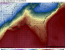
View attachment 188320
Not picking on you...I would stay away from the global models at this point and stick with the higher resolution ones, going forward.

Sent from my Pixel 10 Pro XL using Tapatalk
 
Back
Top