-
Hello, please take a minute to check out our awesome content, contributed by the wonderful members of our community. We hope you'll add your own thoughts and opinions by making a free account!
You are using an out of date browser. It may not display this or other websites correctly.
You should upgrade or use an alternative browser.
You should upgrade or use an alternative browser.
Wintry January 23rd-27th 2026
- Thread starter SD
- Start date
packfan98
Moderator
Thanks. Any chance you could post the 6z too for comparison?
Mahomeless
Member
If the banana high continues to strengthen and reconnects like trends have shown…the SLP won’t get out of south AL before it transfers to the coast.
WolfpackHomer91
Member
@Rain Cold mentioned this earlier. Lets hopeIf the banana high continues to strengthen and reconnects like trends have shown…the SLP won’t get out of south AL before it transfers to the coast.
wake4est
Member
- Joined
- Jan 3, 2017
- Messages
- 52
- Reaction score
- 138
Mpirone12
Member
Is that strictly freezing rain? No sleet factored in?
Sent from my iPhone using Tapatalk
the reason cae did not update the discussion (it was old) was because they were busy drawing up new warning polygons and don't have time to update something people rarely read.
they'll update the discussion later
they'll update the discussion later
As a physician I fully support this sentiment. Please, everyone, check on your elderly neighbors or family or friends who may be in harms way or not prepared. Make sure folks are aware to contact their doctor for medication refills or other needs TODAY before it gets roughThis is where we are better in today's standard of information vs 20, 30 years ago.
This is an upper echelon cold air damming scenario event. Once the TRENDS of the cold press continues to be evaluated, the adjustments will be made faster fortunately.
But like in years past, if this goes the way I personally think it goes, this cold press will continue all the way to event start time. There will be people caught off guard but fortunately not like what we've seen in the past like jn the 70s, 80s, 90s or even the 2000s.
This is an anomalously strong cold air damming scenario, and I hope reliable sources will convey that message to the public on awareness of the worst case scenario to be ready like we would in a hurricanes cone of uncertainty. Expect the worst, hope for the best.
packfan98
Moderator
We are pushing 60 degrees this afternoon. Classic Carolina winter storm to experience these kinds of temps a day or two before the storm! (And I mean it, this is quite common)
They are prepping worse than Helene here. What are you guys seeing? A lot panic and desperation across the socials. Scary stuff
People still believing its going to be snowThey are prepping worse than Helene here. What are you guys seeing? A lot panic and desperation across the socials. Scary stuff
Because they got their hopes up and the apple weather app exists.People still believing its going to be snow
the nam is trying to work some cape in over the top of the wedge while it is ZRing us to the paleolithic era
Dunkman
Member
I tried to add bread to my Walmart plus order last night and they were completely out. I guess that's a data point lol.They are prepping worse than Helene here. What are you guys seeing? A lot panic and desperation across the socials. Scary stuff
GASnowLover99
Member
I imagine part of that is post-Helene fears. At least here in Augusta nobody really expected it to be nearly as bad as it turned out to be, so people are being very cautious now. At least that is what I am seeing in my area based on how busy the grocery store has been.They are prepping worse than Helene here. What are you guys seeing? A lot panic and desperation across the socials. Scary stuff
Harris Teeter by NC State was out of milk last night. Wonder what it will be like when I get to MD tomorrow. I plan to really help out my parents shovel (it'll replace the gym for me haha)They are prepping worse than Helene here. What are you guys seeing? A lot panic and desperation across the socials. Scary stuff
Kidney beansthe nam is trying to work some cape in over the top of the wedge while it is ZRing us to the paleolithic era
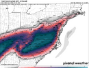
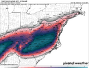
Google AI model ticks further drier for Raleigh area again. Will be interesting to see how this does...about 0.5" QPF, simliar to the NAM for the overrunning part...still plenty cold though.
I think this would be a nice little sleet event for Raleigh but a much bigger one back too CLT-Greensboro-Winston and north.
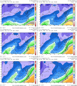
I think this would be a nice little sleet event for Raleigh but a much bigger one back too CLT-Greensboro-Winston and north.


i mean maybe it'll rain hard enough for some runoff. idk dudeKidney beanswith thunder ZR..never thought this was even a weather possibility. An impossible combo
The apple weather app is still telling me 7 inches of snow for Raleigh...Because they got their hopes up and the apple weather app exists.
If it’s >32 degrees, yes. If it’s <32, it will be freezing rain.TWC is showing like 6 hours of normal rain sunday day for ATL is this even accurate?
HailCore
Member
I am now waiting for the ultimate combo: elevated thunderstorms producing hail which is falling into an environment conducive of sleet resulting in a sleet/hail mix! The ultimate clash of warm and cold weather ice!Kidney beanswith thunder ZR..never thought this was even a weather possibility. An impossible combo
Yea they are showing 47 degrees sundayIf it’s >32 degrees, yes. If it’s <32, it will be freezing rain.
Nerman
Member
Username checks outI am now waiting for the ultimate combo: elevated thunderstorms producing hail which is falling into an environment conducive of sleet resulting in a sleet/hail mix! The ultimate clash of warm and cold weather ice!
That model is almost on its own now. Pretty much all others have settled into the 1-2" range (ignoring NAM)Google AI model ticks further drier for Raleigh area again. Will be interesting to see how this does...about 0.5" QPF, simliar to the NAM for the overrunning part...still plenty cold though.
I think this would be a nice little sleet event for Raleigh but a much bigger one back too CLT-Greensboro-Winston and north.
View attachment 187653
View attachment 187656
This model is losing me now. I had more faith in it but now it's limiting QPF too much. We will have moisture from the gulf and the other models are holding steady at 1" + of QPF. Doesn't make sense to keep supporting itGoogle AI model ticks further drier for Raleigh area again. Will be interesting to see how this does...about 0.5" QPF, simliar to the NAM for the overrunning part...still plenty cold though.
I think this would be a nice little sleet event for Raleigh but a much bigger one back too CLT-Greensboro-Winston and north.
View attachment 187653
View attachment 187656
That’s the warm up the euro shows.Yea they are showing 47 degrees sunday
What if it’s equal to 32?If it’s >32 degrees, yes. If it’s <32, it will be freezing rain.
Webberweather53
Meteorologist
What scares me about this ice storm in nc is how strong the warm nose is.
Normally we can cool the low level cad some enough to avoid freezing rain, but that may not be the case here quite as much. Could be a much tougher battle this time around
In all my years of religiously tracking these winter storms, I have never a warm nose this strong on the models.
I had to go back over 30 years to find an event (Feb 1994) with something comparable.
Not sure how much a drier trend would help us here. My guess is not a lot in the ice/freezing rain department because we’re trading volume of precip for ice accrual efficiency.
Cad Wedge NC
Member
I would say that is impossible, but if it rains at 19 degrees, anything is possible.I am now waiting for the ultimate combo: elevated thunderstorms producing hail which is falling into an environment conducive of sleet resulting in a sleet/hail mix! The ultimate clash of warm and cold weather ice!
mydoortotheworld
Member
This is a really sobering thought. Imagine communications will grind to a halt if cell towers lose power and generators run out of fuel. Bad situation…We did. The Euro was out to lunch. Doesn't mean we're going to get snow, but it wouldn't surprise me at all if it continued to trend colder and even provide a better front end thump before turning over to sleet. Areas that do not see the bulk of the precipitation fall as sleet are going to be in big, big trouble. Power will be out for days and with the cold behind the storm, roads may be impassable for days. I don't know how people will get medical help who might need it. If people do not have ample food and water stored up, they will be in trouble. The elderly are going to be in trouble. And if 4 inches of sleet falls along with freezing rain, nobody is going anywhere. Temps will barely get above freezing during the day and plummet into perhaps the single digits at night for several days. And then the next system will be coming in. I'm not trying to sound alarmist, but this isn't a 1% chance kind of thing. We are setting the stage for real disaster, the likes of which many haven't seen.
If it is 47 degrees and raining, it will be regular rain. If it is <32 degrees and raining, it will be *freezing* rain.Yea they are showing 47 degrees sunday
Whether it is freezing rain or rain will be determined by the temperature. They look the same when they’re falling.
And if it’s 32, technically still freezing rain but inefficient accretion esp on roadways.
Stormsfury
Member
It's happened before in 1990 with McAlester, OK with a thunderstorm with sleet and 1/2" hail with a temp of 13°I am now waiting for the ultimate combo: elevated thunderstorms producing hail which is falling into an environment conducive of sleet resulting in a sleet/hail mix! The ultimate clash of warm and cold weather ice!
This looks a bit rough for ATL. >1.25” of QPF and ZR for at least a few hours Sunday.Google AI model ticks further drier for Raleigh area again. Will be interesting to see how this does...about 0.5" QPF, simliar to the NAM for the overrunning part...still plenty cold though.
I think this would be a nice little sleet event for Raleigh but a much bigger one back too CLT-Greensboro-Winston and north.
View attachment 187653
View attachment 187656
SnowNiner
Member
This model is losing me now. I had more faith in it but now it's limiting QPF too much. We will have moisture from the gulf and the other models are holding steady at 1" + of QPF. Doesn't make sense to keep supporting it
For qpf/moisture, it's amazing how accurate the EPS is. I usually stick to that.
My computer told me 11The apple weather app is still telling me 7 inches of snow for Raleigh...

