-
Hello, please take a minute to check out our awesome content, contributed by the wonderful members of our community. We hope you'll add your own thoughts and opinions by making a free account!
You are using an out of date browser. It may not display this or other websites correctly.
You should upgrade or use an alternative browser.
You should upgrade or use an alternative browser.
Wintry January 23rd-27th 2026
- Thread starter SD
- Start date
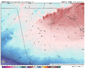
HRRR has made some improvements early still got some work to do with moisture feed into GA but belief it will. If this dry up hole doesn't occur ATL gets CRUSHED
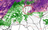
It still fills back in as the amp up air/moisture approaches from west and is still freezing rain before warm air "pushes' CAD out but if didn't loss that 2-3 hours or frz rain accumlations are 100% in the .3 to .5 frz rain in that circle with more to come.

It still fills back in as the amp up air/moisture approaches from west and is still freezing rain before warm air "pushes' CAD out but if didn't loss that 2-3 hours or frz rain accumlations are 100% in the .3 to .5 frz rain in that circle with more to come.
HRRR has made some improvements early still got some work to do with moisture feed into GA but belief it will. If this dry up hole doesn't occur ATL gets CRUSHED
View attachment 188130
I think ATL proper is going to struggle with temps going below 31. NE from there it’s going to end up ugly. I’m preparing for the worst .5-.75” ZR and hoping for a washout here in the low 30s
Too early to tell definitely Euro AI/ICON think not and the latest HRRR took a big nod to those as well it was more of a qpf matter not a cold matter. The qpf was a uptick from last 12z run so it maybe playing catchup if you got fill in that blip as mentioned with moisture ATL is areas to west of ATL are approaching .30 to .40 inches of frz rain and ATL is close to half thru the eventI think ATL proper is going to struggle with temps going below 31. NE from there it’s going to end up ugly. I’m preparing for the worst .5-.75” ZR and hoping for a washout here in the low 30s
Blue_Ridge_Escarpment
Member
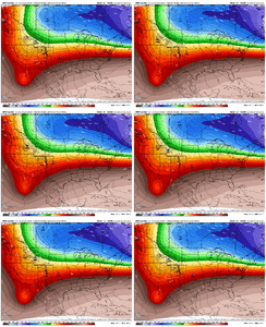
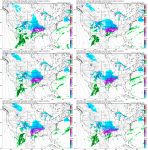
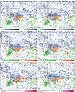
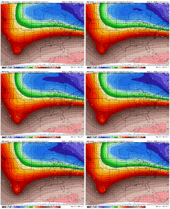
Hour 9 NAM already south with precip compared to 12Z
Same applies with telco service. Ma Bell won't touch anything until power lines have been repaired and winds and roads are safe.Something I haven't seen much talk about is the wind speeds towards the tail end of the event and then post event on Monday/Tuesday. Readings from the models are at a threshold that would prevent linesmen from using their boom trucks. Anyone who loses power should factor that into their amounts of time without.
Oh, and if your power is fed overhead to your home, do what you can now to prevent the service line from being pulled from the meter mast on your home. Utility companies won't touch your service line until a much in demand electrician has made the house ready for service.
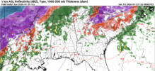
HRRR is not the only model to show this for metro ATL. FV3 and others also have light to no freezing rain/rain during Sunday morning. The main batches of precip are currently modelled in metro ATL as rain to zr Saturday night, and Sunday afternoon a heavy squall line with rainHRRR has made some improvements early still got some work to do with moisture feed into GA but belief it will. If this dry up hole doesn't occur ATL gets CRUSHED
View attachment 188130
It still fills back in as the amp up air/moisture approaches from west and is still freezing rain before warm air "pushes' CAD out but if didn't loss that 2-3 hours or frz rain accumlations are 100% in the .3 to .5 frz rain in that circle with more to come.
Stormsfury
Member
Showmeyourtds
Member
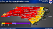
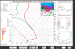
Shirley some of this in the EXTREME area would be at least some pingers...But I haven't seen it in the modeling. All the upper level soundings say ZR too...Thank god for underground utilities and bourbonFFC just sent this to out to media and emergency management partnersView attachment 188120
Last edited:
WxBlue
Meteorologist
beanskip
Member
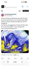
Have a theory on downstream impacts?
Stormsfury
Member
I really don't exactly know BUT I think this might imply a fill in on the high pressure and no escape hatch, more banana high pressure. It also could pertain to models and the energy flying around having it incorrect. All I do know is the what ContentWeatherGuy said. The northern and southern areas of this still could see HUGE adjustments between now and go time.Have a theory on downstream impacts?
Just quickly glancing at 18z NAM rolling in it looks like it's jumping south/flatter
Thrasher Fan
Member
Reminder... during CAD events a lot of moisture can/will fall that is not depicted on radar.HRRR has made some improvements early still got some work to do with moisture feed into GA but belief it will. If this dry up hole doesn't occur ATL gets CRUSHED
View attachment 188130
It still fills back in as the amp up air/moisture approaches from west and is still freezing rain before warm air "pushes' CAD out but if didn't loss that 2-3 hours or frz rain accumlations are 100% in the .3 to .5 frz rain in that circle with more to come.
Even on this run, with the dry hole , HRRR has 0.34” ice on FRAM for ATL.HRRR has made some improvements early still got some work to do with moisture feed into GA but belief it will. If this dry up hole doesn't occur ATL gets CRUSHED
View attachment 188130
It still fills back in as the amp up air/moisture approaches from west and is still freezing rain before warm air "pushes' CAD out but if didn't loss that 2-3 hours or frz rain accumlations are 100% in the .3 to .5 frz rain in that circle with more to come.
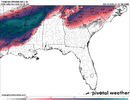
NBAcentel
Member
wow
Member
that is a large move at this range from the nam
to be clear not saying this is gonna turn into snow for NC i am just pulling for maximum sleet imbythat is a large move at this range from the nam
Ok looking at that I can’t help but wonder if there might be FGEN forced band of snow develope much further south in the CAD than what we’re seeing now. If you remember it was about this time frame in the January 2022 storm that the HRRR started picking up on it
CAD a about 1 degree colder in general as well @21z Sat
smast16
Member
NWMSGuy
Member
LongRanger
Member
I notice some has lowered ice totals just a tad, would this because they thinking more sleet for us?to be clear not saying this is gonna turn into snow for NC i am just pulling for maximum sleet imby
Tsappfrog20
Member
Definitely looks like an increase in moisture at hr 30
Sent from my iPhone using Tapatalk
Sent from my iPhone using Tapatalk
looks like it's weakening to me 1043->1041
WolfpackHomer91
Member
Wouldn’t this mean that Northern Stream is running late ? Lead to less clean phase ? But in the end more Suppression?
Sent from my iPhone using Tapatalk
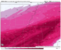
Now on this one I do see the cold press in NC increasing.View attachment 188142
tony romo voice - uhhh idk jim
LukeBarrette
im north of 90% of people on here so yeah
Meteorology Student
Member
2024 Supporter
2017-2023 Supporter
Well I said it earlier, NAM was too far north. Correcting closer to the HRRR. Obviously time for this to come back the other way but we are locking in now.
womp still flipped to ZR by 06z on this run, same as last run. Western upstate/NE GA/SWNC may have been ZR the whole time
Mahomeless
Member
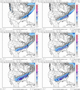
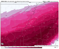
Remember...these models will often latch onto an idea, self-correct in the short term (6-12 hours) with actual observation input, and then derail back to their flawed idea. I have a gut that we are going to continue to see this southern trend with every run of the short range/hi-res models....we've seen this 100 times.If only we did this 2 days ago…. View attachment 188141

