• Hello, please take a minute to check out our awesome content, contributed by the wonderful members of our community. We hope you'll add your own thoughts and opinions by making a free account!

Wintry January 23rd-27th 2026

I still think CLT through GSO and places NW get saved from the worst of the ZR and leaning more towards IP.

Though NE GA/Upstate/Southern Mountains of NC seemed to be cooked since all of the modeling literally ground zero's those areas.
Hope you’re right but concerning that the shirt range models have all trended to an earlier switch from sleet to freezing rain
 
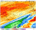
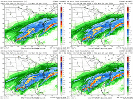
Precip shield a bit further south on 12z Euro at hr 39. Probably will shift the same way as the AI Euro (and the Euro was already south of the AI last run). Famous last words...
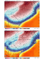
It was sorta similar specifically on the qpf the Temps were colder and more enforced CAD but not as aggressive as the AIEURO... AI EURO/GFS/ICON are similar in CAD now
 
It was sorta similar specifically on the qpf the Temps were colder and more enforced CAD but not as aggressive as the AIEURO... AI EURO/GFS/ICON are similar in CAD now
Seems it picked up the pace a bit, too. Noticed that at 12z that we are trending towards a quicker arrival of precip (which had been going in the other direction).
 
Hope you’re right but concerning that the shirt range models have all trended to an earlier switch from sleet to freezing rain
I think the only one that does that is the RGEM, the other short range models I've seen still have tons of sleet through Sunday morning.
 
1769190313541.png
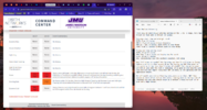
Yes I'm working today. Here is the threat forecast that gets sent to directly to the client, in this case James Madison University. My notes on the right side. I lean more heavily into the RGEM than other models.
 
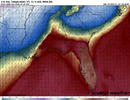
Ignoring QPF, even just the temps in Atlanta are completely different across the latest models for Sunday overnight. Hard for anyone to forecast this one in ATL. Both AIFS and GFSAI have us at 34 here -- which is drawing my attention a bit.

View attachment 188088
I have noted this several times now but you have to keep in mind that with large dewpoint depressions ahead of precip, the models often underestimate temps by 1 to 3 degrees after we wetbulb down. The only time this doesn't apply is if the dry air is located right at the surface with moist/warm air right on top/the dry layer is very shallow. Needless to say that is not the case here. I can't speak on the ais because i don't have experience with following them but the traditional models it's almost a certainty in my book.
 
No, the regular Euro doesn’t do CAD well.

I can't ever recall an event where the Euro was too warm...if anything it's too cold, atleast for Raleigh. But we will see...it's a good test for both models.
 
FFC likely leaning on experience and the human side of forecasting CAD wedges. Interested to see their video briefing when it comes out.
Hope they mention more sleet chances for the higher qpf areas. Dangerous storm with huge implications for sure.
 
Ok.. totally lost here.. west central Ga near LaGrange/east Alabama.. no watches,,advisories.. this map clearly has us in frozen precip as well as the HRRR with the stout climatologically based wedge around 28 degrees.. what am I to think?? Thunderstorm line? Frozen precip from wedge.. m at a loss!! Help please..
I feel for you… as you know it is not unusual to see the wedge entrenched that far south and west. I am from Carroll Co and many times we are right on that edge also. I have shared with friends and family in Carroll to be prepared for losing power but the trends seem to have lowered the risk for them. But it has been a roller coaster.

At this moment I don’t think major icing is going to be an issue there, however, I would not ignore the storm also. I would keep an eye on temp and dew point in your area. Also read the posts from NWS at Peachtree City in their Area Forecast Discussion. They are really good I believe.

And I am sure trying to keep up with this site will help … just trying to sort through all the posts.

Good luck!
Yeah I'm in Paulding a little further North and East of you guys the CAD can at time stretch all the way into Alabama and at times just reach ATL. I listen to the Carolina guys mostly on CAD and it seems this should be a very strong one. We will definitely need to keep a eye on temps coming East to West tomorrow from the CAD the Meso page is really helpful with that and see how much precip is building up south. If conditions like ICON/EURO AI play out it can surprise people even all the way down into south of I-20
 
What a huge difference between the Euro and it's AI....that's 5-6F difference across the area Sunday afternoon.

Are we sure the Op Euro handles CAD well?

View attachment 188099
I’ve been saying the Euro has been garbage at CAD and forecasting this system for the past week. I’m glad yall are on board now 😭
 
URGENT - WINTER WEATHER MESSAGE
National Weather Service Raleigh NC
1259 PM EST Fri Jan 23 2026

NCZ007-021>024-038-039-240800-
/O.CON.KRAH.WS.W.0001.260124T1800Z-260126T1800Z/
Person-Forsyth-Guilford-Alamance-Orange-Davidson-Randolph-
Including the cities of Winston-Salem, High Point, Thomasville,
Asheboro, Carrboro, Greensboro, Chapel Hill, Lexington, Mebane,
Burlington, Roxboro, Graham, Hillsborough, and Archdale
1259 PM EST Fri Jan 23 2026

...WINTER STORM WARNING REMAINS IN EFFECT FROM 1 PM SATURDAY TO 1 PM
EST MONDAY...

* WHAT...Heavy mixed precipitation expected. Total ice accumulations
around one half of an inch. Sleet and snow accumulations between 1
and 3 inches.


* WHERE...Portions of the northern Piedmont of central North
Carolina, including the Triad.

* WHEN...From 1 PM Saturday to 1 PM EST Monday.

* IMPACTS...Significant ice accumulation on power lines and tree
limbs may cause widespread and long-lasting power outages. Travel
could be treacherous. The hazardous conditions could impact the
Monday morning commute.
 
Winter Storm warning in wake county instead of an ice storm? Interesting
For some reason, RAH tends to issue Winter Storm Warnings instead of Ice Storm Warnings even when the criteria supports the ISW. I just haven’t seen many of them issued over the years (nor Freezing Rain Advisories, now defunct). Probably just their WFO preference. I wouldn’t read too much into it.
 
For Wake, Durham and places SE of the warning Supa posted above

...WINTER STORM WARNING IN EFFECT FROM 7 PM SATURDAY TO 1 PM EST
MONDAY...

* WHAT...Heavy mixed precipitation of largely sleet and freezing
rain expected. Total ice accumulations between three tenths and
three quarters of an inch. Total sleet and snow accumulations up
to two inches.

* WHERE...For much of the Piedmont and northern Coastal Plain of
central North Carolina.

* WHEN...From 7 PM Saturday to 1 PM EST Monday.

* IMPACTS...Significant ice accumulation on power lines and tree
limbs may cause widespread and long-lasting power outages. Travel
could be treacherous. The hazardous conditions could impact the
Monday morning commute.

PRECAUTIONARY/PREPAREDNESS ACTIONS...

Persons should consider delaying all travel. If travel is absolutely
necessary, drive with extreme caution. Consider taking a winter
storm kit along with you, including such items as tire chains,
booster cables, flashlight, shovel, blankets and extra clothing.
Also take water, a first aid kit, and anything else that would help
you survive in case you become stranded.
 
I moved to the Chatt area 6 years ago. I've never see a wrap around CAD modeled like this. So there is precedent for this?

January 2005 from an above poster…

It’s rare but if the CAD is strong enough it most certainly can do it


Sent from my iPhone using Tapatalk
 
What's the best idea of when this starts.. trying to find a good time to close tomorrow and get everyone home before around buford area
 
I’ve been traveling today and just got home. Went through the data from this morning and the 12z runs. My worst fear is coming to realization. Precip looks like it’ll be around 1.5” at least. Sleet looks like it won’t be nearly as prevalent down here in the upstate. Campobello/Landrum will hold on to it the longest and I’m only expecting around 2”. That means probably 1-1.25” will fall as ZR. Those in the upstate that think that -10 cold layer at 925 will save us are mistaken. The warm layer sbove it is deeper and just as warm. The only thing that cold layer is going to do is give us colder water with less latent heat. Models show me getting to 29 degrees as the last of the big line comes through. My guess is the CAD over performs like usual and we don’t get above 26-27. Needless to say I think the 85 corridor is getting a minimum of 0.75” of accrual. Every FRAM model run is at 1”. So not only will I have a thick layer of sleet, it’ll probably be covered with catastrophic levels amount of ZR.
 
Looks like CAE felt comfortable enough to push the ice storm warning down to I-20.

Was hoping with some models slightly warmer than yesterday that it wouldn't occur, and still think north of 20 is more concerning.
 
The latest HRRR 17z at 9z Saturday is a good chunk further S with Wintery mix across LA/MS regions and stretching East.

Last frame seen... The further this trends south and eastward the more relevant impact it has early in areas out west for some overrunning maybe even more qpf for main window later
 
Back
Top