• Hello, please take a minute to check out our awesome content, contributed by the wonderful members of our community. We hope you'll add your own thoughts and opinions by making a free account!

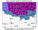
Wintry January 23rd-27th 2026

-- all the way in on ice
View attachment 188029
I get that and appreciate your info on here. I know there's not a ton of representation from Toccoa, Clayton, Rabun georgia to Oconee and Pickens other than a handful but interested in thoughts for those areas where precip is maxed out(a safe bet for 2 inches at least qpf). This system has the dynamics and orientation where we typically blow gsp out of the water on qpf. Im preparing for onset sleet and possible snow mixture and hoping that sleet hangs in for the duration of Saturday. Then another
5-.75 zr which is going to be devastating.
@rburrel2 has been our voice for years and does a helluva job for this area. Just liked to know your thoughts as well..tia
 
A surface low in central VA, that's...uh, different? UKMET is juicy and has 1-2" of QPF of frozen for the NC metros, in any case. the UKMET warms RDU from 33 to 48 between hr 63 and 66, LOL. Seems odd. It also looks relatively promising with regards to front-end snow, though I do not have soundings for this model.

I think I would chalk this up to the UKMET not handling CAD well, but who knows.

View attachment 188072
That's comical at best. The SLP isn't getting out of south AL/south GA before it transfers to the coast. There is zero mechanism to force it to. LP's will take the path of least resistance, and that will be the Carolina coast. Everyone needs to forget anything other than the following....

- Observations out west
- SPC mesoanalysis
- short range/hi-res model output

All of those should be compared back to each other to understand ACTUAL trends and how accurate model output is to actual obs.
 
I get that and appreciate your info on here. I know there's not a ton of representation from Toccoa, Clayton, Rabun georgia to Oconee and Pickens other than a handful but interested in thoughts for those areas where precip is maxed out(a safe bet for 2 inches at least qpf). This system has the dynamics and orientation where we typically blow gsp out of the water on qpf. Im preparing for onset sleet and possible snow mixture and hoping that sleet hangs in for the duration of Saturday. Then another
5-.75 zr which is going to be devastating.
@rburrel2 has been our voice for years and does a helluva job for this area. Just liked to know your thoughts as well..tia
Oh yeah, the SC escarpment and western upstate, specifically Oconee Co, as well as NE GA and the highlands/brevard vicinity in NC, look like they could be ground zero for this one ice-wise. I wouldn't be surprised if there are locations that don't even get any sleet in that region.
 
That's comical at best. The SLP isn't getting out of south AL/south GA before it transfers to the coast. There is zero mechanism to force it to. LP's will take the path of least resistance, and that will be the Carolina coast. Everyone needs to forget anything other than the following....

- Observations out west
- SPC mesoanalysis
- short range/hi-res model output

All of those should be compared back to each other to understand ACTUAL trends and how accurate model output is to actual obs.
I made my very first comment last night about this topic. The future low headed to E TN - was showing signs of "having no idea where to go", leading me to think if this is an indication of a lower, fizzling track, and energy transfer sooner and further S off the E coast. If I am following.
 
Oh yeah, the SC escarpment and western upstate, specifically Oconee Co, as well as NE GA and the highlands/brevard vicinity in NC, look like they could be ground zero for this one ice-wise. I wouldn't be surprised if there are locations that don't even get any sleet in that region.
Thanks alot
I tend to agree unfortunately..biblical as burrel has said
 
Oh yeah, the SC escarpment and western upstate, specifically Oconee Co, as well as NE GA and the highlands/brevard vicinity in NC, look like they could be ground zero for this one ice-wise. I wouldn't be surprised if there are locations that don't even get any sleet in that region.
The folks in this area have had their share of weather woes during the past two years with Helene and now this upcoming ice storm. I'm hoping the current weather forecasts don't pan out for their sake.
 
Do you have an argument against it? Sorry worded weird
Assuming you mean argument against sleet and argument against ZR...

Earlier onset time could potentially help against ZR with more time in a less stout warm nose. These events do tend to run a bit ahead of schedule so that wouldn't be shocking here, but on the other side of the coin I expect more light freezing drizzle/rain than the models may indicate.

Against sleet, this is a massive warm nose. This is a stupid warm nose. If QPF turns out a bit lighter than anticipated or shows up later, I'm not sure anyone in the upstate would get more than a coating of sleet. I don't really expect to see more than a half inch of sleet or so here, although GSP is more bullish on that.
 
A surface low in central VA, that's...uh, different? UKMET is juicy and has 1-2" of QPF of frozen for the NC metros, in any case. The UKMET warms RDU from 33 to 48 between hr 63 and 66, LOL. Seems odd. It also looks relatively promising with regards to front-end snow, though I do not have soundings for this model.

I think I would chalk this up to the UKMET not handling CAD well, but who knows.

View attachment 188072
Might make it 65 here.
 
I made my very first comment last night about this topic. The future low headed to E TN - was showing signs of "having no idea where to go", leading me to think if this is an indication of a lower, fizzling track, and energy transfer sooner and further S off the E coast. If I am following.
In which case it would be more of a Miller B and there would be a dryslot?
 
Brads latest vlog is pretty concerning, basically all of nc down to cola with freezing drizzle from 2am sat night - Sunday evening. He thinks we see .5”-.75” accrual because of the mist / drizzle sticking to everything.
The next Euro/NAM runs will be interesting to see if the dry slot they have been featuring materializes again. At this point, we need someone to throw us a life preserver.
 
c6ac52cc21db60f7c115df9c3b720cc5.jpg


Sent from my iPhone using Tapatalk
 
The next Euro/NAM runs will be interesting to see if the dry slot they have been featuring materializes again. At this point, we need someone to throw us a life preserver.
He said even with the dry slot models aren’t picking up on the drizzle/ mist that likely will still be around, and with temps low 20s will envelop everything. We almost have gotten to a worst case scenario with us losing some of the heavy rates we saw the past few days.
 
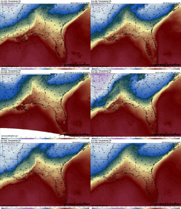
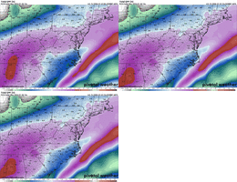
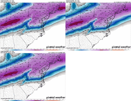
Ignoring QPF, even just the temps in Atlanta are completely different across the latest models for Sunday overnight. Hard for anyone to forecast this one in ATL. Both AIFS and GFSAI have us at 34 here -- which is drawing my attention a bit.

pivotal-weather-comparison-latest (2).gif
 
The next Euro/NAM runs will be interesting to see if the dry slot they have been featuring materializes again. At this point, we need someone to throw us a life preserver.
I believe there will be a dry slot that takes place during the transfer to the coast. Where that sets up will be key. Unfortunately, I do think the RDU area will be effected by the dry slot. I say unfortunately because that brings in the lighter amounts that can stick to power lines.
 
Wow was not expecting this? Given the overall reduction in QPF across ATL area as well as super borderline temps I’d figure they’d wait to tonight or even tomorrow morning
Exactly, doesn’t seem to make sense to expand it that large. Models for my area of western Paulding county appeared to be getting less precip
 
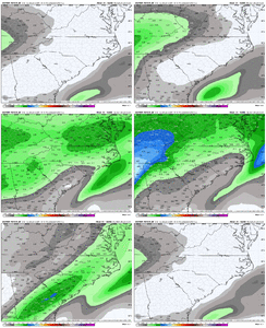
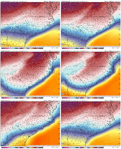
Well I will say this for the people back West in AL/GA HRRR/RAP Meso Models recent runs definitely are bringing that initial stretch of Winter Precip tomorrow AM more and more South and more stretched out. This is similar to the Global Icon. Interesting to watch that potential run to run to see if that is something for the onset that continues

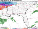
The 15z RAP@Sat. 13z
1769189103720.png

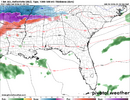
16z @ Same time
1769189127135.png
 
devastating euro ai run for Atlanta. They’re getting smoked. That pretty much seals it.
Probably what prompted the FFC to expand the warning as far south and west as they did. along with their experience with CAD undermodeling. The warning extends a row of counties south of me now, which is interesting to say the least.
 
12z regular euro will be interesting -- all that 500mb energy we were watching earlier this week REALLY changed in just the first 24 hours of this run -- much more separation -- the die is likely cast, but will be fun to track.
 
Ignoring QPF, even just the temps in Atlanta are completely different across the latest models for Sunday overnight. Hard for anyone to forecast this one in ATL. Both AIFS and GFSAI have us at 34 here -- which is drawing my attention a bit.

View attachment 188088
Of course 2 seconds after I post this the Euro AI comes out and switches ATL from 34 to 31 at the Sun 06z + increases QPF. Ouch. Big shift from the "most accurate model" (besides WxNext which we have no idea about unless Bouncycorn or someone with StormVistaWX access shares)
 
devastating euro ai run for Atlanta. They’re getting smoked. That pretty much seals it.
Yeah just eyeballing times it looks like near 20 on AL/GA board up thur East ATL.

Starting around 1-2 AM CAD is in place in those locations and stays until 12-1 PM Sunday (Parts further NE still below Freezing)
and at in that same time range it looks like those same areas received anywhere between .40 to .80 qpf so yeah that's probably mostly Frz Rain in that window
 
Back
Top