-
Hello, please take a minute to check out our awesome content, contributed by the wonderful members of our community. We hope you'll add your own thoughts and opinions by making a free account!
You are using an out of date browser. It may not display this or other websites correctly.
You should upgrade or use an alternative browser.
You should upgrade or use an alternative browser.
Wintry January 23rd-27th 2026
- Thread starter SD
- Start date
Question, what happens GA if the low doesn't cut?
Mahomeless
Member
Sleet stormQuestion, what happens GA if the low doesn't cut?
BufordWX
Member
Mahomeless
Member
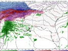
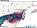
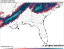
HRRR is all over this thing in the short range.HRRR showing a small finger of light precipitation all the way into W GA tomorrow morning. Maybe even trying to sqeeze a few flakes in far N AL as well?View attachment 188199
does this not look exactly like what we were seeing around tuesday/wed on the models?HRRR showing a small finger of light precipitation all the way into W GA tomorrow morning. Maybe even trying to sqeeze a few flakes out in far N AL as well?View attachment 188199
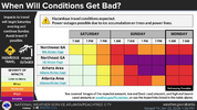
This is the first Ice Storm warning for the entire GSP coverage area. Ever
Cad Wedge NC
Member
Was just about to post the exact same thing...... This looks like the GFS a few days ago. Can we come full circle?does this not look exactly like what we were seeing around tuesday/wed on the models?
256wx
Member
Every hour the HRRR looks a tick better for us here in North Bama.
For freezing rain?Every hour the HRRR looks a tick better for us here in North Bama.
SkynyrdDawg
Member
None of the models have been showing frozen precip over north Alabama....correct? I wasn't expecting anything but some FR or sleet in extreme NW Alabama. Are temps on HRRR colder than what has been modeled? I wonder what that means for NW GA where temps were expected to be much cooler than Bama with the CAD.HRRR showing a small finger of light precipitation all the way into W GA tomorrow morning. Maybe even trying to sqeeze a few flakes out in far N AL as well?View attachment 188199
LukeBarrette
im north of 90% of people on here so yeah
Meteorology Student
Member
2024 Supporter
2017-2023 Supporter
HRRR showing a small finger of light precipitation all the way into W GA tomorrow morning. Maybe even trying to sqeeze a few flakes out in far N AL as well?View attachment 188199
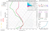
Would be careful thinking much would happen, would need at least an hour to saturate the atmosphere
256wx
Member
Shows snow, at least for a couple of hours. Better than no snow.For freezing rain?
If I remember correctly, it had a sleet storm for the metro ATL area up to NC. Right?Was just about to post the exact same thing...... This looks like the GFS a few days ago. Can we come full circle?
LukeBarrette
im north of 90% of people on here so yeah
Meteorology Student
Member
2024 Supporter
2017-2023 Supporter
View attachment 188203
Would be careful thinking much would happen, would need at least an hour to saturate the atmosphere
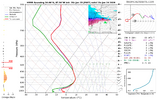
even the stuff to the west would proabably lack saturation at the surface. I would bet on maybe some sleet pings with this for sure.
Edit: Also absolutely no saturation in the DGZ would probably be rain
From what I understand the longer the Low rides the gulf and stays south the lesser impact the warm nose will be downstream thru GA Sunday and additional the track of the low trending further south is *I believe* helping the early Saturday lowering and over-running from MS/AL. This helps two ways it keeps the Warm Nose growth lesser longer allowing the CAD to build in stronger and get in place with little issue.Question, what happens GA if the low doesn't cut?
Now....
If it never cut and curled up thru Florida like Miller A then later in Sunday that changeover to rain probably doesn't happen north of I-20 Warm nose stays south and with cold press come in parts of N.GA could see Sleet/Snow mixture VERY UNLIKELY
Tsappfrog20
Member
GFS seems about 3-6 hrs faster with more moisture
Sent from my iPhone using Tapatalk
Sent from my iPhone using Tapatalk
the problem I have is...I don't think the low will cut, Wishfully thinking maybe.From what I understand the longer the Low rides the gulf and stays south the lesser impact the warm nose will be downstream thru GA Sunday and additional the track of the low trending further south is *I believe* helping the early Saturday lowering and over-running from MS/AL. This helps two ways it keeps the Warm Nose growth lesser longer allowing the CAD to build in stronger and get in place with little issue.
Now....
If it never cut and curled up thru Florida like Miller A then later in Sunday that changeover to rain probably doesn't happen north of I-20 Warm nose stays south and with cold press come in parts of N.GA could see Sleet/Snow mixture VERY UNLIKELY
do we want it faster or slower?GFS seems about 3-6 hrs faster with more moisture
Sent from my iPhone using Tapatalk
BufordWX
Member
beanskip
Member
18z GFS gets a whisker warmer but that whisker makes all the difference in ATL.
I noticed that too... it's so weird. I think the GFS is out to lunch. and it still cuts up the apps, I just don't see it18z GFS gets a whisker warmer but that whisker makes all the difference in ATL.
RAH mentions a third low involved (maybe)....
A pair of lows will develop along the srn and ern periphery of the
wedge, one over the central Gulf Coast and the other off the
Southeast US coast Sat night/Sun. The leading low off the Southeast
US coast will lift nwd along the Carolina and mid-Atlantic coasts
Sat night/Sun. A third low may develop north of or break off from
the Gulf Coast low and lift nwd along and west of the Appalachians
on Sunday, while the primary low tracks ewd across the Deep South
and Southeast. It should then lift newd along the Carolina coast and
meet up with the leading low off the Northeast US coast Sun night.
We're in the range of the high resolution models now, I wouldn't take it to seriously.18z GFS gets a whisker warmer but that whisker makes all the difference in ATL.
Soil temps are pretty middling after the last couple days, but not terrible. They shouldn't pose much of a factor with BL temps so cold, anyways (not to mention the cold between now and then). I tend to find soil temps matter most when you get wintry precip around / above freezing (particularly during the daytime hours), but that won't be the case for most in the Carolinas, at least.
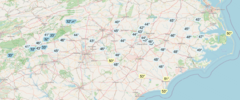

The NAM is great for thermals! Nails the wedge temps and the upper level thermals as well! Wouldn’t worry about the 18z GFS
Guaranteed ATL will be colder than the GFS models
Guaranteed ATL will be colder than the GFS models
NBAcentel
Member
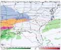
21z RAP is absolutely brutal for freezing rain
And it ended right as the heaviest ZR was moving over the upstate
NBAcentel
Member
Light/steady freezing rain, colder temps (mid 20s) just awful
Brent
Member
I should just mention the warm nose has been overdone in OKC already
Good thing it's the LR RAP, right?Light/steady freezing rain, colder temps (mid 20s) just awful
packfan98
Moderator
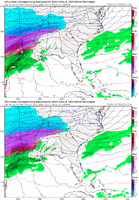
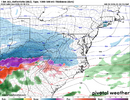
While I appreciate Pivotal with the actual measurement of .46 right over MBY, I don't know how the upslope areas of @ForsythSnow to @iGRXY aren't absolutely hammered by this.
On a side note, good grief Mississippi.
Benholio
Member
And remember that is frozen qpf not accrual
2.26 is crazy work. If even half of that verifies…While I appreciate Pivotal with the actual measurement of .46 right over MBY, I don't know how the upslope areas of @ForsythSnow to @iGRXY aren't absolutely hammered by this.
On a side note, good grief Mississippi.

