Storm5
Member
Gonna squash it this run it looks like
Sent from my iPhone using Tapatalk
Sent from my iPhone using Tapatalk
Agreed. That could send out pieces of energy and have a timing thing between highs coming down.Still lots of energy in the southern stream out west
Sent from my iPhone using Tapatalk


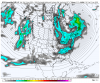
Some wintry mix showers poss for rare places of coastal Texas, coastal Louisiana, north-west Florida and then Myrtle Beach, SC barely avoids the wintry precip.Close call at hr 228...for Florida winter weather in the north-western part of the state.

That is a weird H5 pattern.

Basically a typical December Niño pattern, lol, gfs is weird
View attachment 30614
Don’t know how u can make this statement logically .. the model at its longest range still isn’t even into February .. plus with the MJO just going to be starting to get it’s act together by this time period of our possible event and then continuing to move into favorable phases for February snow events don’t know how u could make the statement that we have to score in these 5 days or we don’t see weeks of favorability ?Stale cold air beyond day 10..meh
We need to capitalize. I’m not very confident we’ll get several weeks worth of opportunities
Well, I stated my confidence level which is more of an opinion mostly based on recent February failure and what seems to be the new normal. I just don’t believe we we’ll see a favorable pattern last very long. Because when does it? Let’s just go ahead get some snow and after that it can be as hot as it wants to for the remainder of winter.Don’t know how u can make this statement logically .. the model at its longest range still isn’t even into February .. plus with the MJO just going to be starting to get it’s act together by this time period of our possible event and then continuing to move into favorable phases for February snow events don’t know how u could make the statement that we have to score in these 5 days or we don’t see weeks of favorability ?
I do understand confidence level is low ... long range Gfs saying you’re not going to be happy with many more winter weather chances to comeWell, I stated my confidence level which is more of an opinion mostly based on recent February failure and what seems to be the new normal. I just don’t believe we we’ll see a favorable pattern last very long. Because when does it? Let’s just go ahead get some snow and after that it can be as hot as it wants to for the remainder of winter.
I hope the mean isn’t skewed because member 19 is a MASSIVE beast.Gefs snow mean is already higher than last run at 216, likely signaling the better shift

Miller A? Whats that? Lol. Its been so longThere’s about to a few insane ensemble members, especially the ones with a more classic miller A setup
Yeah so basically anything between scattered gulf flurries and a HECS. That narrows it down considerablyLol thru hour 240, some are suppressed View attachment 30621