-
Hello, please take a minute to check out our awesome content, contributed by the wonderful members of our community. We hope you'll add your own thoughts and opinions by making a free account!
You are using an out of date browser. It may not display this or other websites correctly.
You should upgrade or use an alternative browser.
You should upgrade or use an alternative browser.
Wintry January 14-16th storm potential.
- Thread starter TheBatman
- Start date
dsaur
Member
When you don't know what's coming, then point out I 20, and say, "beyond here be monsters", lol. I can't begin to count how many times I've been walking around in "north of I 20" stuff since I've been down here, lol. Still only 44 here. With occasional passing patches of virga. Still have some patchy stars.Either that, or they totally ignore all the models y’all have posted here.. the rap model really hands it to us and I thought it was a good short term model.. isn’t the rap a version of the eta? Or am I confusing that with the NAM?
W
WSW
Guest
Storm5
Member
Still developing to the SW in eastern Mississippi
BKWRN29
Member
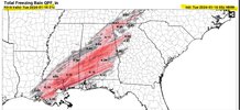
How likely is this to happen? I don’t understand why they are not forecasting these totals.. I live in north Dallas county and work in east montgomery so I am trying to get a picture of what to expect or if I should just call in tomorrow.
Branch
Member
Ehh starting to look dryer to the north
Windergawx
Member
I -20 idk seems awful warm out I don't see the cold anywhere close
That and the high rez models are being forced to acknowledge the cold isn’t moving.Ehh starting to look dryer to the north
NO CLUE AS IM NO METEROLIGIST BUT I WOULD SAY IT DOES HAVE A GOOD CHANCE TO VERIFY. JP DICE SAYS THERE IS MORE PRECIP FORMING TO THE SW IN MISSISSIPPI AND THE COLD IS HEREHow likely is this to happen? I don’t understand why they are not forecasting these totals.. I live in north Dallas county and work in east montgomery so I am trying to get a picture of what to expect or if I should just call in tomorrow.
BKWRN29
Member
I would think so too since the models are this consistent and we are only hours from the event. I’m just hung up on the fact it’s not being forecasted. If it verifys then it is going to be a MESS.NO CLUE AS IM NO METEROLIGIST BUT I WOULD SAY IT DOES HAVE A GOOD CHANCE TO VERIFY. JP DICE SAYS THERE IS MORE PRECIP FORMING TO THE SW IN MISSISSIPPI AND THE COLD IS HERE
Darklordsuperstorm
Member
28 degrees with light rain. Odenville.
hilljec
Member
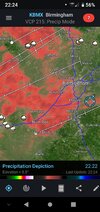
A little glaze forming on elevated surfaces and automobiles in Mountain Brook, AL. 27 degrees and light rain, highest rain returns just moved through.
IF ANY OF THOSE MODELS WERRE TO VERIFY IT WOULD ABSOLUTELY BE A MESS.. AND IT WOULD COMPLETLY CATCH FOLKS OFF GUARDI would think so too since the models are this consistent and we are only hours from the event. I’m just hung up on the fact it’s not being forecasted. If it verifys then it is going to be a MESS.
MOBILE NWS IS REALLY CONCERNED ABOUT THE POSSIBLITY OF A FLASH FREEZE DOWN THERE WITH THE STANDING WATER FROM EARLIER RAINS
YOU GOT MORE COMING IN THE TERMS OF HIGHER RETURNSA little glaze forming on elevated surfaces and automobiles in Mountain Brook, AL. 27 degrees and light rain, highest rain returns just moved through.


