olhausen
Member
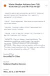
Latest map for middle Tennessee.

Because weathernerds precip maps are often deceiving and show wintry precip to far southWow, that has frozen precip almost to Birmingham. I live in Blount County, and NWS Bham is calling only for rain in my area.
I can pretty much guarantee you that Crossville will get more than Nashville. They always do.Latest map for middle Tennessee.
View attachment 102010
Yeah they are like 1800 foot??correct?I can pretty much guarantee you that Crossville will get more than Nashville. They always do.
That's the GFS, their maps are just more colorful.Because weathernerds precip maps are often deceiving and show wintry precip to far south
Yeah crossville , Jamestown and all those elevated areas do much much better then middle Tennessee. I think they average like 15 inches of snow vs Nashville’s 4-6. The Highland rim where I live also does a decent bit better then Nashville and even Hendersonville just 20 minutes south of me. White House has areas that hit around 920 feet of elevation which does help. Its not as good as Jamestown or crossvile but probably I’d say 6-8 inches a year is probably the avg.I can pretty much guarantee you that Crossville will get more than Nashville. They always do.

About 1,850 feetYeah they are like 1800 foot??correct?


im thinking more freezing rain and sleet for usMan us up here in far nw bama are REALLY ON the line
Taking 76 on over to Highlands?Not getting my hopes up on this one. I’ve been surprised before though. I might drive up the mountain to 3500ft and see what’s going on up there in the morning.


Can you pull Chattanooga for me?This is probably the best agreement I’ve seen the day before a storm on all 3 of these models. Look at the pretty colors.
euro ens
View attachment 102032
GFS ens
View attachment 102033
Oh Canada!
View attachment 102034


That’s 12z lolAbout 25 mile south shift. That would a lot of sleet if that was true for extreme Northern Alabama.View attachment 102040
On these maps it doesn’t come up as Chattanooga. At least not from what I see. A lot of these or all of them are air ports and I don’t know that region so have no idea what to look for. The maps I use are 15 minutes from my house because that the closest I can find. Maybe someone who knows that area can pull the correct ones.Can you pull Chattanooga for me?


Tats so close in extreme n bama ,I think everyone would agree that it could go either wayOn these maps it doesn’t come up as Chattanooga. At least not from what I see. A lot of these or all of them are air ports and I don’t know that region so have no idea what to look for. The maps I use are 15 minutes from my house because that the closest I can find. Maybe someone who knows that area can pull the correct ones.
I can give you these though.
View attachment 102053View attachment 102054View attachment 102055
Probably gonna be mostly/all Ice/sleet around Northern Alabama/northern MS, great looking event for TN, especially middle and northern parts of TN including Nashville, could be a nice fronto band that drops 1-2” per hour rates. But further south that’s a pretty stout warm nose on the nam 3km although it’s certainly close to becoming more of a sleet setup, especially in northern Mississippi, it could end of as a couple of flurries for N AL, but it’s hard to bet against the NAM and it’s warm nose it’s showing, especially with decent SW flow around 850mb.Tats so close in extreme n bama ,I think everyone would agree that it could go either way


that is a little more ice than i would like. you would think anything over .25 of ice would be winter storm criteria
I agree just saying if it's off just a smidgen it could be a different storyProbably gonna be mostly/all Ice/sleet around Northern Alabama/northern MS, great looking event for TN, especially middle and northern parts of TN including Nashville, could be a nice fronto band that drops 1-2” per hour rates. But further south that’s a pretty stout warm nose on the nam 3km although it’s certainly close to becoming more of a sleet setup, especially in northern Mississippi, it could end of as a couple of flurries for N AL, but it’s hard to bet against the NAM and it’s warm nose it’s showing, especially with decent SW flow around 850mb.View attachment 102057View attachment 102058View attachment 102059
I believe we busted 2 degrees here. Would be nice to hang around 34 tomorrow instead of 36/37My high busted 3 degrees low today. High was 48 not 51… interesting
looks like midmorning through midday/early afternoonGonna chase in north Bama tomorrow. When is the heaviest precip coming in?
Cold air in the these storms seem to always struggle over the Cumberland Plateau to get into Chattanooga, Dalton, and Chatsworth when it is borderline.I believe we busted 2 degrees here. Would be nice to hang around 34 tomorrow instead of 36/37