CltNative90
Member
In between South Park and South End. Park and Woodlawn area.What part of south charlotte? I’ve still got nothing over the border in Union County
In between South Park and South End. Park and Woodlawn area.What part of south charlotte? I’ve still got nothing over the border in Union County
Show us a video when they are conducive for stated ford ranger donuts.I’d like to report that road conditions in my locale do not support ford ranger donuts… yet. Currently light mix ip/zr. There is a glaze on most things. Also radar looks anemic as hell.
Ah ok. I just went out and checked again. I’ve got some sleet now.In between South Park and South End. Park and Woodlawn area.
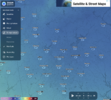
 The dry layer is so shallow and we are already getting freezing drizzle. It won't be much longer until the heavier rates get going


ZR and 21 degrees near RDU.
Not good.
Yea I just took another look outside and thought I saw some ZR mixing in with the pingers already. No bueno.Near RDU some ZR mixing in with the sleet now