Here as well . I guess that's goodThis dry slot on the front end is sick. This thing was originally supposed to start way earlier. It’s totally dry here right now. Had tiny light freezing drizzle earlier for about 60 seconds and that was it

Here as well . I guess that's goodThis dry slot on the front end is sick. This thing was originally supposed to start way earlier. It’s totally dry here right now. Had tiny light freezing drizzle earlier for about 60 seconds and that was it
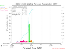
I only saw rain/drizzle with this band (as far as I know) but I was a bit north of the main higher reflectivity. One interesting thing about this batch of precip is the quick wet bulbing that is dropping temps right over north Fulton and extending into southern Forsyth and North Gwinnett. I expect as the heavier precipitation continues to move in, the temperatures will likely fall faster than anticipated (until catching up with the wet bulb/dew points).I’m down to 33.8. Let’s see what this batch of precip does. Wonder if there’s any sleet
View attachment 188747
Almost all of GSP precip comes from the rain band later tomorrow , bufkit tells the taleThis dry slot on the front end is sick. This thing was originally supposed to start way earlier. It’s totally dry here right now. Had tiny light freezing drizzle earlier for about 60 seconds and that was it

I haven't gone outdoors, but I also don't hear any pinging noise. I'll wait to check in the morning.Here as well . I guess that's good
Precip was not expected to start in the upstate until closer towards midnightWhen is consistent precip gonna move in to upstate area, thought there would have been a bit more by now
we're getting there. RH creeping up near 60-65%. most of the latest CAMs bring solid precip in here in the 11p-12a windowWhen is consistent precip gonna move in to upstate area, thought there would have been a bit more by now

That's not what locals and all the others was saying. Most was saying between 4 and 6pmPrecip was not expected to start in the upstate until closer towards midnight
That's just not true. Like 3 days ago it looked like noon and then it was delayed to 6 then 9 and within the last 24 hours closer to midnightThat's not what locals and all the others was saying. Most was saying between 4 and 6pm
The local Mets absolutely was, I heard them plainly say just today it would be starting between 4 and 6pmThat's just not true. Like 3 days ago it looked like noon and then it was delayed to 6 then 9 and within the last 24 hours closer to midnight
Such a smart idea. I love this. My son and I are going to go blow some up right now.33/25 and light rain in Cumming. Weather balloons confirm just wet not freezing so far
View attachment 188759
I hope and pray you are right. So far, little has happened where I live about five miles south of Raleigh but the radar is filling in.Big ice totals feel like a bust for 85 and maybe even 40 South folks.
Bone dry here and 27/20. I need a sleet pellet or something for a morale boost.

The torture of being a weather weenie. Even when you know it's a great thing to not be getting slammed by ice...your inner weenie is annoyed. I try to explain this to normal folks and they look at me like i'm a nut lolBone dry here and 27/20. I need a sleet pellet or something for a morale boost.
Give it time, may be tomorrow but give it time. Then it's gonna move through so fast it be overBone dry here and 27/20. I need a sleet pellet or something for a morale boost.