-
Hello, please take a minute to check out our awesome content, contributed by the wonderful members of our community. We hope you'll add your own thoughts and opinions by making a free account!
You are using an out of date browser. It may not display this or other websites correctly.
You should upgrade or use an alternative browser.
You should upgrade or use an alternative browser.
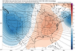
Pattern Jan 2025 Powered by Rheem AC
- Thread starter SD
- Start date


A step towards glory boys. There is no turning back now.
SnowwxAtl
Member
Can weToss GFS as usual it’s lost. Euro leads the way most the time
Sent from my iPhone using Tapatalk
So the GFS is on its own?A step towards glory boys. There is no turning back now.View attachment 156550
It seems the GFS’s heart is starting to grow.

Take this shi to banterGFS still insisting that winter is cancelled. View attachment 156544
I'm all for looking at long range, but I don't understand the constant overreaction to anything at D10 and beyond. Somehow the GEFS has cancelled winter yet looks like this. This literally means nothing to me, but it seems to for others so I show it. Just proves the point it can and will oscillate with basically every run for many more days.

As I said yesterday, there continues to be a signal for a southern storm/precipitation event in the 1/3 - 1/6 range. Nobody is figuring out the details for a while, but cold air will possibly be nearby so we watch.

As I said yesterday, there continues to be a signal for a southern storm/precipitation event in the 1/3 - 1/6 range. Nobody is figuring out the details for a while, but cold air will possibly be nearby so we watch.
NBAcentel
Member
Webberweather53
Meteorologist
The GEFS's western trough pattern is already showing cracks (pretends to be shocked).

Brent
Member
I'm all for looking at long range, but I don't understand the constant overreaction to anything at D10 and beyond. Somehow the GEFS has cancelled winter yet looks like this. This literally means nothing to me, but it seems to for others so I show it. Just proves the point it can and will oscillate with basically every run for many more days.
View attachment 156552
As I said yesterday, there continues to be a signal for a southern storm/precipitation event in the 1/3 - 1/6 range. Nobody is figuring out the details for a while, but cold air will possibly be nearby so we watch.
View attachment 156553
Just to bounce off that but I think this is the best signal we've had all season so far for some snow around the 2nd-4th here
I'm not even looking seriously at anything beyond that yet it's too far out
I remember when Christmas was gonna be 70 degrees 2 weeks ago... It's mid 50s and rainy now
wow
Member
I'm just going to keep listening to Trammell Starks until Jan 96 returns
Brent
Member
Well the GFS tries to snow here a little
That's better than last run
That's better than last run
LukeBarrette
im north of 90% of people on here so yeah
Meteorology Student
Member
2024 Supporter
2017-2023 Supporter

The GFS is indeed back
LukeBarrette
im north of 90% of people on here so yeah
Meteorology Student
Member
2024 Supporter
2017-2023 Supporter

The 00z Euro, Days 6 to 15. Now that's the friggin kinda run we can get behind.

accu35
Member
What a cold run on the 0z Euro. Lots of potential
End of the Euro run may be the best-shaped boot pattern I've ever seen 


Euro Ens Mean. We'd have to time things up as always, but lots to like here with the trough ridge complex working east in the N Pac and low in NW Atlantic. Let's see if we can get better model agreement going forward

Last edited:
Six Mile Wx
Member
The AIFS sends in the TPV by the end of the run.


Looks like the Euro and the GFS are showing some wintry precip around the 6th, I hope this continues.
Webberweather53
Meteorologist
We are really cooking if we can get the OMI MJO index into phase 1


Seems like for once the MJO is progressing swiftly in our favor. Of course the negative here is it moving to fast through the favorable phases, but it does look like we are moving in the right direction here.We are really cooking if we can get the OMI MJO index into phase 1
View attachment 156565
View attachment 156564
View attachment 156562

Webberweather53
Meteorologist
Will be interesting to see who wins...I think we all know how this ends though.
View attachment 156566
Meh the GEFS has tried to drop upper troughs down here in the sw us in the long range to no avail. It was all over some sort of cut off in the long range at the beginning of January then caved to other guidance
The GEFS is already caving in the pacific jet retraction earlier in the run & I doubt that pattern lasts long at all even if it shows up. It’s not really supported by the background state or the teleconnection pattern
Webberweather53
Meteorologist
Meh the GEFS has tried to drop upper troughs down here in the sw us in the long range to no avail. It was all over some sort of cut off in the long range at the beginning of January then caved to other guidance
The GEFS is already caving in the pacific jet retraction earlier in the run & I doubt that pattern lasts long at all even if it shows up. It’s not really supported by the background state or the teleconnection pattern
The wavelengths collapse on the GEFS and GEPS, allowing a cut off to sneak into the SW US. Could happen but it won’t stay that way for very long here regardless. Maybe it warms up briefly for a few days but there’s a risk of CAD/ice in that pattern. It would be one thing if it was March or if we had a retracted pacific jet, but with an Aleutian low, -EPO, +TNH, -NAO, and it being January, we’re likely to return back to the -EPO/+TNH look pretty quickly and stay there til probably late January
Let’s hope it’s wrong as we know Feb comes fast and we know how Feb’s work around here. Tick tockThe wavelengths collapse on the GEFS and GEPS, allowing a cut off to sneak into the SW US. Could happen but it won’t stay that way for very long here regardless. Maybe it warms up briefly for a few days but there’s a risk of CAD/ice in that pattern. It would be one thing if it was March or if we had a retracted pacific jet, but with an Aleutian low, -EPO, +TNH, -NAO, and it being January, we’re likely to return back to the -EPO/+TNH look pretty quickly and stay there til probably late January
Webberweather53
Meteorologist
It wouldn’t surprise me if it was right here but my other point is it doesn’t matter that much. We will return back to the -EPO/+TNH pattern pretty quicklyLet’s hope it’s wrong as we know Feb comes fast and we know how Feb’s work around here. Tick tock
Eric - are you going with your ideas expressed previously about this winter that once the MJO makes it back to the Indian Ocean, we won’t have too much Pac Jet momentum loss because of this year’s SST pattern, with convection there helping to support the -EPO/+TNH pattern?It wouldn’t surprise me if it was right here but my other point is it doesn’t matter that much. We will return back to the -EPO/+TNH pattern pretty quickly
I like a blend of the Euro and CFS for the MJO going into early / mid Jan


Prestige Worldwide
Member
Webberweather53
Meteorologist
Eric - are you going with your ideas expressed previously about this winter that once the MJO makes it back to the Indian Ocean, we won’t have too much Pac Jet momentum loss because of this year’s SST pattern, with convection there helping to support the -EPO/+TNH pattern?
I like a blend of the Euro and CFS for the MJO going into early / mid Jan
View attachment 156568
View attachment 156569
Yep that’s likely what’s going to happen and it’s in line with Nina climatology. I think we transition back to a -PNA pattern as we get past MLK Day. There’s usually a lagged response between the jet retraction and an Indian Ocean mjo orbit
CNCsnwfan1210
Member

Looks moist for early January
Sent from my iPhone using Tapatalk
This would more than suffice


Looks moist for early January
Sent from my iPhone using Tapatalk
Maybe Jan will be similar to last January which was fairly rainy.

NBAcentel
Member
ICON starting off 12z right. Slides the trough eastward (something the GFS/GEFS hasn’t wanted to do) 
- Joined
- Jan 23, 2021
- Messages
- 4,603
- Reaction score
- 15,199
- Location
- Lebanon Township, Durham County NC
A pattern I’m noticing on the ensembles is there’s two or three members each run showing multiple events. I’m seeing it on all of them as well.
NBAcentel
Member
I found a joke, the GEFS. This was more then halfway a cave to the EPS 
100% chance somebody in the SE gets snow/ice if that verifies.ICON starting off 12z right. Slides the trough eastward (something the GFS/GEFS hasn’t wanted to do) View attachment 156577
Looks bad
