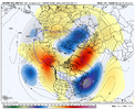
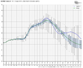
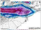
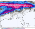
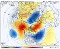
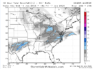
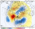
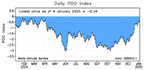
Good I need the trof to go back into the west at end of JAN and info early FEB so I can get some cold and snow chances.
-
Hello, please take a minute to check out our awesome content, contributed by the wonderful members of our community. We hope you'll add your own thoughts and opinions by making a free account!
You are using an out of date browser. It may not display this or other websites correctly.
You should upgrade or use an alternative browser.
You should upgrade or use an alternative browser.
Pattern Jan 2025 Powered by Rheem AC
- Thread starter SD
- Start date
AJ1013
Member
Another Dallas snowstorm loading…
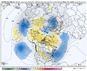
Honestly, I like this look better than what we’re in. No positive anomalies across the full CONUS toward end of the run. Should be able to get more west to east waves into the west coast without a strong western ridge there. Gotta have the beast from the east though (ridge working into Greenland). Long range caveats apply of course. I do think the GEFS will try to break down the mid month pattern too quick
100% agree…pattern wants to nina which screwed this all up so let it Nina with Atlantic help and big ole neg epo/wpo.Honestly, I like this look better than what we’re in. No positive anomalies across the full CONUS toward end of the run. Should be able to get more west to east waves into the west coast without a strong western ridge there. Gotta have the beast from the east though (ridge working into Greenland). Long range caveats apply of course. I do think the GEFS will try to break down the mid month pattern too quick
Blue_Ridge_Escarpment
Member
Laying down our own snowpack should help us in the day 10+ timeframe. Did I do that right?
I like the jet moving equatorward here - helps with getting low pressure out of AK100% agree…pattern wants to nina which screwed this all up so let it Nina with Atlantic help and big ole neg epo/wpo.

Depends on which ten days you are talking aboutLaying down our own snowpack should help us in the day 10+ timeframe. Did I do that right?
We need all the ten days we can get around our area.
Iceagewhereartthou
Member
Highs in the 30's to low 40's are broadly winter storm supportive when you factor in dewpoints / evaporational cooling etcView attachment 159659
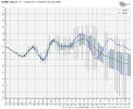
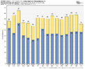
Eps isn't really a warm 2 weeks incoming. May not be extremely cold but still a very impressive stretch
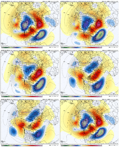
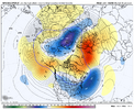
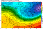
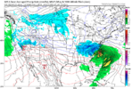
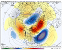
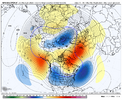
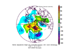
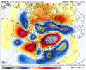
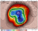
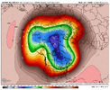
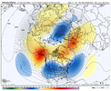
If the Greenland blocking can indeed form like this (fairly big and in retrograding fashion), this is what I'd envision the pattern looking like - bowl trough of blue across the full conus. Would setup possible wintry chances Jan 20 - Jan 27 via opportunities for cold air to go with a bit more storminess compared to the current pattern. I think the GEFS version is too far west with the trough, just like it was with the current pattern (3rd image). Long range stuff here of course.


Last edited:
rburrel2
Member
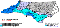
This is gonna be the coldest December/January combo since...??? Couldn't tell ya. Maybe 2010/2011?
LukeBarrette
im north of 90% of people on here so yeah
Meteorology Student
Member
2024 Supporter
2017-2023 Supporter
L
That 7 day period on the 6z would leave me overall pleased with winterView attachment 159846
Fantasyland GFS did a funny
NBAcentel
Member
This is our last below normal Dec/Jan...and of course is our last winter with multiple snow events.This is gonna be the coldest December/January combo since...??? Couldn't tell ya. Maybe 2010/2011?
Past 3 BN Dec/Jan...2018, 2011, 2010....kind of sad. Let's enjoy this below normal temps, its very rare.
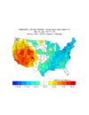
iGRXY
Member
Say hello to CAD and Miller B’s with thisIf the Greenland blocking can indeed form like this (fairly big and in retrograding fashion), this is what I'd envision the pattern looking like - bowl trough of blue across the full conus. Would setup possible wintry chances Jan 20 - Jan 27 via opportunities for cold air to go with a bit more storminess compared to the current pattern. I think the GEFS version is too far west with the trough, just like it was with the current pattern (3rd image). Long range stuff here of course.


12z is a nice strat split with an hour glass look with one lobe in Asia and the other in E Canada
Models were way off on CAD down this way, we have skyrocketed north of 50 with peaks of sunshine. We may make a run at 60.
Webberweather53
Meteorologist
I think we probably take a very brief, maybe 3 ish day/half week reset after the Jan 9-12 (ish) system goes by & then our window for scoring a winter storm quickly re-opens yet again & should stay open through about Jan 25th or so. That's certainly a pretty respectably sized window, esp considering how crappy the winters have been around here lately.
The closer we get to MLK Day & beyond, the more things will retrograde & the -PNA will finally begin to show up. The -PNA combined with a -NAO is a notorious Miller B/Cold air Damming/split flow printer and that's what our wintry threats are more likely than not to entail (if they appear of course).
As we near the beginning of February, the well advertised long range pattern change to a more prototypical Nina look probably shows up, though it'll be eastward shifted slightly (w/ ridging in the Gulf of Alaska & a trough in the west-central US) & we see an extended milder spell/faux early spring. Also in somewhat typical Nina fashion, we probably have an active storm track for the western parts of the board (TN/OH/lower-mid MS Valley) w/ some severe weather opportunities thrown into the mix.
Fun times ahead.
Webberweather53
Meteorologist
With the way the MJO has been so active this year, I could see things get kind of interesting again right at the tail end of February into March, though by then we are fighting climo in a big way
I wonder if we get a caboose (3rd system) to close out the pattern. Those typically are helpfully for wintry weather in and south of the I-20 corridor.
Lo
Love it. I want to keep the below-normal pattern through 2/10. After that, I don't care.Means are trying to pull the pv across the pole and into the Hudson bay regionView attachment 160001View attachment 160002
Eps is a cross polar flow engineView attachment 160003
Webberweather53
Meteorologist
Is that good? What does that cause?
Cad Wedge NC
Member
Yeah, that's got "CAD storm" written all over it.
What would be fun is to split the goal posts of those low anomalies and throw a cutter / apps runner into the retrograding Greenland block which then backs everything up behind it - cold air moves south out of W Canada - then you bring in a classic, southern Miller A shortly thereafterYeah, that's got "CAD storm" written all over it.

