HSVweather
Member
I hope many here can score as this moves east!Great pics...very happy for you folks in Bama..love me some Lake Guntersville!
I hope many here can score as this moves east!Great pics...very happy for you folks in Bama..love me some Lake Guntersville!

Just started to get sleet /rain / snow mix.God waiting to flip this last band is painful
Sent from my iPhone using Tapatalk
Still all sleet here though.That dry slot is filling in fast around Walker county AL area. Hopefully continues

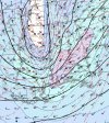
It pushes some really strong rates through Alamance/Durham/Orange around 11-2PMish.02z HRRR looks further south!
Edit: You said Carolina’s but this storm doesn’t acknowledge South Carolina as being on the map.Well, I actually saw a few flurries with this storm. That was a pleasant surprise. Looks like the main course went to many across north MS, TN, AL, GA and the Carolinas. But it was nice to get a little teaser.
Yeah didn’t know what others were talking about with the deform band drying out or whatever .. usually deform bands at least make it through central NC .. can’t say the same for Eastern NC but this one still looking good for a great burst of snow and in the daytime so we can see the snow falling ?It pushes some really strong rates through Alamance/Durham/Orange around 11-2PMish.
Storm, where are you in BHM?I've got sleet and snow !!!
Sent from my iPhone using Tapatalk
Who knows what the Triad (NC) will see tomorrow. As it stands right now we are under a Flood Watch and wind advisory starting at 4am. I expect RAH will also issue WWA for their Northern and NW counties if the def band still looks imminent. The thought of heavy snow with wind gusts up to 45-50 mph is just crazy… but it could actually happen.
Crazy what the dynamics of a ULL does and just washing away that dry slotI've got sleet and snow !!!
Sent from my iPhone using Tapatalk

Keep hope alive
WeenieI’ve got every window in my house open. #winning
It started at 52 here and took 7 hours to get to 33.How long did it take for those in Alabama to go from 60s to 30s?