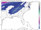
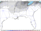
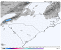
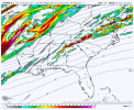
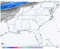
Have at it
-
Hello, please take a minute to check out our awesome content, contributed by the wonderful members of our community. We hope you'll add your own thoughts and opinions by making a free account!
You are using an out of date browser. It may not display this or other websites correctly.
You should upgrade or use an alternative browser.
You should upgrade or use an alternative browser.
Wintry Jan 2-4 2022 Winter Weather Event/Obs
- Thread starter SD
- Start date
LukeBarrette
im north of 90% of people on here so yeah
Meteorology Student
Member
2024 Supporter
2017-2023 Supporter
Va peeps are watching closely
accu35
Member
Few more good runs and Alabama will be happy.
Montanasnow30
Member
I’ll be coming down to Huntsville Alabama today to join the party let’s hope we get some flakes
I would love to see this trend well for our state, but those half a foot totals and insane dynamics for the mountains have me in a tempting mood. I have a cabin that is at 2700 feet outside of gatlinburg that I may have to bite the bullet on.
accu35
Member
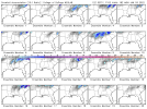
12z gefs has some solid back side snow on this run so far. I believe we’re almost at a ULL situation?
Last edited:
accu35
Member
CMC looking moist up so far
Avalanche
Member
Head on up Hwy 441.I would love to see this trend well for our state, but those half a foot totals and insane dynamics for the mountains have me in a tempting mood. I have a cabin that is at 2700 feet outside of gatlinburg that I may have to bite the bullet on.
accu35
Member
Where’s the thread for the 31-1st storm???
LovingGulfLows
Member
- Joined
- Jan 5, 2017
- Messages
- 1,499
- Reaction score
- 4,100
I'll be satisfied if I can get a few novelty flakes from this on the backside....not sure the cold air will rush in fast enough though by the time the moisture is gone.
accu35
Member
So far trends on 12z models today are juiced up.
HSVweather
Member
Where’s the thread for the 31-1st storm???
Severe - New Years Severe Weather Event
Decided to start the thread to avoid confusion with Wednesday's threat.
southernwx.com
Dewpoint Dan
Member
Make oneWhere’s the thread for the 31-1st storm???
accu35
Member
Looks like Ms/Al are the “sweet spots” as of now. Outside of the mountains lol
cd2play
Member
Hopefully many of us can score our first flizzard of the season with this system.I'll be satisfied if I can get a few novelty flakes from this on the backside....not sure the cold air will rush in fast enough though by the time the moisture is gone.
Stick me anywhere up in Avery county for this one  ️
️
- Joined
- Jan 23, 2021
- Messages
- 4,603
- Reaction score
- 15,199
- Location
- Lebanon Township, Durham County NC
The canadian is isothermal except the surface at 96. My sounding shows 35/29 so I would assume that means whatever falls then is snow.
Avalanche
Member
Funny, just talked about Newland being a spot for snow in Avery.Stick me anywhere up in Avery county for this one️
I know this setup is not optimal, but I would be happy to just see some flakes flying down this way. Can someone shed some light on exactly what we need to happen for this to trend better for us, and is it even possible?
Storm5
Member
GEFS is heavily skewed by a few members
Sent from my iPhone using Tapatalk
Sent from my iPhone using Tapatalk
Avalanche
Member
CAD out ahead of the LP that takes a more southerly track? Dont mean to be captain obvious, as I dont really know.I know this setup is not optimal, but I would be happy to just see some flakes flying down this way. Can someone shed some light on exactly what we need to happen for this to trend better for us, and is it even possible?
tennessee storm
Member
Cold chasing moisture. Doubt it less higher elevationsHopefully many of us can score our first flizzard of the season with this system.
Webberweather53
Meteorologist
This one has a real chance in the coastal plain of NC and into SE VA. Metwannabe in the driver seat
I take back everything negative I said about youThis one has a real chance in the coastal plain of NC and into SE VA. Metwannabe in the driver seat
- Joined
- Jan 23, 2021
- Messages
- 4,603
- Reaction score
- 15,199
- Location
- Lebanon Township, Durham County NC
It was a close call, about as close as you can be.12z Euro is non-zero.
View attachment 99985
Avalanche
Member
Eh. Grasping at straws with oil on our hands. Im with you though, whatever we can muster.12z Euro is non-zero.
View attachment 99985
brendan123
Member
Watching from Se Va… I’d be happy for anything really, It’d be nice to finally see a few flakes
I'll send pics =)Funny, just talked about Newland being a spot for snow in Avery.
accu35
Member
Even for central Bama?
Late bloomer- yes please. Seriously that is extremely close ???
Yes we both need something similar here slightly south and more neutral/ negative tilt.Even for central Bama?
Slight south and neutral/negative tilt, very slight, would make for a nice coastal surprise. This going to be fun to watch as it gets inside NAM rangeYes we both need something similar here slightly south and more neutral/ negative tilt.
You know one of the cams are going to uncork a total weenie run and everyone is going to go bonkersSlight south and neutral/negative tilt, very slight, would make for a nice coastal surprise. This going to be fun to watch as it gets inside NAM range
I mean the latest NAM looked like it would bode well for Mississippi eastward if it were able to go out any longer, but I only looked at reflectivity. I just know that just about ALL of our snows here in Alabama are not modeled outside of 84 hours or even showing up for that matter. There is no telling how this will pan out, but its nice to have something to track. I have seen a lot of times in this range where the Euro is lost and then the NAM spits something out for the Euro to catch on 48-54 hours before the storm. We need a lot to go right, but we need that on all of our snows. Hopefully we can start to see some better trends here soon.


