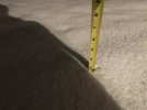
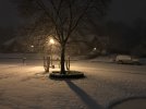
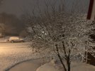
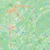
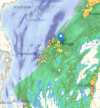
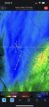
Snowing hard now. Sticking to my deck. 35 degrees
-
Hello, please take a minute to check out our awesome content, contributed by the wonderful members of our community. We hope you'll add your own thoughts and opinions by making a free account!
You are using an out of date browser. It may not display this or other websites correctly.
You should upgrade or use an alternative browser.
You should upgrade or use an alternative browser.
Wintry Jan 2-4 2022 Winter Weather Event/Obs
- Thread starter SD
- Start date
Shadypines33
Member
Tiny flakes, but a lot of them.
Snowflowxxl
Member
Congrats to our Alabama posters. Y'all often get the shaft more than other states on the board.
Dewpoint Dan
Member
Nobody gets the shaft more than SC !Congrats to our Alabama posters. Y'all often get the shaft more than other states on the board.
HSVweather
Member
HSVweather
Member
It is, and I tried to post a video but the mobile feature on iPhone safari doesn’t upload videos it appearsThe wind is whipping, right? I tried to post a video but I can't.
ColdCoreLow
Member
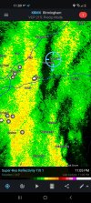
Pivoting right over the top of bhm
Snowflowxxl
Member
SC and AL are close. SC benefits with CAD sometimes when AL doesn't. SC gets killed with the warm nose though.Nobody gets the shaft more than SC !
Sam Sparks
Member
It was 36° when the changeover happened IMBY, just FYI ❄
Brent
Member
It is, and I tried to post a video but the mobile feature on iPhone safari doesn’t upload videos it appears
I've never had luck with the forum. I use streamable you just make an account upload and post the link here. Did it last night for our flurries
Storm5
Member
Pivoting right over the top of bhm
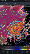
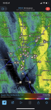
Yeah this is amazing . Band east of Jefferson in Tuscaloosa is intensifying
Sent from my iPhone using Tapatalk
Wow that is probably double what we have in downtown Huntsville.
VegasEagle
Member
2 inches three miles east of HSVweather
Windergawx
Member
Was thinking about heading to blairsville around 3am.. the heavier totals seem to be shifting more west
HSVweather
Member
LOL, spitting out over a foot for GSO when they are unlikely to even get an inch. These clowns can sure be silly! Unfortunately, they get shared on social media and the casuals run with it thinking a foot of snow is actually going to fall.
Darklordsuperstorm
Member
Snowing like a hunter biden house party now!
ColdCoreLow
Member
Eastward component has really slowed considerably in the last 30 minutesYeah this is amazing . Band east of Jefferson in Tuscaloosa is intensifying
Sent from my iPhone using Tapatalk
Soil, road and shingle temps look like they were a real issueView attachment 101381
Sticking to the roads and sidewalks now. These are tiny flakes, but they're coming down really heavy.
Stormlover
Member
over 2 1/2 at monrovia2 inches three miles east of HSVweather
Ron Burgundy
Member
FFC just pushed the WSW down into Lumpkin and White countries. Picked up Dahlonega and Cleveland. Those aren’t “bust” trends for NGA.
URGENT - WINTER WEATHER MESSAGE
National Weather Service Peachtree City GA
1151 PM EST Sun Jan 2 2022
GAZ015-016-031300-
/O.UPG.KFFC.WW.Y.0001.220103T0500Z-220103T1400Z/
/O.EXA.KFFC.WS.W.0001.220103T0500Z-220103T1400Z/
Lumpkin-White-
Including the cities of Dahlonega and Cleveland
1151 PM EST Sun Jan 2 2022
...WINTER STORM WARNING IN EFFECT UNTIL 9 AM EST MONDAY...
* WHAT...Heavy wet snow expected with total snow accumulations of
one to three inches forecast with locally higher amounts
possible, especially in areas 2000ft above sea level. Winds
gusting as high as 45 mph.
* WHERE...Lumpkin and White Counties.
* WHEN...From midnight tonight until 9 AM EST Monday.
* IMPACTS...Travel could be very difficult. The hazardous
conditions could impact the morning commute.
PRECAUTIONARY/PREPAREDNESS ACTIONS...
If you must travel, keep an extra flashlight, food, and water in
your vehicle in case of an emergency.
&&
$$
Storm5
Member
Ripping face
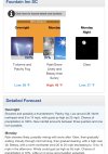
Y’all check out this forecast for an elevation just under 3,000 feet in gatlinburg. I had a cabin picked out but they said they required a 3 night minimum during the holidays and I couldn’t do it. While I’m enjoying my 2 hours of snow here, I just can’t help but think about what is going to happen up there. Winter is young!
 forecast.weather.gov
National Weather Service
HSVweather
Member
This is really nice after torching for 3 weeks and my weather station hit 81 yesterday. Decent dusting at the moment. Still 34
Iceagewhereartthou
Member
Wow everyone, fantastic pics and videos! I am so happy for all you guys seeing the snow. I am insanely jealous too but happy for all of you; enjoy!
thanksgivingbrown
Member
Just heard tree branches breaking in Huntsville. This is wild
Darklordsuperstorm
Member
Stephenb888
Member
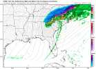
Maybe that heavy precip over upstate Sc can change over to snow? One could hope.Look at the returns over the upstate at 6am good grief
View attachment 101407
If we can just funnel enough cold air in right towards the end as precip tries to exit I don’t think flakes are of the question.Maybe that heavy precip over upstate Sc can change over to snow? One could hope.
HSVweather
Member
Still coming down hard, we may be 4” now. This was about 1110 CT
Stormlover
Member
7 inches at the Tennessee/Alabama line at Ardmore


