FFC:
Potential Weekend Storm System:
Well, lets get to the fun thing you probably came to read about,
the potential winter storm late Saturday through Sunday.
Unfortunately, model guidance has not really come into that much
better of agreement from what we were looking at this time
yesterday, leading to a very low confidence forecast. That is not
surprising, given the sensitivity of this type of setup, and we
will likely continue to see large model spread and run to run
inconsistency until 24-36 hours out. The quick summary of the
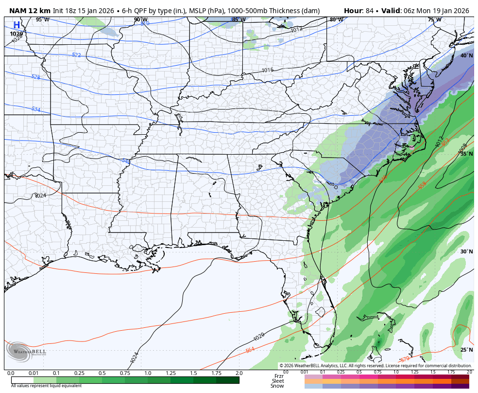
synoptic setup for this time period is that another shortwave
trough will be diving across the Great Plains and tracking through
the Southeast US. The exact location of the track, as well as the
speed and strength of the system will determine where winter
weather impacts (if any) would be. The latest consensus of
guidance is split up into a few camps, with the simplest summary
being some further north, and some further south. In general,
areas just along and north of the whatever the track is would see
all snow, while areas to the south of the track see rain. The
tracks that are further north would bring accumulating snow with
significant impacts from central Georgia up through the I-20 /
I-85 corridor, while the more southerly tracks keep north GA dry
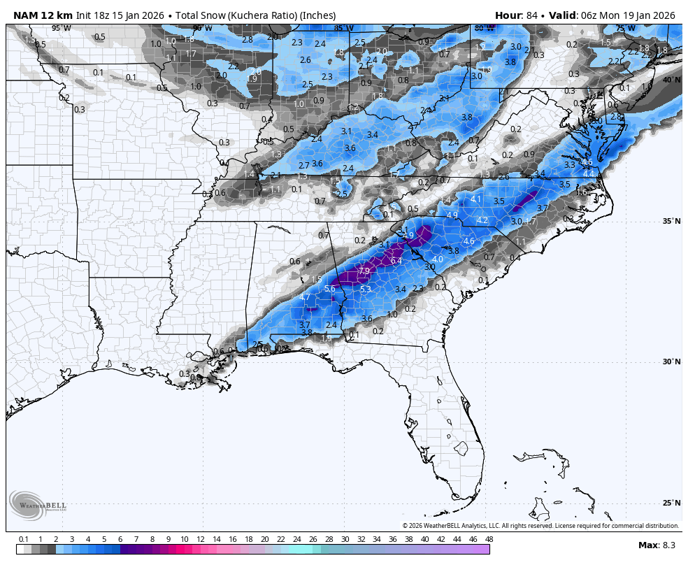
and bring snow up to a line from Columbus to Macon. Getting into
forecast snowfall amounts would be too premature at this point,
but for those that appreciate probability, there is a 10-20%
chance of a quarter inch (0.25") of snowfall across the I-20 /
I-85 corridor (including Atlanta metro). Across central GA, along
and south/east of a line from Columbus to Macon, there is a 35-50%
chance of 0.25" of snow. For chances at 1" or more of snow, most
of north GA is generally at a 5-10% chance, with central GA at
15-30%. These chances may seem low, but that is due to the large
spread amongst the model guidance. To be blunt, given the dynamic
setup, impressive moisture, and cold air in place...wherever the
track ends up going, there will likely be a swath along and just
north of it that sees several inches of snow. The advice we have
for all residents of north and central Georgia, is to play it safe
and prepare as if there will be significant travel impacts on
Sunday, even if it does not materialize. Please stay tuned to
future forecast updates, and be sure to only follow trusted
sources of weather information