packfan98
Moderator
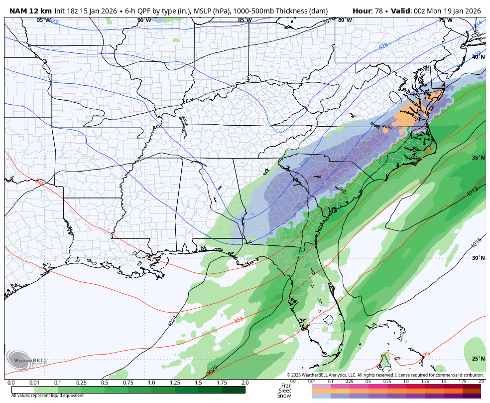
This is 6 hours old. New run is coming in now.View attachment 183868
View attachment 183869
32k NAM shows classic 85 snow. Long range NAM; follow with caution.
View attachment 183866
View attachment 183867
This is 6 hours old. New run is coming in now.View attachment 183868
View attachment 183869
32k NAM shows classic 85 snow. Long range NAM; follow with caution.
View attachment 183866
View attachment 183867

This is all 12z and not 18z.
oh sorry; lol. Well for comparison then.This is 6 hours old. New run is coming in now.
Looks pretty good to me so far. Heights along the east coast are a bit higher so that should help with the tilt
View attachment 183870
Looks pretty good to me so far. Heights along the east coast are a bit higher so that should help with the tilt
View attachment 183870
Chill with the post famya def a slam for Macon and above I'm pretty sure atp
ya def a slam for Macon and above I'm pretty sure atp
Yes, you need to read more and post less or be banned from this thread.Chill with the post fam
case in point, it would probably be more filled in than this if this exact scenario played out
Just coming into range for the precip maps. Looks to be SE of 12z with the footprint of precip so far.Anyone have screens? Stuck at work and can’t pull up maps
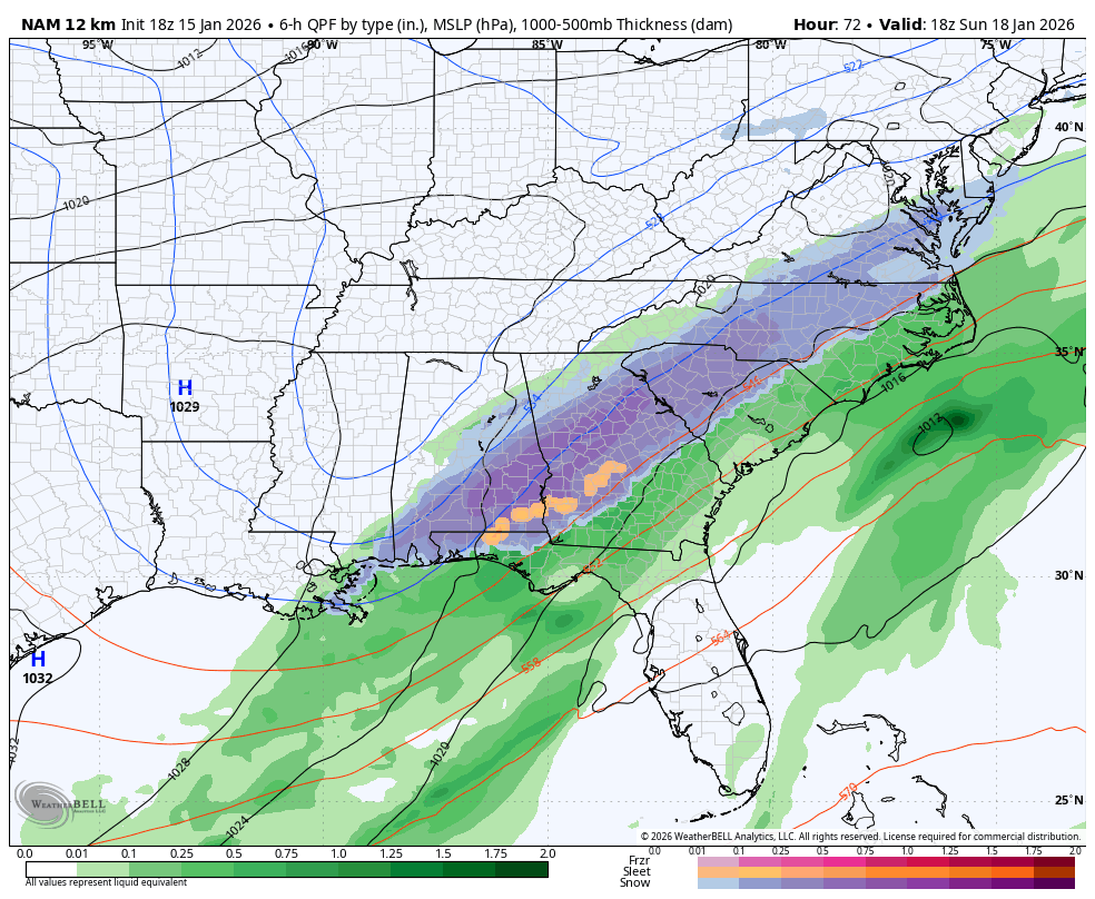

SE correction before the NW correction.Either way it did shift SE from 12Z

How has this model preformed in past storms? Doesn’t it over estimate generally?
Exactly that's why I think us in the Foothills are sitting pretty. This reminds me of 2017 a lot. Webb has been trying to tell people all week how set ups like these will work. That precipitation field will most definitely fill in Northwest up against the escarpment.One thing I can say for certain, if that 500mb map was what it truly was at game time, the surface would be exploding a whole lot more on the NW side.


That's another screwjob here sadly. So close but so far. But also the NAM. Have to see what the others do.Just keeps snowing in a lot of areasView attachment 183888