10pm. Still snowing NW NC. This nwfs is insane on backside of the storm coming up on the 48 hr mark by 4 to 6am I beleive
-
Hello, please take a minute to check out our awesome content, contributed by the wonderful members of our community. We hope you'll add your own thoughts and opinions by making a free account!
You are using an out of date browser. It may not display this or other websites correctly.
You should upgrade or use an alternative browser.
You should upgrade or use an alternative browser.
Wintry Jan 15-16 Winter Storm Discussion & Obs
- Thread starter SD
- Start date
Avalanche
Member
Is there a winter storm Izzy snow total map anywhere?

My Chair by the creek. Watch out TARHEEL I'm gaining on you lol
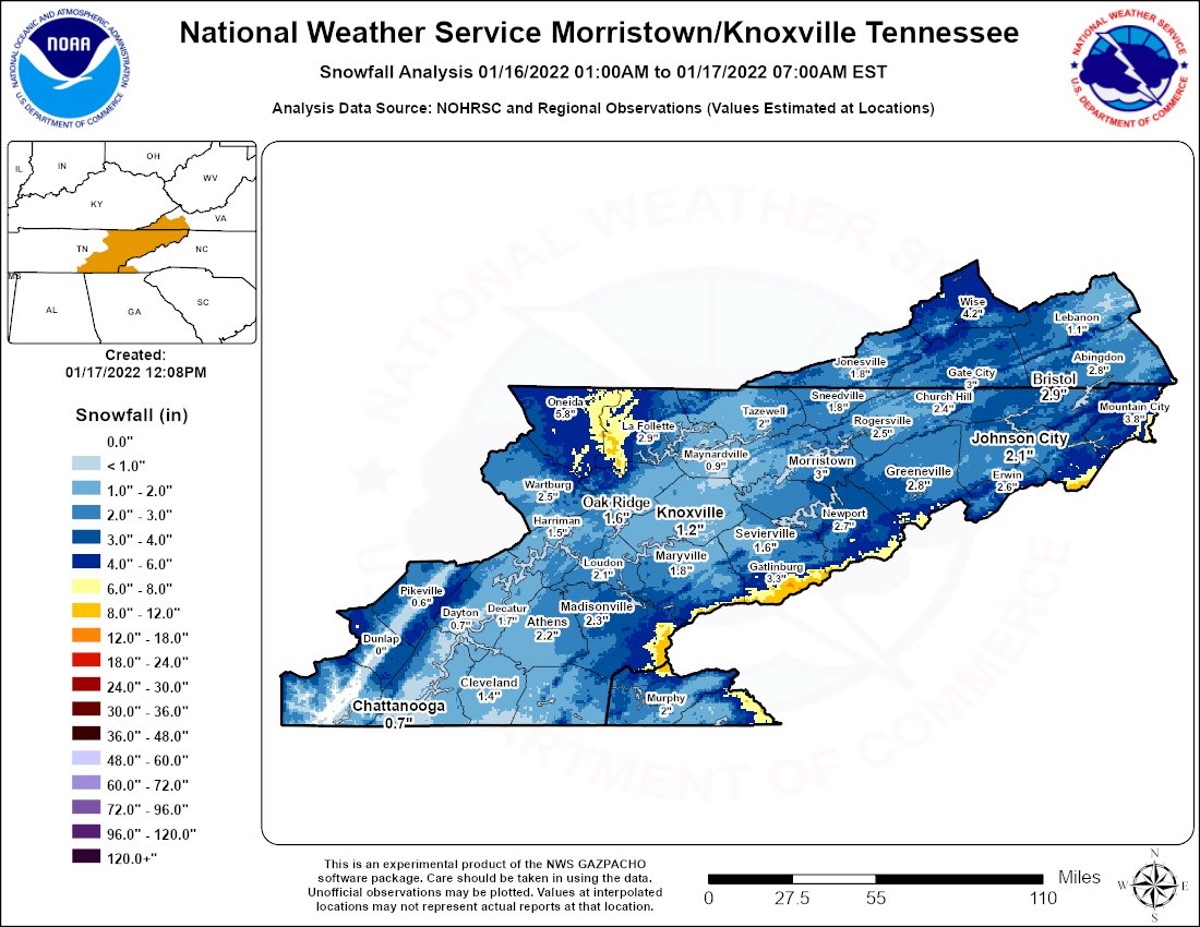
Man, WAA really flooded the Tennessee Valley. At least you all got a little backside stuff in Chattanooga.
just got home and I still have 3” of snow ?
back home south of 85 and there’s still a lot of snow on the ground.
75 mph wind gust officially recorded in #BlowingRock yesterday, 68 mph in #BooneNC
4x4 doing folks no good. Have to plow roads because of drifts. Hopefully they can dig out by Thurs p.m.. 2cnd half storm was worse than frontside
Not that this is significant, but KATL updated their snowfall from a T to .3" for this storm.
I guess thats something.
I guess thats something.
Ugh roads are just awful it’s thick ice and can’t be scraped if they had enough plows they out with Covid. Wilkes county school closed Thursday. Again. @Rain Cold i can’t believe you wanna move up the mtn it’s even worse
LickWx
Member
Wrong storm thread ! Unless your a time traveler heading to the pastCanadian is going to drop two inches on Atlanta just watch.
Sent from my iPhone using Tapatalk
ATLwxfan
Member
Just reliving
Sent from my iPhone using Tapatalk
Sent from my iPhone using Tapatalk