• Hello, please take a minute to check out our awesome content, contributed by the wonderful members of our community. We hope you'll add your own thoughts and opinions by making a free account!

Pattern Jammin' January

Guys if we ARE going to do this run by run let’s just focus on one system.

The closest one is the 20th. In fact it’s only 6-7 days out. So we can actually look at each run for trends with it.

That being said. The 20th storm is very amped up. I think our hope for it would be to see a less amped low pressure.

We have a 1040+ hp to work with in the 20th so a lot of us could definitely see some form of wintry weather. We just need a weaker low.
 
If there is a model out there that shows bad news, expect Tarheel to find it! It is the OP of the freaking GFS dude, it is going out of business because it was so bad, yet you keep posting it?
 
You should probably take a break from the board . It’s gonna drive you crazy over the next few days


Sent from my iPhone using Tapatalk

Nah, I am fine. I already got more than average with that one storm in December. I am just commenting on what I see now. Sure, things can change. I just think it is funny how that storm happened when we were not really in what is considered a great pattern, and now we have what is called a great pattern and the models are showing rain here. It's like having the number one seed in the NCAA tournament and losing in the first round.
 
What is causing every storm on gfs to cut?


Sent from my iPhone using Tapatalk

For the 20th it’s a few things
-the energy is too strong (already a 1004mb now over Oklahoma)
-nothing to keep the energy south (no high pressure to suppress the low)
-orientation of the ridge isn’t ideal, which means this storm gets stronger, faster.
-also the energy is elongated, from New Mexico to Kentucky. This means the energy to the north of Kentucky can easily “pull” the system east, capturing it and essentially going inland. If this was a more organized wave it could possibly remain SE, but at the same time we would have to worry about a cutoff and that could create problems. The ideal solution would be a weaker shortwave.
bdeae1145cf022c9e73cfc152ff44f34.jpg


After the 20th it’s pure chaos, model has no idea what to do with the energy. They’re cutting by chance. The pattern change wasn’t supposed to start until Jan 20 so I’ll say we are on track.
d1cec9e3461be20a4fa5c61b8e84b864.gif


Sent from my iPhone using Tapatalk
 
Nah, I am fine. I already got more than average with that one storm in December. I am just commenting on what I see now. Sure, things can change. I just think it is funny how that storm happened when we were not really in what is considered a great pattern, and now we have what is called a great pattern and the models are showing rain here. It's like having the number one seed in the NCAA tournament and losing in the first round.
You don't have a great pattern right now..... you wont have a great pattern for at least a few days

Sent from my SM-G955U using Tapatalk
 
Last edited:
Nothing but rain here on the model runs next week. I am having doubts about this great pattern working out. But I get 10 inches of snow in early December pretty much out of the blue without a really great pattern. Go figure. I am starting to think we have no idea what setup and sypnotics will give us snow here anymore.
Bro, you had 10 inches of snow already... Sheesh man, I’m begging for a inch down here. I feel like everyone up in that region is just in the bonus at this point anyways.
 
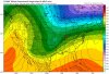
Here's a preliminary map of the ice storm that struck NC late yesterday and early this morning merging data from NWS Local Storm Reports, CoCoRaHS, mPING, & person communication. For some parts of western NC, this is their 3rd significant ice storm of the winter & we're not even halfway thru our seasonal climo yet.
View attachment 10984


View attachment 10986
View attachment 10985
Looking good. Did see a bunch of higher reports in Forsyth and Guilford (there are more but here's a good sample).

0450 AM FREEZING RAIN 2 NNE KERNERSVILLE 36.15N 80.06W
01/13/2019 E0.30 INCH FORSYTH NC 911 CALL CENTER

CORRECTS PREVIOUS FREEZING RAIN REPORT FROM
2 NNE KERNERSVILLE. TREE DOWN ON PINEY GROVE
ROAD IN KERNERSVILLE.

0256 AM FREEZING RAIN 1 SE WINSTON-SALEM 36.09N 80.25W
01/13/2019 E0.25 INCH FORSYTH NC 911 CALL CENTER

CORRECTS PREVIOUS FREEZING RAIN REPORT FROM
1 SE WINSTON-SALEM. A TREE WAS DOWN IN THE
ROADWAY AT 130 S GREEN ST IN DOWNTOWN
WINSTON-SALEM.

0354 AM FREEZING RAIN 4 N LEWISVILLE 36.14N 80.41W
01/13/2019 E0.20 INCH FORSYTH NC 911 CALL CENTER

CORRECTS PREVIOUS FREEZING RAIN REPORT FROM
4 N LEWISVILLE. A TREE WAS DOWN IN THE
ROADWAY ON THE 2400 BLOCK OF VIENNA - DOZIER
ROAD IN PFAFFTOWN.

0411 AM FREEZING RAIN 1 ENE RURAL HALL 36.24N 80.27W
01/13/2019 E0.25 INCH FORSYTH NC 911 CALL CENTER

CORRECTS PREVIOUS FREEZING RAIN REPORT FROM
1 ENE RURAL HALL. TREE DOWN ON CRESTBROOK
DRIVE IN RURAL HALL.

0743 AM FREEZING RAIN SUMMERFIELD 36.20N 79.90W
01/13/2019 E0.25 INCH GUILFORD NC PUBLIC

CORRECTS PREVIOUS FREEZING RAIN REPORT FROM
SUMMERFIELD. MULTIPLE TREES AND POWER LINES
DOWN IN SUMMERFIELD.

0744 AM FREEZING RAIN 4 NNE COLFAX 36.18N 79.99W
01/13/2019 E0.25 INCH GUILFORD NC 911 CALL CENTER

CORRECTS PREVIOUS FREEZING RAIN REPORT FROM
4 NNE COLFAX. MULTIPLE TREES AND POWER LINES
REPORTED DOWN IN OAK RIDGE.
 
There is a lot of chaos in models right now.

Even only 84 hrs out.

This little system probably has track implications for the 20th. Although I don’t know what we would need it too do to give us a more favorable track for the 20th.

4EBD8F20-E5BC-4CA8-8562-CAFF79175CB8.gif
 
Stilll have ice on all the trees up here by airport this morning. Makes for a beatifull landscape.

Those minor icing events used to be common here. Not so anymore. I don’t even remember when the last one was.


Sent from my iPhone using Tapatalk
 
Seems like a waiting game at this point. I must confess, I'm a pessimist 95% of the time, especially with winter weather... BUT, I think this is gonna be different. I'm not sure when, but I believe we're all gonna score at some point this winter.
 
The Radiant forecast for this morning is reflective of the SE ridge fighting back the cold the further SE you are in the SE. Whereas DFW and Memphis are 8 colder than normal (-8) for the period 1/19-28, Birmingham is -5, ATL is -4, RDU is -3, SAV/GNV are -2, and Daytona is only -1. I’ve been noticing a tendency on model consensus of cold having more and more difficulty getting deep into the SE. If this trend holds, the best shots at significant wintry in late Jan will be AL/TN westward.
Perhaps this SE ridging is related to the MJO then being back over on the right side. If so, hopefully this will change as the MJO comes back to the left as we approach the end of Jan. The good news overall though is the projected great high latitude blocking that should become a bigger and bigger factor as we go later in the month.
 
Last edited:
The Radiant forecast for this morning is reflective of the SE ridge fighting back the cold the further SE you are in the SE. Whereas DFW and Memphis are 8 colder than normal (-8) for the period 1/19-28, Birmingham is -5, ATL is -4, RDU is -3, SAV/GNV are -2, and Daytona is only -1. I’ve been noticing a tendency on model consensus of cold having more and more difficulty getting deep into the SE. If this trend holds, the best shots at significant wintry in late Jan will be AL/TN westward.
Perhaps this SE ridging is related to the MJO being on the right side. If so, hopefully this will change as the MJO comes back to the right as we approach the end of Jan.
I’m not sure Larry. I think it’s more transient than a feature we are having to worry about ATM.
 
Looking good. Did see a bunch of higher reports in Forsyth and Guilford (there are more but here's a good sample).

0450 AM FREEZING RAIN 2 NNE KERNERSVILLE 36.15N 80.06W
01/13/2019 E0.30 INCH FORSYTH NC 911 CALL CENTER

CORRECTS PREVIOUS FREEZING RAIN REPORT FROM
2 NNE KERNERSVILLE. TREE DOWN ON PINEY GROVE
ROAD IN KERNERSVILLE.

0256 AM FREEZING RAIN 1 SE WINSTON-SALEM 36.09N 80.25W
01/13/2019 E0.25 INCH FORSYTH NC 911 CALL CENTER

CORRECTS PREVIOUS FREEZING RAIN REPORT FROM
1 SE WINSTON-SALEM. A TREE WAS DOWN IN THE
ROADWAY AT 130 S GREEN ST IN DOWNTOWN
WINSTON-SALEM.

0354 AM FREEZING RAIN 4 N LEWISVILLE 36.14N 80.41W
01/13/2019 E0.20 INCH FORSYTH NC 911 CALL CENTER

CORRECTS PREVIOUS FREEZING RAIN REPORT FROM
4 N LEWISVILLE. A TREE WAS DOWN IN THE
ROADWAY ON THE 2400 BLOCK OF VIENNA - DOZIER
ROAD IN PFAFFTOWN.

0411 AM FREEZING RAIN 1 ENE RURAL HALL 36.24N 80.27W
01/13/2019 E0.25 INCH FORSYTH NC 911 CALL CENTER

CORRECTS PREVIOUS FREEZING RAIN REPORT FROM
1 ENE RURAL HALL. TREE DOWN ON CRESTBROOK
DRIVE IN RURAL HALL.

0743 AM FREEZING RAIN SUMMERFIELD 36.20N 79.90W
01/13/2019 E0.25 INCH GUILFORD NC PUBLIC

CORRECTS PREVIOUS FREEZING RAIN REPORT FROM
SUMMERFIELD. MULTIPLE TREES AND POWER LINES
DOWN IN SUMMERFIELD.

0744 AM FREEZING RAIN 4 NNE COLFAX 36.18N 79.99W
01/13/2019 E0.25 INCH GUILFORD NC 911 CALL CENTER

CORRECTS PREVIOUS FREEZING RAIN REPORT FROM
4 NNE COLFAX. MULTIPLE TREES AND POWER LINES
REPORTED DOWN IN OAK RIDGE.

Nice catch I'll definitely make the necessary changes, I had a sinking feeling the ZR reports in the Triad were a little low but didn't realize they were virtually all too low.
 
Last edited:
Back
Top