-
Hello, please take a minute to check out our awesome content, contributed by the wonderful members of our community. We hope you'll add your own thoughts and opinions by making a free account!
You are using an out of date browser. It may not display this or other websites correctly.
You should upgrade or use an alternative browser.
You should upgrade or use an alternative browser.
Pattern Jammin January 2024
- Thread starter SD
- Start date
SnowwxAtl
Member
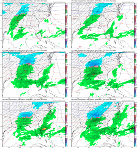
I have been looking at this one and about to stick a folk in til now.i would.... not shut the door on this quite yetView attachment 142401
BMX basically sayin "We nailed it so far".... And, I think they have. (Bold emphasis is mine)
000
FXUS64 KBMX 150224
AFDBMX
Area Forecast Discussion
National Weather Service Birmingham AL
824 PM CST Sun Jan 14 2024
...New SHORT TERM...
.SHORT TERM...
(Tonight through Monday)
Issued at 752 PM CST SUN JAN 14 2024
At 8 pm, the latest surface analysis has a decent thermal gradient
in northwest Alabama. BHM and TCL were near 45 degrees while parts
of Marion/Winston/and Lamar counties were below freezing. As the
temperature falls overnight, that main gradient between frigid
cold temperatures and slightly warmer conditions stays roughly in
the far northwest. Mean moisture has increased to near saturation
far northwest and some of the radar returns have moved over Marion
and Winston Counties already this evening. Proximity soundings
indicate that this precipitation may be a mix with snow, freezing
rain and sleet. The main heavier reflectivities should remain
north of central Alabama overnight. So the Winter Storm Warning
area overnight is good for now. More of the wintry precipitation
is expected to return to northwest areas during the morning hours.
This area will expand southward with time into Monday afternoon
and evening. At this time, no adjustments to the areas, timing or
amounts are necessary. Will monitor the latest observations and
model guidance and will modify as appropriate. Now is the time to
take preventative measure for this wintry mix through Tuesday
morning.
75
Previous short-term discussion:
(This afternoon through Monday)
Issued at 1015 AM CST SUN JAN 14 2024
As of 10 AM, not much a change is expected to the short term
forecast through Monday. The weather across Central Alabama will
begin to change and get worse later tonight, especially in the far
NW.
A wintry mix is expected generally across the far NW counties for
tonight, but also some mixed activity with only minor
accumulations for portions of Lamar up to Cherokee county. With
the potential for 1-2 inches of accumulation in Marion/Winston
before all is said and done. A winter storm warning is now in
place starting at 6 PM tonight through 6 AM Tuesday. The advisory
is currently in place for Lamar, Fayette, Walker, Blount, Etowah,
and Cherokee but hold off until 6 AM Monday to start there with
minimal if any accumulation expected overnight tonight.
Will most likely extend the advisory further south with the
afternoon updates, but will need to see the forecast numbers
before deciding hour far south we want to go. While the warning
area may see a band of snow scrape the area, there will likely be
some sleet/freezing rain at times mixed in. So, we are looking at
snow (snow/sleet) accumulations (1-2 in) and ice (from freezing
rain) as well (generally less than 1/4 inch of ice). It does not
take much ice with these cold temperatures to create problems
spots and travel is discouraged in the advisory as well for
Monday.
Most of the precipitation, south of the current advisory, will be
in the form of rain possibly mixed with a few ice pellets at times
right along the I-20 corridor through the daytime hours. As we get
into the hours after sunset we will begin to see the wintry mix
slide south and east. More details on that will be in the extended
portion.
GoDuke
Member
Just looking at that makes me hear steel drums. Time to book a cruise.
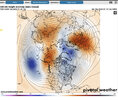
What about sc and ncAbsolutely sick pattern should this actually come to fruition. Not only are we about to ridge bridge across the pole, but the ridging over Scandinavia will push the PV southward. Dream pattern for MS, AL and GA.
View attachment 142413
What about sc and nc
My guess is y’all will find a way to fail.
Absolutely sick pattern should this actually come to fruition. Not only are we about to ridge bridge across the pole, but the ridging over Scandinavia will push the PV southward. Dream pattern for MS, AL and GA.
View attachment 142413
tonysc
Member
Getting very tired of that snow wall around SC. It's getting ridiculous.
MichaelJ
Member
When JB talks about winter coming back in Feb and into March, it does mean a lot of snow, just not in the SE. Remember he focuses almost exclusively on the Mid Atlantic and NE in winter. I also think he may be on to something with the MJO becoming "stuck" longer in Feb rather rotate into 8
NCSNOW
Member
Apparently the CFS didn't get the message how Fab Feb was gonna be. Getting the vibe the ole canonical Unicorn forecast I've been hearing hyped all winter, is gonna show up like a flat tire here in 2 weeks.
Twister
Member
FAB FEB gonna be FABApparently the CFS didn't get the message how Fab Feb was gonna be. Getting the vibe the ole canonical Unicorn forecast I've been hearing hyped all winter, is gonna show up like a flat tire here in 2 weeks.


Sent from my SM-S911U using Tapatalk
Yep but he also had our area in the big snowfall area and that hasn’t happened yet. He definitely has nailed the pattern all winterWhen JB talks about winter coming back in Feb and into March, it does mean a lot of snow, just not in the SE. Remember he focuses almost exclusively on the Mid Atlantic and NE in winter. I also think he may be on to something with the MJO becoming "stuck" longer in Feb rather rotate into 8
His Saturday updates continue to state that the SE will get snow.When JB talks about winter coming back in Feb and into March, it does mean a lot of snow, just not in the SE. Remember he focuses almost exclusively on the Mid Atlantic and NE in winter. I also think he may be on to something with the MJO becoming "stuck" longer in Feb rather rotate into 8
But does he say what year?His Saturday updates continue to state that the SE will get snow.
rburrel2
Member
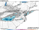
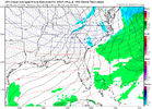
I'm curious to see what the hi-res models do with the Thursday night threat. For the upstate it looks like we just need precip to hang on a tad longer before drying up. Globals show anywhere from .01-.20 for us. Soundings are iffy too, but usually with strong evaporational cooling threats the hi-res models show quicker cooling and more snow, and that's what we have here with a really dry air mass in place.

