• Hello, please take a minute to check out our awesome content, contributed by the wonderful members of our community. We hope you'll add your own thoughts and opinions by making a free account!

Pattern Jammin January 2024

When JB talks about winter coming back in Feb and into March, it does mean a lot of snow, just not in the SE. Remember he focuses almost exclusively on the Mid Atlantic and NE in winter. I also think he may be on to something with the MJO becoming "stuck" longer in Feb rather rotate into 8
As I’ve said about some other posts about the MJO, go and look at the info Grit and Webb posted about the MJO back on 1/6. Phase 4-7 isn’t as bad as we’ve all thought in February, especially when it’s low amped like it looks to be.

Edit: those posts from Grit and Webb were made in the Winter Discussion Thread.
 
Last edited:
Apparently the CFS didn't get the message how Fab Feb was gonna be. Getting the vibe the ole canonical Unicorn forecast I've been hearing hyped all winter, is gonna show up like a flat tire here in 2 weeks.
I just looked at the Weekly and Monthly that ran last night and they both still look really good.
 
I'm mildly intrigued with the late week system, one of these has to over perform right? I mean again it's just a slight difference here or there for some east of the apps to see a little snow
I can think of several examples of similar type "threats" in the day 3-4 range that wound up turning in to a solid 2-3 inch storm here. Many more that didn't pan out, but you can't discount it completely. You miss 100% of the shots you don't take.
 
I'm mildly intrigued with the late week system, one of these has to over perform right? I mean again it's just a slight difference here or there for some east of the apps to see a little snow
Well both the 6z GFS and ICON are continuing the trend of being a bit more moisture east of the mountains and EPS, GEPS, and GEFS moisture has increased as well. Soundings look like they would support snow with enough moisture from I-95 west in NC and back into the SC upstate. It should be noted that more moisture definitely made it into NC this morning than any model predicted
 
I'm mildly intrigued with the late week system, one of these has to over perform right? I mean again it's just a slight difference here or there for some east of the apps to see a little snow
Today gives me a lot higher confidence in Friday. I noticed on 6z gfs it has snow showers popping up in multiple locations, esp down east over a 12 hour span. It and the Icon have been consistent. Should be cold enough, where maybe some can get a trace to accumulate and get on scoreboard.
 
Today gives me a lot higher confidence in Friday. I noticed on 6z gfs it has snow showers popping up in multiple locations, esp down east over a 12 hour span. It and the Icon have been consistent. Should be cold enough, where maybe some can get a trace to accumulate and get on scoreboard.
Not getting my hopes up but Friday’s system has the looks of one of those that can start to bring some surprises once we get 36 hours out. The cold push looks for really good on both the GFS and ICON and it’s actually coming in more from the north instead of the west. Both the models and EPS, GEFS have and uptick in moisture and 850s look good.
 
Dang just read Alan Huffman update. 60s next week he would not be surprised if some 70s didn’t show up late next week, and as far as cold for February weeklies has warmed for weeks 3/4 so may be mid/late fab Feb before any cold air drops into the US. Fab Feb is a big ? now.


Sent from my iPhone using Tapatalk
 
Going to be some teeth gnashing that after the next few days winter on hiatus until mid-Feb. We have to get ourselves out of this mess to end January, that will take time. So yeah, let's hope/pray by mid-Feb we have a serviceable pattern. ?

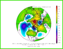
ecmwf-ensemble-avg-nhemi-z500_anom_7day-6572800.png
 
Going to be some teeth gnashing that after the next few days winter on hiatus until mid-Feb. We have to get ourselves out of this mess to end January, that will take time. So yeah, let's hope/pray by mid-Feb we have a serviceable pattern. ?

View attachment 142444
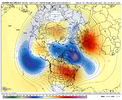
At least by the end of the EPS and GEFS, they both agree the western ridge goes up and east trough goes down, but we got that glaring low in the bay. Better than the SER taking hold and staying with how persistent it always is.
gfs-ens_z500a_namer_65.png

eps_z500a_namer_61.png
 
Back
Top