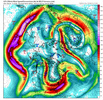
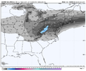
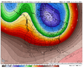
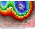
I really like this look ?
-
Hello, please take a minute to check out our awesome content, contributed by the wonderful members of our community. We hope you'll add your own thoughts and opinions by making a free account!
You are using an out of date browser. It may not display this or other websites correctly.
You should upgrade or use an alternative browser.
You should upgrade or use an alternative browser.
Pattern Jammin January 2024
- Thread starter SD
- Start date
Please tell me this is the average and not the total for the entire decade.
It’s the yearly average for Greensboro, NC, admittedly one of the snowiest places in the Southeast outside the mountains.
RDU NWS on Friday system....
Our next chance for precipitation comes as the mid/upper level low
sags south from Ontario strengthening a mid-level jet to 80-110 kts
over the TN Valley and southern Mid-Atlantic. At the nose of this
jet, strengthening upper divergence and moistening mid/upper levels
may lead a slight chance for rain or snow over the west and northern
Piedmont, and northern Coastal Plain (Albemarle to Roanoke Rapids
and locations north) early Fri morning, before transitioning to all
rain after 8 AM. There is still a fair bit of uncertainty during
this time on the strength/timing of the upper trough, leading a low-
confidence forecast on Fri.
Batman
Member
Post of the year above IMO! Thanks for posting what I have been thinking as I read posts here for a long long time. I live in the deep south. Central GA. I have lived here for 32 years. We average about 2" of snow per season. That means some years we get a good snow or two. More years that not, we get shut out. If I tally up all of the snow I have received over the last 32 winters and divide by 32, it comes to....really, really close to 2. We are in a snow drought right now. We have been in them before. Usually, the snow drought will end with a few years of above or well above average snowfall. Maybe, this year is the start of that. Only God knows. It does seem like in recent years that the base of troughs have plunged and/or settled more to our west. It also seems that more winter weather has focused west of us where the troughs have been centered. While it is disappointing, I also remember the same thing happening from time to time in the 90's and early 2000s. Bottom line is that I will take where we are right now and what appears to be in front of us for the remainder of the winter with more optimism than the prospects that most winters present. I have lived through many winters where I don't really see much of a possibility of a good pattern or storm to track. If you live in the deep south, love winter weather and are disappointed when you don't get it, you will spent most winters disappointed. This is not a new development.Ive been around a while in NC. You younger guys keep throwing around how great the 80s and 90s where. They werent all some crank them up to be. Yea we had a couple noteworthy artic blast (7 dayish in length) , a big snow jan 88. Really those where the highlights. I can remember way to many Above normal winter days and thinking its never gonna snow anymore. The 70s where stellar and the best decade for winter wx in NC imo was 2000-2010. Espeacilly 2000-2004. In central NC you had the crusher,Historic Catatstrophic ice stirm Dec 2002 and the Feb 28,2004 upper level thundersnow beast( 17 inches here).
Bottom line we are in a slump. They come an go down here because of our location. The rubber band will snap back the other way soon. Always does.
We are making at run at 60 today. 57 at KATL and 55 at KPDK.
Drizzle Snizzle
Member
Enjoy it because the arctic air will be here soonWe are making at run at 60 today. 57 at KATL and 55 at KPDK.
Blue_Ridge_Escarpment
Member
GFS ensembles agree too??This is a NE storm, just in case some were wondering View attachment 142259
This is a NE storm, just in case some were wondering
Safe to say all winter storms these past few years are:
1- NE Storms
2- Mid-atlantic storms
3-Mid South
I'm just mind blown at our 70's theory that if it snows in Big D or Baton Rouge or Mississippi we goin' get snow. ?
Personally the GEFS has a bad spot with me considering it had our secondary go up in vapor with this system right now. CMC ens/EC ens look in lockstep right now. Not great when the GEFS is a outlier out of the ensGFS ensembles agree too??
Mostly mid-south to (interior) NESafe to say all winter storms these past few years are:
1- NE Storms
2- Mid-atlantic storms
3-Mid South
I'm just mind blown at our 70's theory that if it snows in Big D or Baton Rouge or Mississippi we goin' get snow. ?
Safe to say all winter storms these past few years are:
1- NE Storms
2-
3-Mid South
Probably going to get a high quality namming with the late week system when it puts too much waa fgen out front Thursday night
Hang it in it LouvreBack to square 1. Finding the pattern (it’s coming) View attachment 142266View attachment 142267

Ight yall, how long do you all think this thaw last? Seems fleeting. Maybe we can salvage the tail end of January. Can’t stand the idea of tossing time away.
Couple days either side of 7 days. Wouldn't be too surprised to see the the cold dump to our west first and get a SER reflection to temporarily delay itIght yall, how long do you all think this thaw last? Seems fleeting. Maybe we can salvage the tail end of January. Can’t stand the idea of tossing time away.
griteater
Member
"I don't know how much gas the viewers have left in the tank Johnny"Back to square 1. Finding the pattern (it’s coming)
But yeah, we have some ensemble agreement on this Alaska Ridge pattern for late Jan into early Feb


I think they've done a good job so far this year with the pattern at that range. I think the tall PNA ridge is coming and we'll have another window. The MJO is appearing to want to meander in phase 6 but it loses a lot of weight anyway come Feb. Seems like Webbs graph showed even 4 was actually decent in Feb.Back to looking at the multi-hundred-hour maps.
They have actually done a fantastic job. They sniffed out what’s going on right now & they have been showing the thaw coming for several days now.I think they've done a good job so far this year with the pattern at that range. I think the tall PNA ridge is coming and we'll have another window. The MJO is appearing to want to meander in phase 6 but it loses a lot of weight anyway come Feb. Seems like Webbs graph showed even 4 was actually decent in Feb.


